-2")
3/12 PM All Zones Update: High-Impact Blizzard Likely Tuesday Into Wednesday
Today has been what some may call the “calm before the storm”, as the day has been characterized by mostly sunny conditions across the entire area with temperatures only in the upper 20’s to low 30’s, which is below normal for this time of year. We have also seen some gusty winds across the area thanks to isobaric packing between an Arctic high pressure system centered over the central Canadian prairies and a deep low pressure system off of the eastern Canadian maritime region. As this low pressure continues to the east, winds should gradually diminish this evening as the high pressure from Canada takes control. Tonight should be an excellent night for steep radiational cooling. Under mostly clear skies and light winds, temperatures will be able to fall into the upper single digits for inland locations and teens for the rest of the region, so another very cold night is expected.
This developing low pressure has been the focus of our attention for the past week, and this system is set to significantly impact our area with the main threats being very heavy snowfall, strong gusty winds, and even coastal flooding for areas along the New Jersey coast and portions of Long Island. Though the speed of this system has increased over the past day or so–we have high confidence in there being the potential for 12-24″ of snow as this system rapidly strengthens just off the Delmarva peninsula Tuesday morning, and heads to the north east, just inside of the 40/70 Benchmark by Tuesday evening.
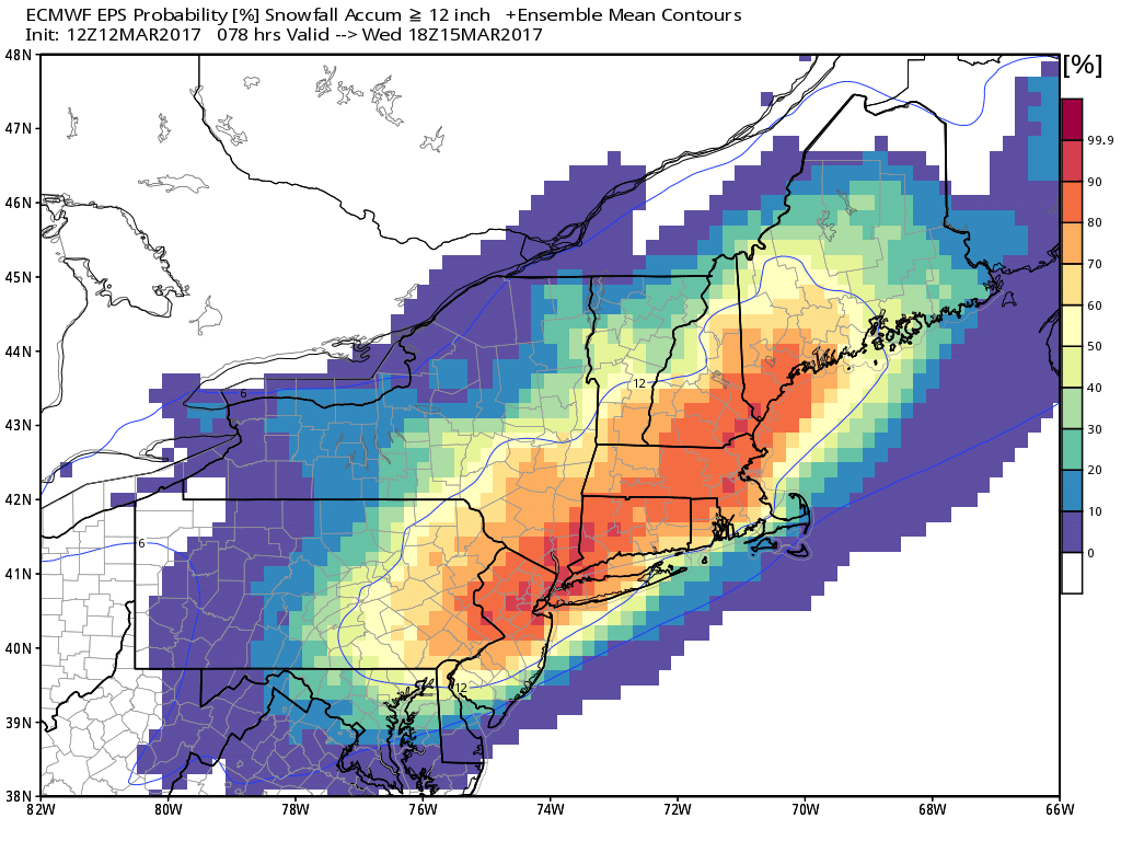
12z European ensemble probability of greater than or equal to 12 inches by Wednesday afternoon (Contour indicates mean position of 12″)
This afternoons model guidance has almost unanimously shifted to a more impactful storm for the NYC metro area compared to what they had just 24 hours ago. We have excellent agreement that a shortwave disturbance currently located over Montana/Wyoming will interact and later on phase with two other key pieces of energy during the next day or so. As this main piece heads into the Mississippi Valley region, the first interaction will take place between the Pacific wave and a polar disturbance that will be located over the Great Lakes. This piece over the Great Lakes is directly associated with the tropospheric polar vortex and will help to significantly deepen the trough over the central part of the country. This significant deepening will allow the trough to possibly dig all the way into the Gulf of Mexico and interact with leftover energy from the subtropical jet streak that will be sitting over the Gulf of Mexico.
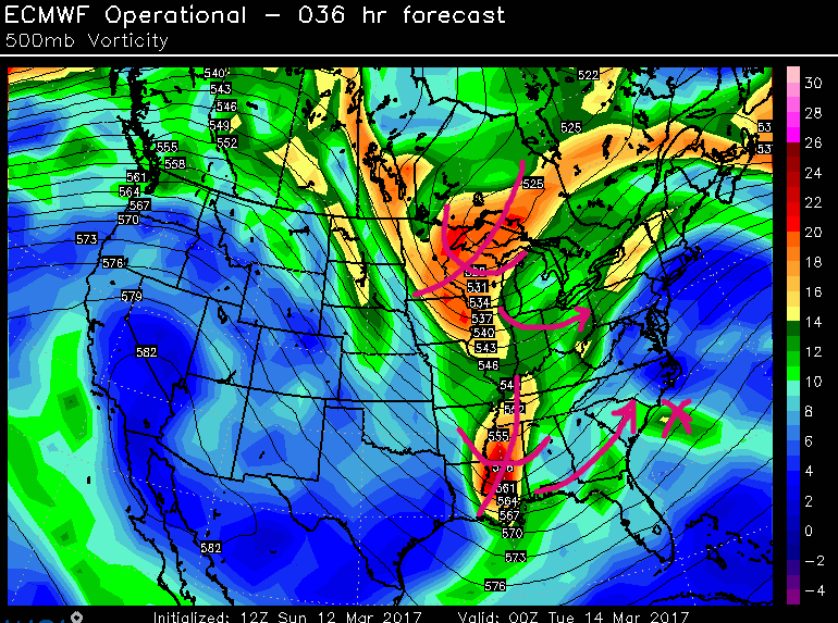
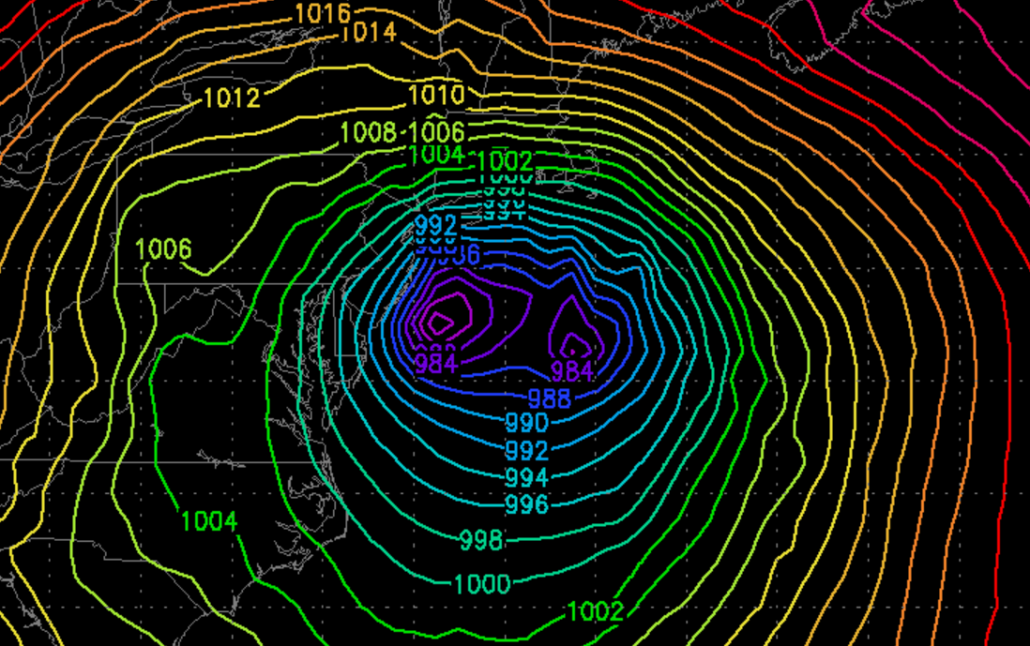
500mb vorticity from the 12z ECMWF showing each key piece of upper level energy needed to form our storm system over the Gulf
As the original Pacific disturbance begins to take on a more negative tilt early Tuesday morning, secondary surface cyclogenesis should take place over the Gulf of Mexico. This surface cyclone will be located over a region of very warm surface temperatures relative to this time of year. This will guarantee that there will be a significant amount of water available from the Gulf/Caribbean for this low to take in as it begins its early stages of formation. This abundant moisture needs to be watched as the hi-res models get closer to the actual event as high-moisture environments are often underestimated until the last 24 hours before a storm, which could lead to an uptick in precipitation amounts.
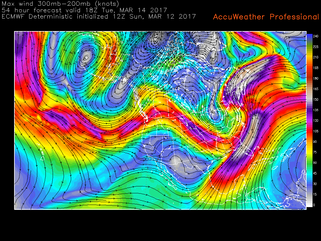
This highly anomalous precipitation will have also have the full-support of a very impressive upper level jet streak running at around 200-300mb. This upper level jet will allow the secondary surface low to begin to undergo a period of rapid deepening, as upper level divergence aloft aided by the dual-jet configuration, promotes very strong convergence in the lower levels of the atmosphere. This much talked-about jet will also promote the explosive development of a large, and impressive precipitation shield as low level moisture is quickly brought from the surface to the mid-upper levels of the atmosphere.
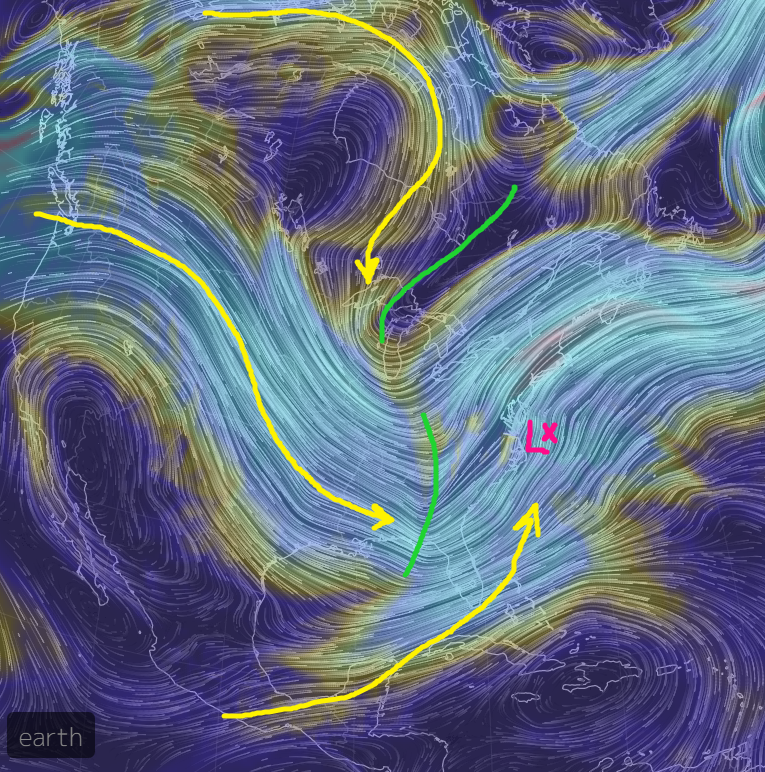
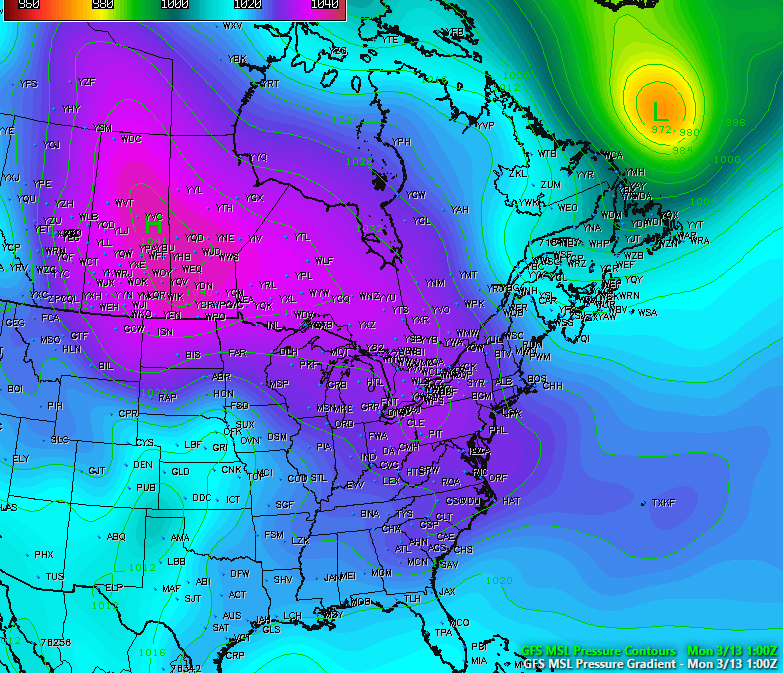
500mb winds from the GFS showing the interactions between the upper level system in the Great Lakes as well as the “trigger” for surface low development located in the Mississippi Valley. Upper level jets highlighted in yellow.
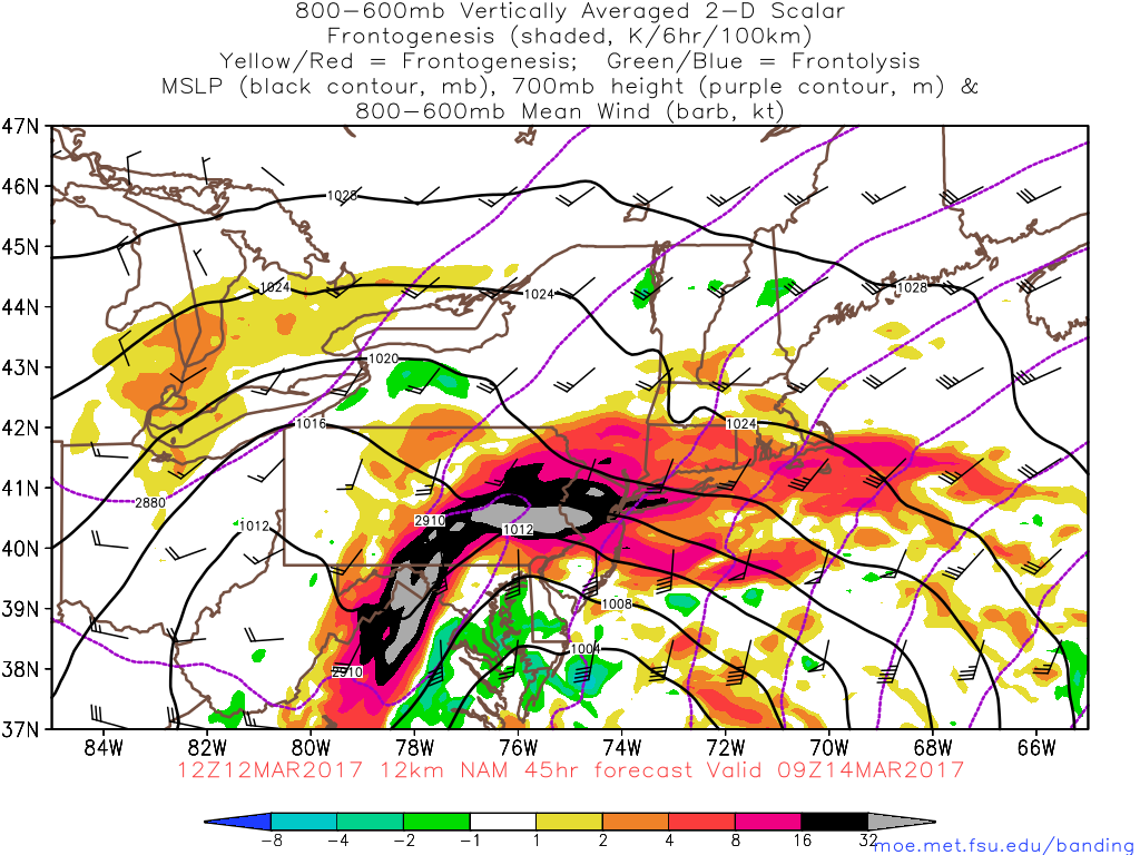
This large and impressive system should move north into over the Outer Banks of North Carolina by very early Tuesday morning. We should see the initial precipitation start to break out from south to north by 4am, with rates steadily increasing by 5am or so. As the low pressure begins to rapidly intensify and pull in the Arctic air to our northwest, a very sharp gradient will set up within the atmosphere as warmer winds off the NJ coast clash with the colder/denser air mass. This warmer air will very rapidly rise overtop the colder air, and will promote incredible lift over the NYC metro area by 6am or so. This lift, or frontogenesis, in conjunction with the upper level jet helping to evacuate mass at the surface and further promote the lift-will begin to sustain this process and will likely lead to very intense bands of snow that should move in from the south. As these bands become more mature, they should then rotate erratically from west to east across the entire metro area.
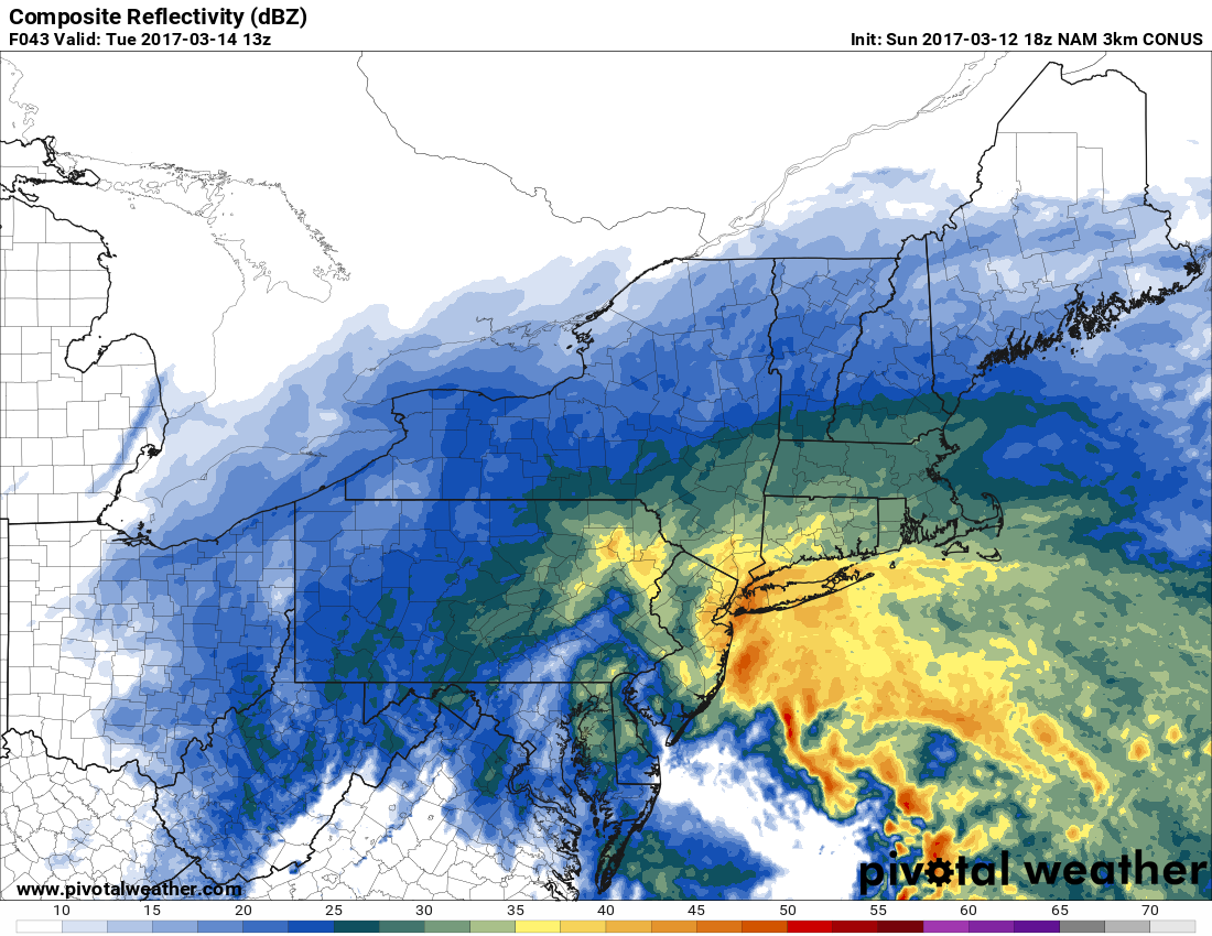
18z 3km NAM showing very intense precipitation and bands coming off from the coast as the main surface low rapidly deepens (Valid 9am Tuesday)
These bands will be quite similar to some of the more prolific banding events we have seen in this area, with Boxing Day in 2010, the February Blizzard in 2006, and last years blizzard all probably being quite similar in intensity. Where the exact locations of these bands will exist will be very hard to forecast until the storm is actually on radar, but snowfall rates of 2-4″ an hour, visibilities around zero, rapid temperature drops, strong wind gusts, and even thundersnow are all possible. Exactly where these bands set up and decide to rotate over will ultimately determine the exact snowfall distribution, as there may be areas of sinking air in between the most intense bands that works to limit snow growth and reduces overall totals.
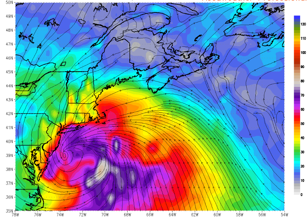
Surface wind gusts in knots from this afternoon’s european model (Valid 2pm Tuesday)
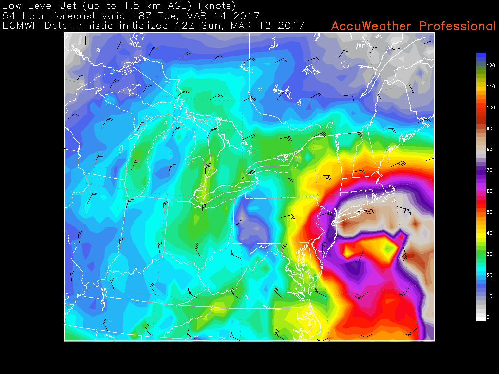
One of the more significant impacts outlined by the European model this afternoon was very strong wind gusts across the entire area. There will be a very potent low level jet positioned from east to west across the region, just to the north of the surface low on Tuesday morning/afternoon. The high pressure system to our north and the rapidly deepening low pressure will really aide isobaric packing, which will cause winds to increase throughout the afternoon, possibly gusting into the 50 mph range during the most intense period of banding. This kind of wind combined with the very heavy snowfall has the potential to create widespread blizzard conditions during the day Tuesday that last for over 8 hours or so, which may create significant blowing and drifting of snow. This will lead to road crews likely not being able to keep up with cleanup and road conditions will be extremely hazardous throughout the day, so travel is not encouraged unless absolutely necessary.
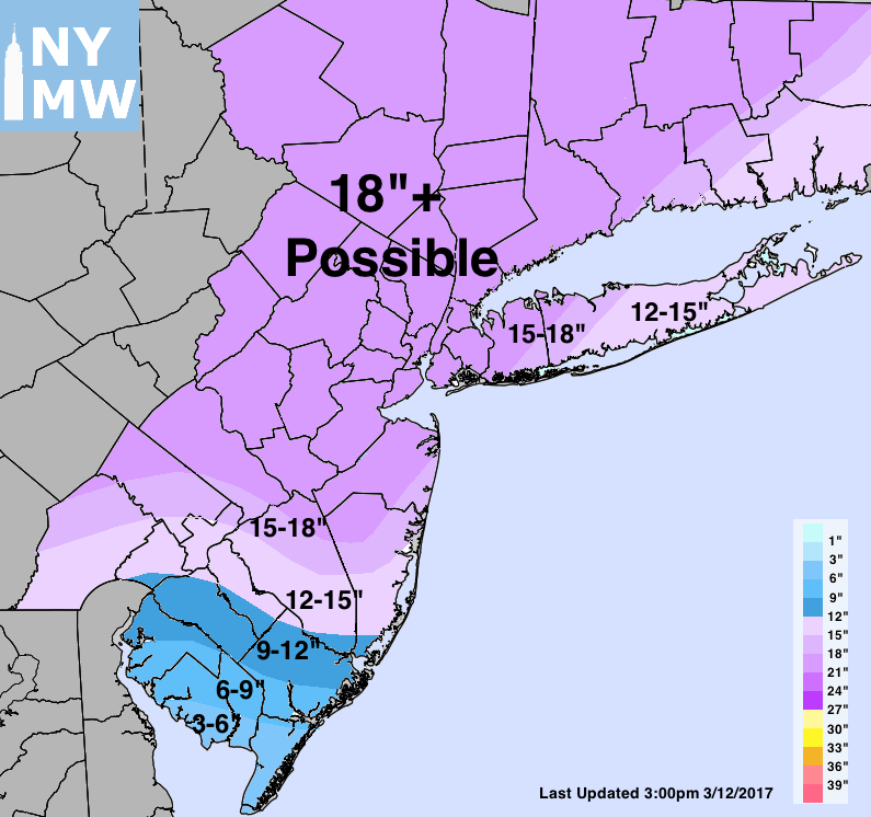
Our first official storm total snowfall forecast is included below. Please note that the main purpose of this map is to delineate the areas which we anticipate will see the heaviest snowfall banding and highest impacts. The map may shift or change over the next 24 hours as new data is available and observations are taken into account.