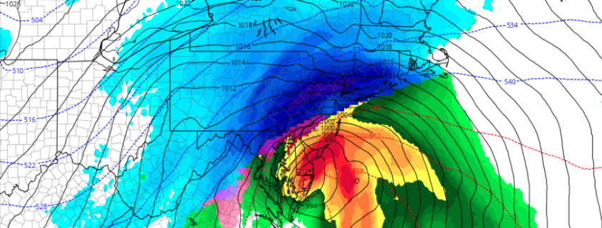
Blizzard 2017 Storm Overview, Hazards, and Preparation
Good afternoon! It is becoming more clear by the hour that a major winter storm with blizzard conditions will be impacting the area late in the overnight and into Tuesday. Extreme snowfall rates — 2 to 5″ per hour — are possible on Tuesday morning, as well as wind gusts up to 50mph. This will dramatically reduce visibilities below 1/4th and even below 1/8th of a mile or lower at times. This may also lead to some power outages, so be sure to be prepared with flashlights, batteries, a full tank of gasoline, and charged phones.
The storm has trended slightly warmer for coastal locations, with faster timing — but stronger dynamics away from the immediate coast has elevated the potential for extremely heavy snow and severe impacts. Even coastal areas will still see very heavy snow before a quicker changeover to sleet and rain — but less snow than inland areas. This video below has all of the details regarding the storm’s evolution, impacts, and meteorological explanation behind why the snow will be so heavy. Stay tuned for further updates!

