-2")
3/24 Interior Zones AM Update: Light Wintry Mix Possible Today, More Unsettled Weekend Weather
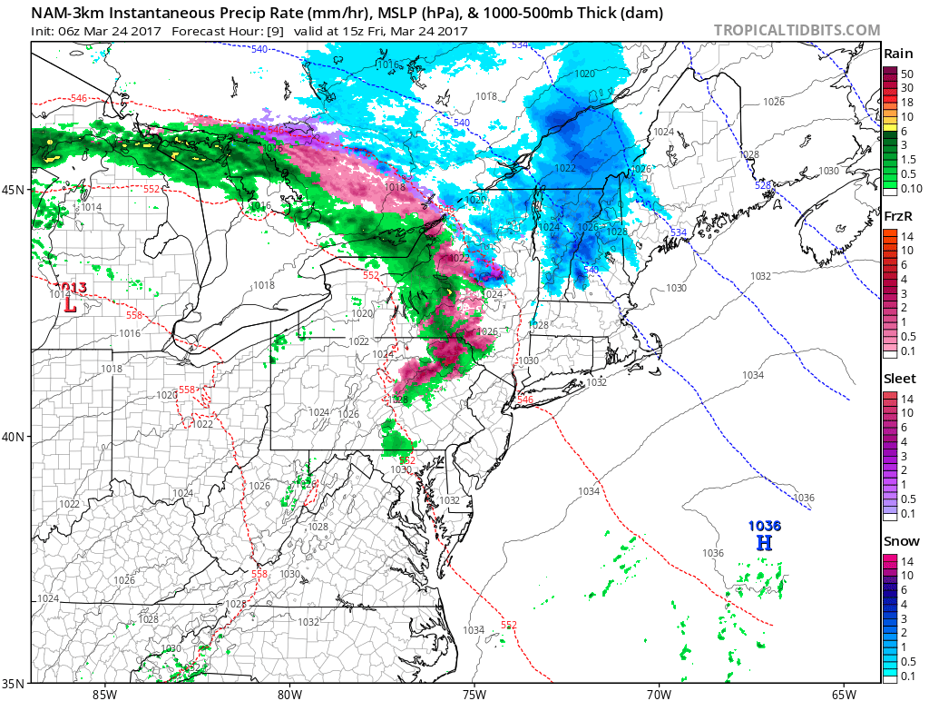
Happy Friday! Today, a warm front and shortwave will producing some areas of light snow, sleet and/or freezing rain over parts of Western NY and PA. This activity will be moving into Northeast PA, Southeast NY, Northwest NJ and Northwest CT, around 10am to 12pm noon. No significant wintry hazards are anticipated. But driving on the roads may become a little more treacherous late this morning and early this afternoon.
Mid-level warm-air advection has already caused 850mb temperatures to warm above freezing across most Central NY and PA. While 925mb and surface temperatures remaining somewhat colder. So this precipitation to likely to be wintry mix snow, sleet and/or freezing rain. Some drier-air in the lower lower levels may cause some precipitation to lighten or diminish moves further east. But this could result in some evaporative cooling, which could keep temperatures near or below freezing into early this afternoon.
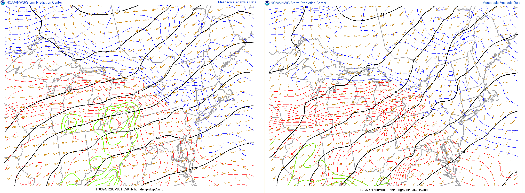
Temperatures at 850mb and 925mb (several thousand feet above our heads) at 8am this morning
A very light coating of snow/sleet or glaze of ice is possible on roadways through early afternoon. Then as warm front lift further north, temperatures should rise well into 30s and lower 40s in these areas with more light rain for this areas later this afternoon. So road conditions should improve in time for this evening’s commute.
Any lingering rain showers should taper off early this evening. Temperatures will likely hold steady most of the night in upper 30s to lower 40s, with light southwest winds. Temperatures could rise into lower to middle 50s with clouds perhaps breaking for some sunshine tomorrow morning. But high pressure building into New England will forces the warm front to return back south as backdoor cold front tomorrow afternoon and evening. More clouds and scattered rain showers are likely to return as well.
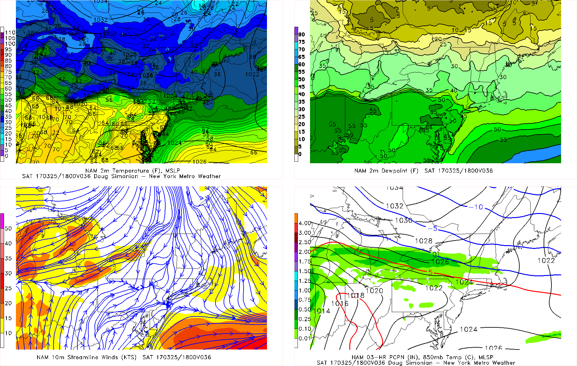
The NAM at 2pm Saturday with backdoor cold front moving over Central NJ, causing a wide range of temperatures from north to south over the region
Temperatures will fall back into the 40s and 30s by tomorrow evening. Sunday will be much colder and dreary day, with mostly cloudy skies and light rain or drizzle temperatures. High temperatures will only be in the upper 30s to lower 40s. Which is well below normal for this time of year.
More rainfall could arrive with next storm system coming Sunday night or Monday. Then more temperature swings and unsettled weather will likely into much of next week. Stay tuned for more zone forecast updates on the weather for this weekend and next week.