-2")
3/26 All Zones AM Update: Cold & Dreary Today with Showers into Monday
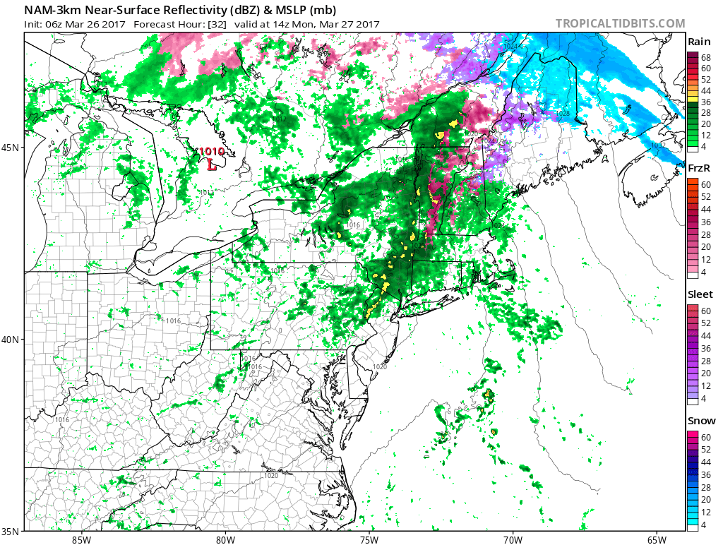
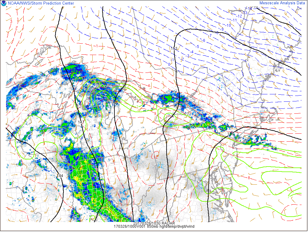
Happy Sunday morning! Thanks to strong high pressure over Southeast Canada, a backdoor cold front has pushed well south into the Mid-Atlantic region this morning. This has caused a colder marine airmass with cloudy skies and light northeast winds move into region. A band of rain showers along a 850mb thermal boundary have been running over Southeast New York and Northern New Jersey since the overnight hours and is now slowly moving northeast. Some of the highest elevations over the Interior, may even see some freezing rain with these showers this morning, with surface temperatures near freezing early this morning. Which could lead to icy spots on some roads.
Skies will remain mostly cloudy for rest of the day and night, with plenty of moisture trapped underneath a low-level inversion. More lift from weak mid-level warm air advection through could still result in some scattered showers or drizzle to redevelop, especially over parts of region this afternoon and evening. Although high pressure to the northeast, may nose in enough keep eastern areas a little drier this afternoon. High temperatures during will range from upper 30s north to lower to middle 40s south. Which is well around 10 or 15 degrees below normal. Temperatures tonight will not fall that much from daytime highs.

NAM model forecast at 5pm today showing high pressure off the New England coast, keep more easterly winds with cold temperatures and light showers developing over Western parts of the region.
Then low pressure associated with weakening cut-off low and shortwave energy, will track into the Great Lakes region tonight and Monday. This will cause the backdoor cold front to return north as a warm front again later tonight and tomorrow morning. But high pressure departing to the northeast, will likley keep this warm front south of much of the region until at least Monday afternoon.
Stronger mid-level warm advection, ahead of this front will likely cause more cloud cover and showers to develop later tonight and Monday morning. A steadier period of moderate to heavy rain is also possible with more moisture. But the best forcing (lift) will be with more shortwave energy and low pressure tracking northwest of the region. So rainfall totals aren’t not expected to be high and no significant flooding issues are expected over the local region. Some areas of patchy fog are also possible, late tonight or Monday morning as the warm front lifts north.
On Monday afternoon, the warm front should move far enough north, for any showers linger from the morning to gradually taper off. But more clouds, some fog or drizzle may remain, causing a wide range of temperatures from north to south over region. Currently we think based departing high to northeast and early Spring climatology most of Northern New Jersey and New York City and areas further northeast ,will likely remain in 40s or 50s with more cloud cover tomorrow afternoon. Further south over Central or Southern parts New Jersey and Pennsylvania temperatures will are more likely to rise into the 60s or higher again, with more southwest winds and breaks of sunshine.
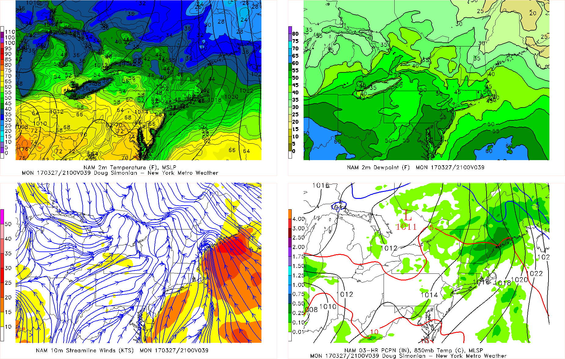
NAM model forecast for 5pm Monday showing warmer temperatures in the 60s over Southern NJ and Southeast PA with more southwest winds, colder temperatures remain further north with more clouds and showers.
The pattern will remain somewhat unsettled for the rest of the week, with an active Pacific jet. Another frontal system will move through later Tuesday and Tuesday night with some more rain likely. Then a southern stream storm system may impact the region with more precipitation by Friday. But uncertainty is high with the track and any northern stream interaction with this system. A stronger cold front will also cause temperatures to swing from above to below normal between both systems Wednesday and Thursday. Stay tuned for more zone forecast updates on the more unsettled weather for this week.