-2")
3/27 All Zones Early Afternoon Update: Dreary and Unsettled Weather Continues
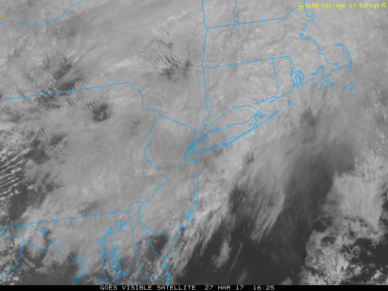
Happy Monday afternoon! Showers this morning were mainly associated with a shortwave trough. Which is now moving northeast of the region this afternoon. As the warm front slowly lifts northward through the region, skies may begin to brighten or break for sunshine across parts of the area later this afternoon. But it will remain dreary with mostly cloudy skies overall, through early this evening. A few more scattered showers are possible as well. Some areas of patchy fog and drizzle may continue be around this afternoon, especially near the coast. But visibilities should gradually improve.
Winds will be more south-southeast later this afternoon, this will allow to slowly rise into lower to middle 50s, over NYC, Long Island and Northern NJ. Temperatures may reach still reach 60s further south Central and Southern NJ, Southeast Pennsylvania, with clouds clearing for more sunshine. While parts of the Lower Hudson Valley, Connecticut and Long Island may only rise into mid-upper 40s.
Later this evening, some weak mid-level ridging may allow for more skies more clear to partly cloudy. But some scattered showers are possible with weak warm-air advection overnight. Some areas of patchy, dense fog may redevelop again later tonight and early Tuesday morning with more residual moisture and calmer winds overnight. So take some precaution still driving roads and prepare for more travel delays for tomorrow morning’s commute.
Some dreary weather may continue for most of the region during the day on Tuesday. Latest models show more onshore winds with another frontal boundary stalling to the south. Then a wave of low pressure along this front will cause more showers to increase later in afternoon and evening. Depending on position of the frontal boundary and the amount of cloud cover, temperatures could range from 40s/50s to 60s/70s north to south across the region.
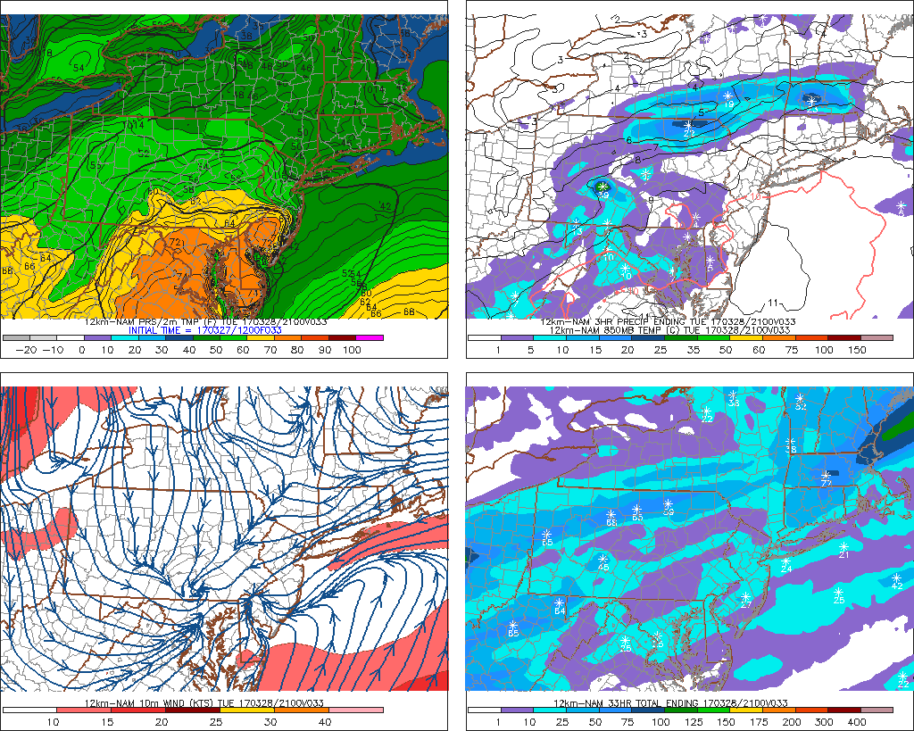
NAM model forecast at 2pm tomorrow with some showers and wide range of temperatures from north to south over region, while low pressure along the boundary approaches
More showers or steadier rain may continue in early Tuesday night. Then a cold front will finally move through with more clearing skies by Wednesday morning. Northwest downslope winds will support sunshine and high temperatures in the upper 50s to lower 60s on Wednesday afternoon. Then a cooler airmass settles in with temperatures dropping into the upper 20s to middle 30s by Wednesday night. By Thursday, high pressure building in from Southeast Canada with mostly sunny skies highs in the upper 40s to middle 50s over the region.
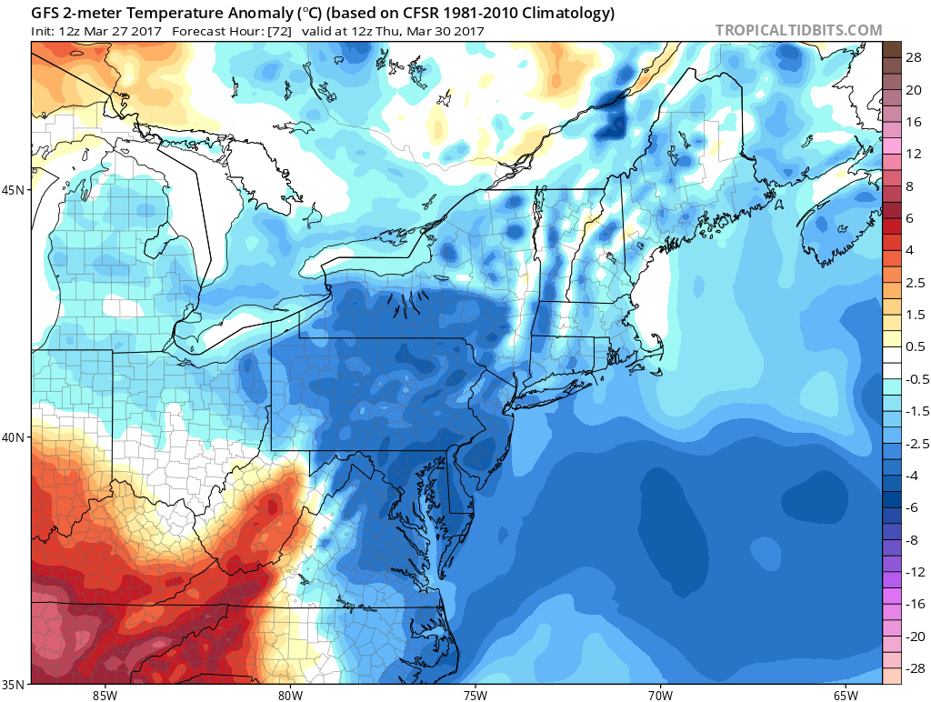
GFS showing temperatures a few degrees below normal by Thursday morning
But then more dreary and unsettled weather returns by the end of the week, with another cut-off low opening up and moving from the southwest. Surface temperatures initially may support some wintry mix over far norther areas of the Interior. Otherwise the airmass will likely moderate enough for predominately rain on Friday and Saturday. Stay tuned for more zone updates on the more unsettled weather this week.