-2")
Public Analysis: Active Pattern Out West Yields Another Damp and Dreary Week
Good afternoon!
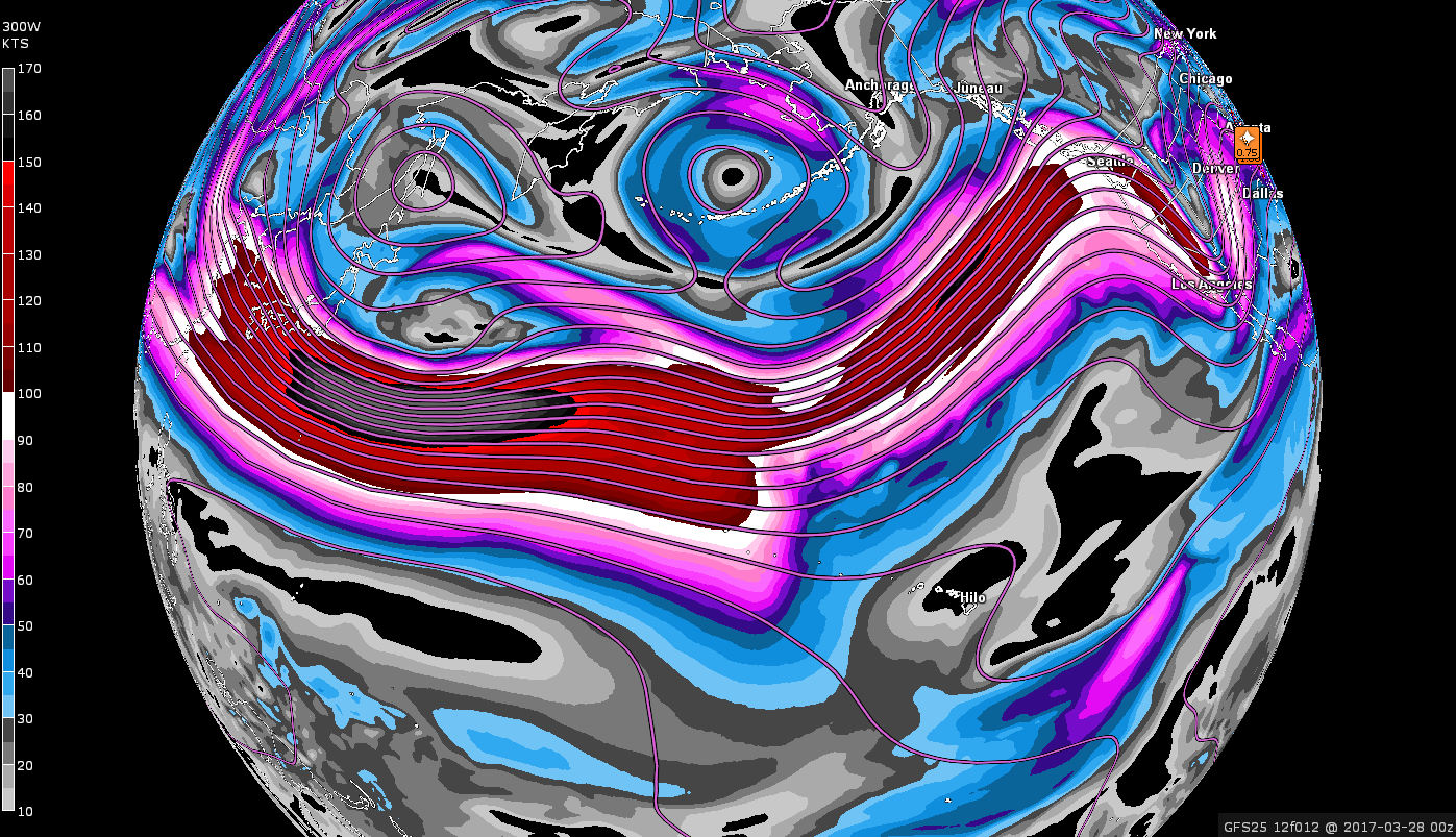
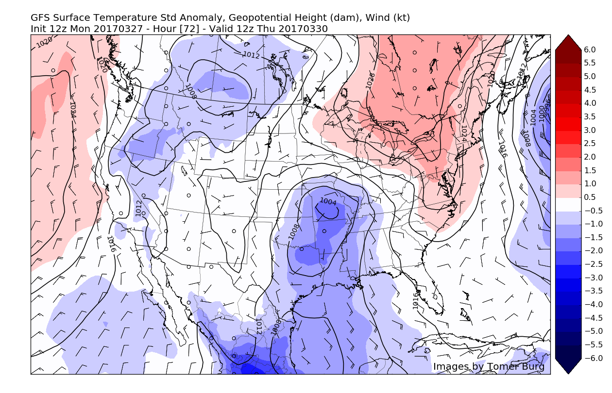
After the brief warmup that some locations saw on Saturday afternoon, we’re back into the same cool and wet pattern that we have been stuck in for nearly a week now. For now, we expect this to continue for at least the rest of this week as a very active Pacific jet streak allows storm after storm to roll through the Central Plains, and then eastward to the Northeast. While the brunt of the weather will be felt out to our west with multiple severe episodes likely, our area should at the very least should see an abundance of rain. Even though this may seem like a pretty abysmal pattern to be stuck in, most of the Northeast does actually need the rain as most of our area and especially portions of Connecticut remain in a moderate to severe drought. So, the more we can chip away at these precipitation departures before the summer months, the better off we’ll be in the long-run.
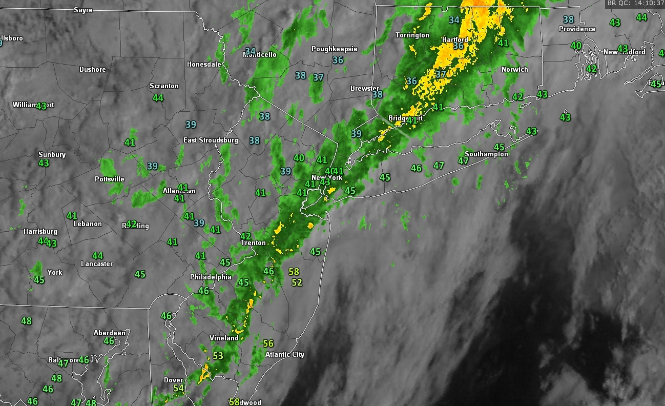
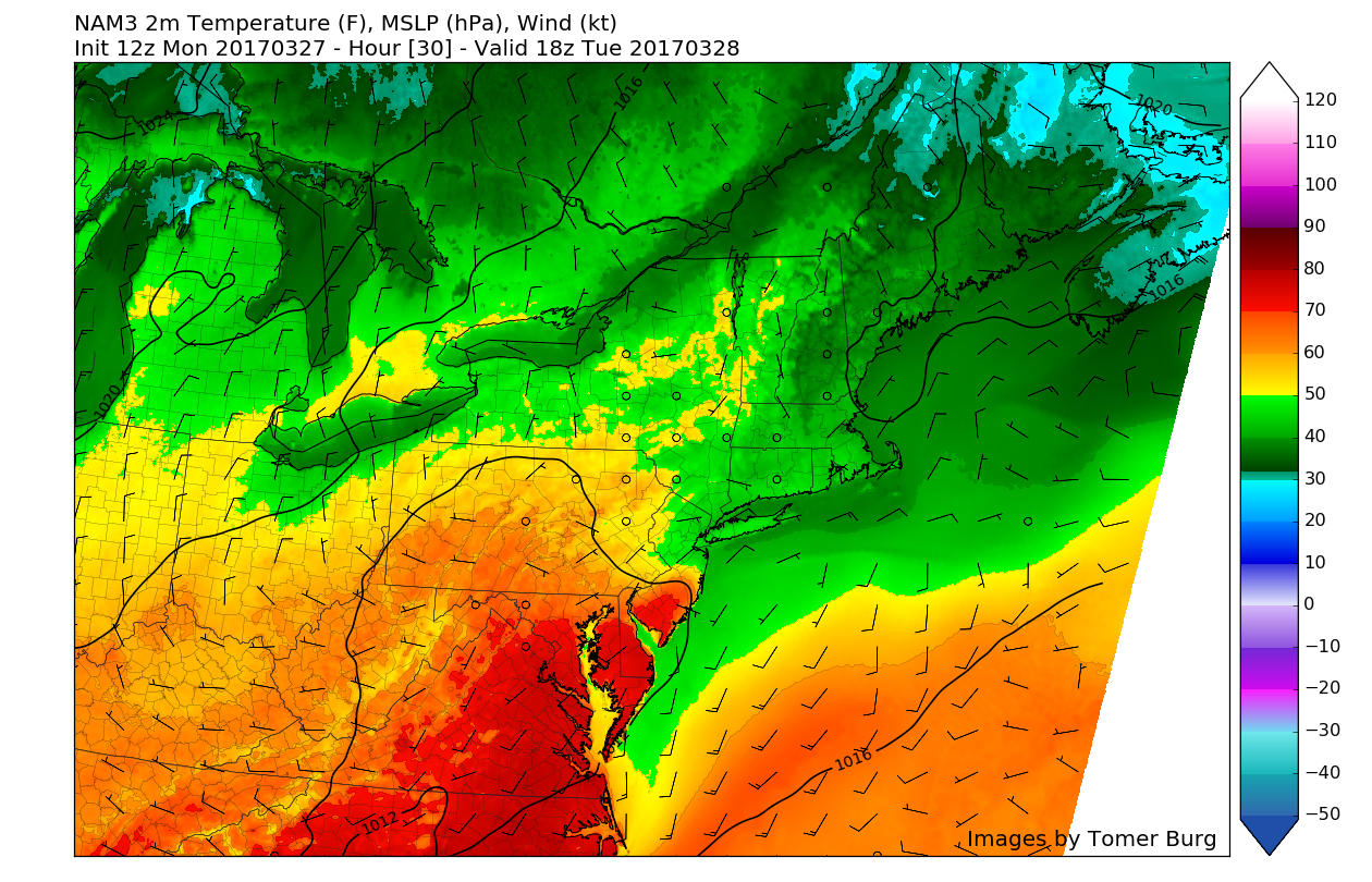
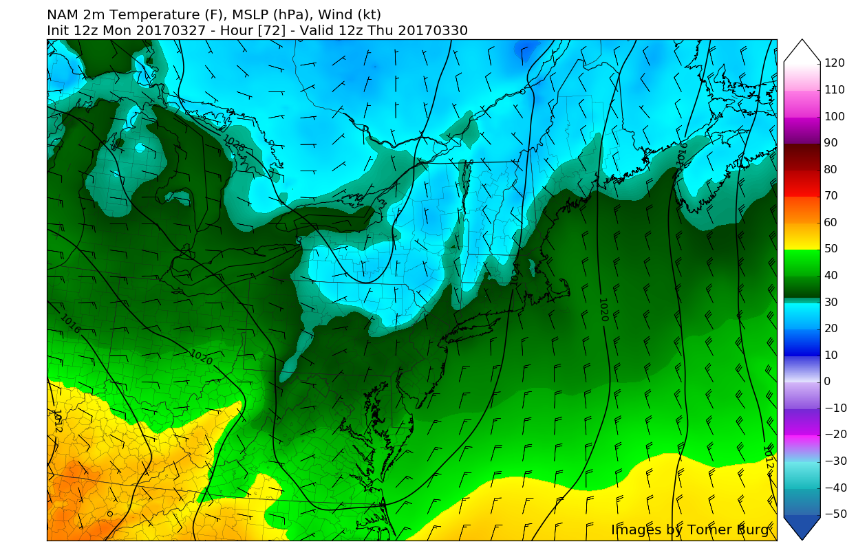
Earlier this morning we saw multiple rounds of showers roll through with some locally heavy rainfall noted from some weather observation sites. The last batch of steadier showers moved through the NYC metro area at around 930 am, and has since left behind mostly cloudy and cool conditions. As of 3pm, temperatures were quite variable, with southern New York, portions of Connecticut, and far northern New Jersey stuck in the low to mid 40’s. To the south, the NYC metro area is currently near 50 degrees, with warmer temperatures of about 60 degrees common near central/south New Jersey.
A warm front has been lifting to the north through southern NJ this afternoon, which is why we are seeing another stark contrast with temperatures today. Just like this past weekend, this warm front will only be allowed to lift so far north before stalling out. This will cause temperatures to remain generally steady as thicker cloud cover to the north prevents any more significant warming. With moist southwesterly flow overspreading the region, mostly cloudy conditions are expected for the entire region, but some southern locations in NJ and PA may see some less-dense cloud cover, or even a few late peaks of sun.
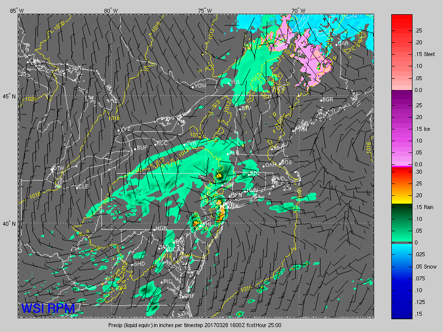
Latest visible satellite, surface temperatures, and regional radar imagery of the Northeast (Valid 2:20pm)
As we head into the evening, clouds may begin to clear a bit more to partly cloudy conditions with time due to some very brief dry air. This dry air will be located just ahead of another disturbance that will move in during the overnight hours and work to once again enhance the mid to low-level moisture air in the atmosphere just enough so that we may have to worry about some showers. Patchy fog may develop later tonight into tomorrow morning with increasing moisture and very light winds. This fog seems like it will be localized in nature, but motorists may need to exercise caution when proceeding into the morning commute tomorrow.
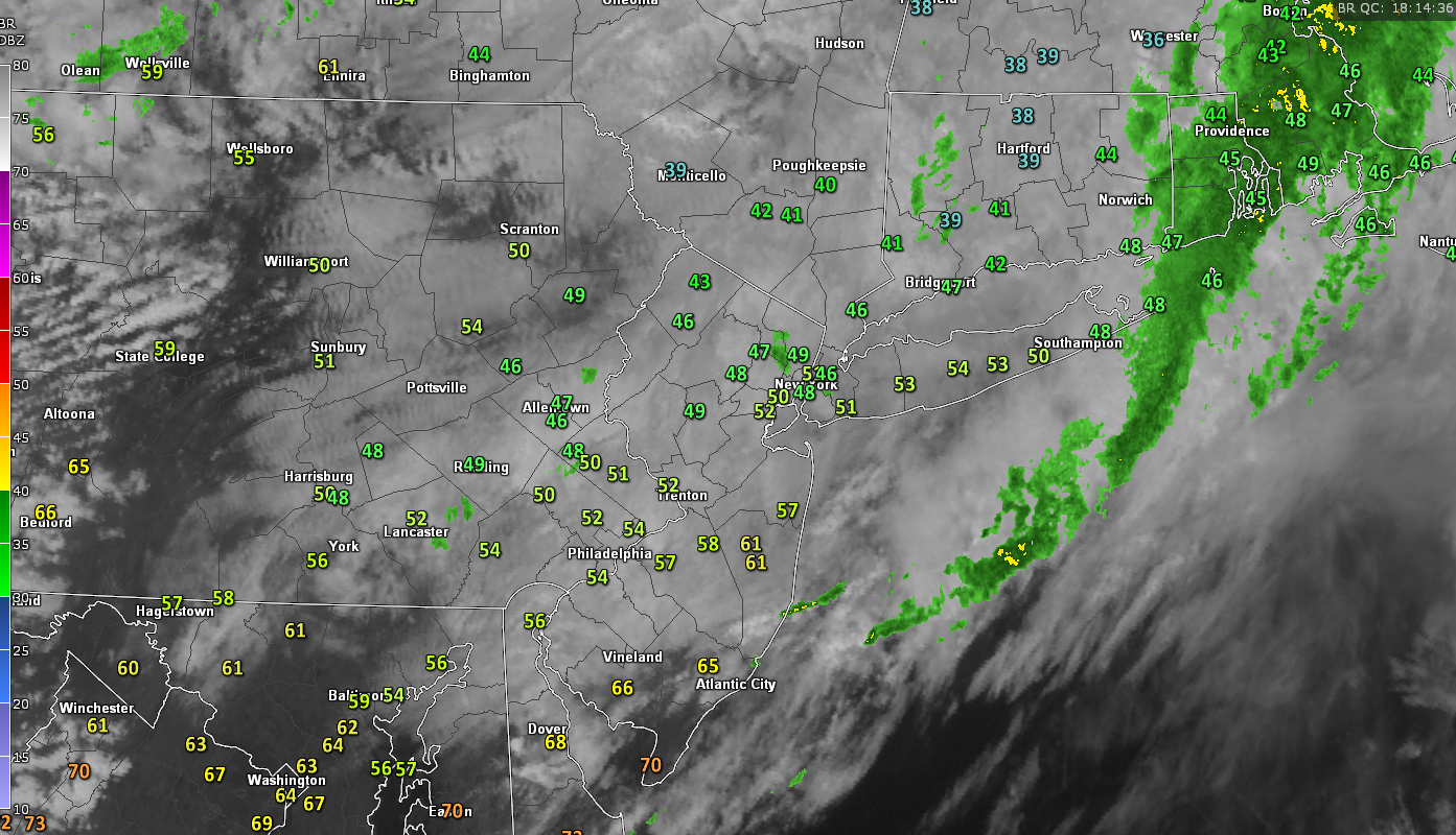
With the aforementioned warm front stalled to the south of NYC tomorrow morning, another cool and dreary start to the day is expected with another tight temperature gradient likely setting up. Where this gradient sets up will be dependant on where the frontal boundary decides to rest. This will lead to another situation where temperatures to the north of the boundary will be in the 40’s to mid 50’s, and temperatures to the south of the front may rise into the 60’s and even low 70’s in some locations.
This will be a difficult feature to nail down, as yesterday’s models did a poor job with just how much the warm front would lift to the north for today. Regardless, as we go throughout the day tomorrow, an area of low pressure will develop along the stalled frontal system and provide a good chance of some showers, and possibly even a few rumbles of thunder across the area tomorrow afternoon. These showers should continue throughout the afternoon and into Tuesday night just ahead of a cold front. Temperatures should remain relatively mild, with lows in the mid-upper 40’s, to low 50’s for the southernmost locations.
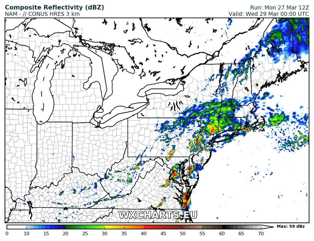
This afternoons 3km NAM showing showers and possibly even a thunderstorm in the southern zones tomorrow evening as an area of low pressure moves through (Courtesy of WxCharts.eu)
Finally on Wednesday things seem to calm down for the moment as a cold front associated with the weak area of low pressure moves through the Northeast. This cold front will provide some fresh, cool air for the entire region, so expect highs mainly to be in the mid 50’s to around 60 degrees on Wednesday afternoon with clear skies also likely. As we move into Wednesday night, a large area of high pressure passing to our north in Canada will briefly reinforce this cold air, which will work to drop temperatures into the upper 20’s to mid 30’s across the region—with some frost possible for inland locations.
As the high pressure system up in Canada continues to move quickly to the east on Thursday, another sunny, but below normal day looks to be on tap. Northwesterly flow will limit temperatures to the upper 40’s and low 50’s, and these temperatures will certainly feel below-normal when coupled with some light, but gusty northwest winds.
12z NAM showing a much cooler air mass on Thursday morning with temperatures below freezing for some northern locations (Valid 8am Thursday)
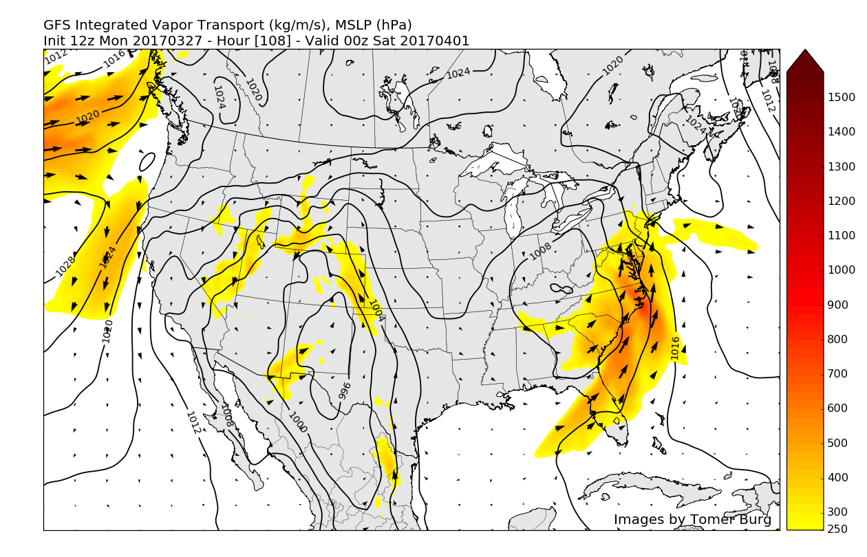
Unfortunately, this calmer period seems to be short-lived as a cut-off mid level system works its way east by Friday evening and into Saturday morning. This system will be somewhat slow-moving in nature and will have a hefty moisture feed from the Gulf of Mexico, which may allow for some heavy rainfall across much of the Northeast this weekend. We may have to monitor this system for some potential flooding issues, as warm air and heavy rainfall will quickly erode any residual snowpack in northern New England.
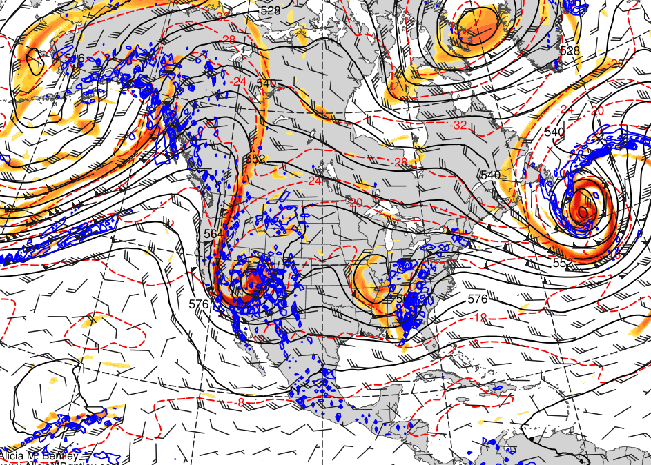
With the extremely active Pacific jet lining up disturbances all the way back to Japan, it seems likely that we should remain in this stormy pattern for at least the next week to ten days, so make sure to stay tuned for the latest updates on any upcoming systems!
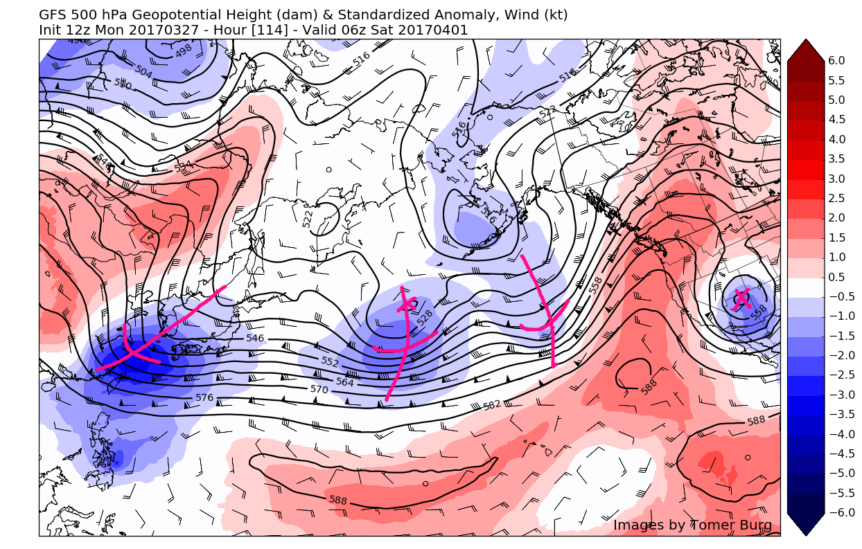
12z GFS showing multiple disturbances lined up all the way back to Japan courtesy of a very active upper level jet (Valid Saturday at 2am)
For more information and posts like this one, make sure you sign up for Zone Forecasts — where multiple detailed articles, videos, and interactives are posted each day. Also, come interact with our staff and many other weather enthusiasts at 33andrain.com!
Have a great day!
Steve Copertino