-2")
3/28 All Zones AM Update: Showers & Isolated T-Storms Today, Another Storm System Friday
Happy Tuesday! More unsettled, dreary weather is in store for today. Low pressure will be tracking from the Ohio Valley this morning to just south of Long Island. This will keep a frontal boundary front further south and most of the region underneath a marine airmass with temperatures only in the 40s or 50s with onshore winds and cloudy skies for most of the day. Temperatures might sneak up into 60s over Southern NJ or Southeast PA with the frontal boundary nudging northward as a warm front, later this afternoon.
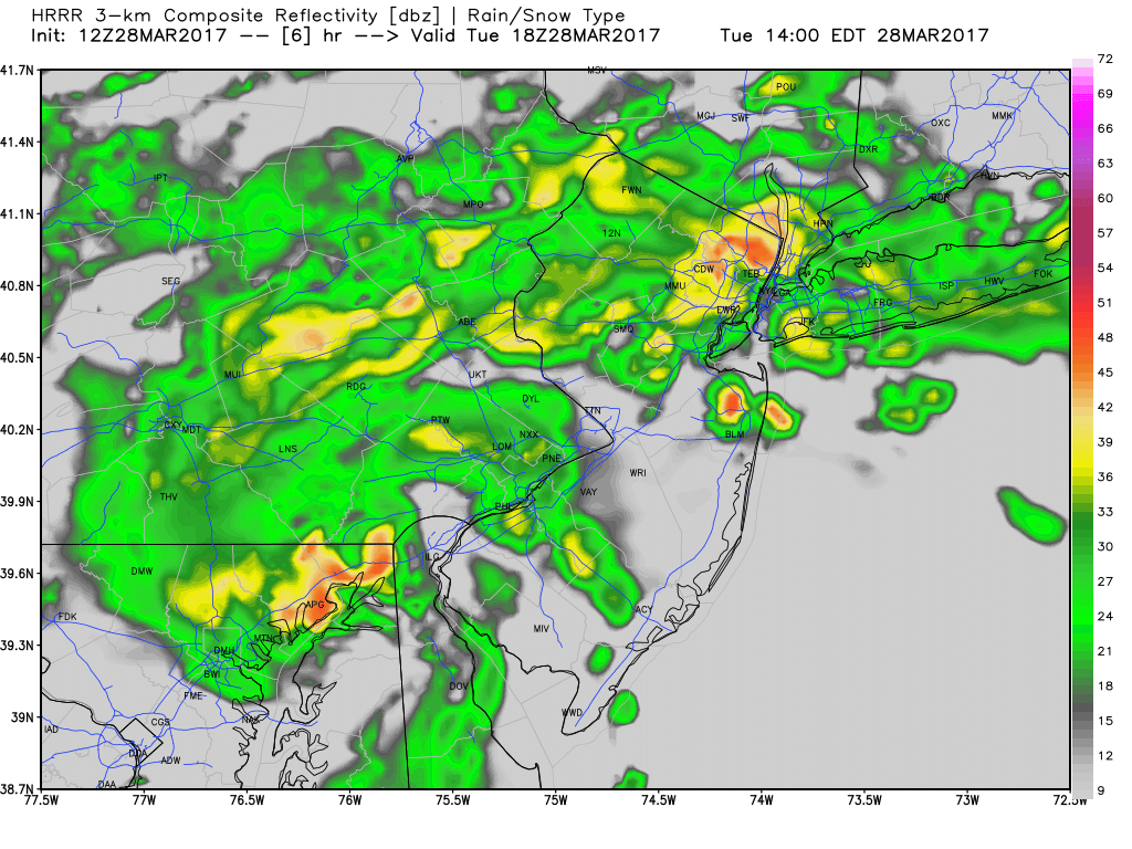
Some scattered showers and isolated thunderstorms have moving through region early this morning, and this continue with some lift, elevated instability, abundant low-level moisture, north of warm front over Mid-Atlantic region. Some areas patchy fog and drizzle will continue to be around this morning as well.
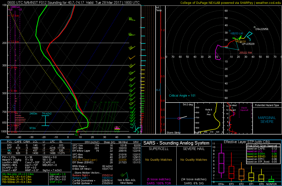
Then showers will become more widespread over the region, as low pressure and associated shortwave trough a move closer to region this afternoon and evening. Some steadier, heavier bands of rain may also develop for some parts of the region as well. Model guidance also indicates more elevated instability, with steeper mid-level lapse rates and MUCAPE that could support some isolated or embedded thunderstorms again, with some heavy downpours and frequent lightning, especially from around NYC south. This could could some localized, minor flooding on roadways for this afternoon and evening’s commute. But no significant flooding or severe weather hazards are anticipated.
NAM model showing shortwave through and low pressure produce heavier shower activity by early this evening
Some rainfall could linger into early tonight, before the low pressure and shortwave trough moves east of the region. Then weather conditions will improve greatly over next few days. Skies will begin clear on Wednesday with drier northwest downslope winds. Temperatures will rise into the upper 50s to lower 60s with more sunshine by the afternoon hours. Then a cold front comes through late in afternoon or early evening dry with a lack of lift and moisture.
Behind this front, it will turn colder and blustery with temperatures dropping into 20s over Interior and lower to middle 30s closer to the coast late Wednesday night. Thursday will be a cooler day than Wednesday. But Canadian high pressure building into the region will provide mostly sunny skies and lighter winds. High temperatures in lower to middle 50s. Which is just near or slight below normal for this year.
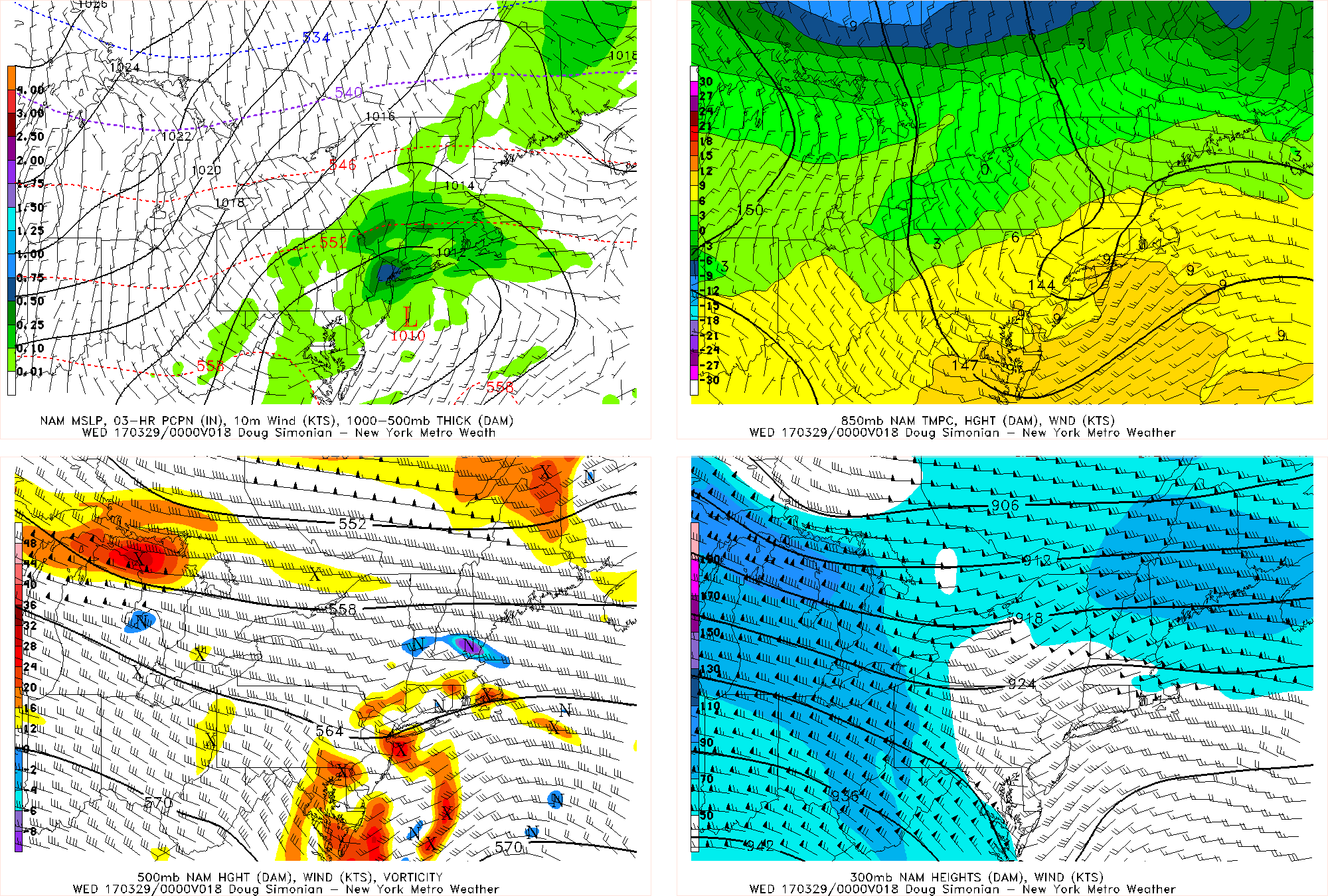
But the pattern remains active this week with another storm system coming from southwest for Friday. High pressure will be departing the northeast and low pressure tracking into the Great Lakes will cause more south/southeast flow and the airmass to moderate over Northeast. So we anticipate this storm system will be predominately rain for most of the zones. But some precipitation could arrive as early as late Thursday night or Friday morning, with some lift and moisture from mid-level warm air advection. If that occurs, enough could cold air could be still be in place for some snow, sleet and/or freezing rain for the Interior areas, before changing to rain later in the day. We continue to monitor this potential through the week.
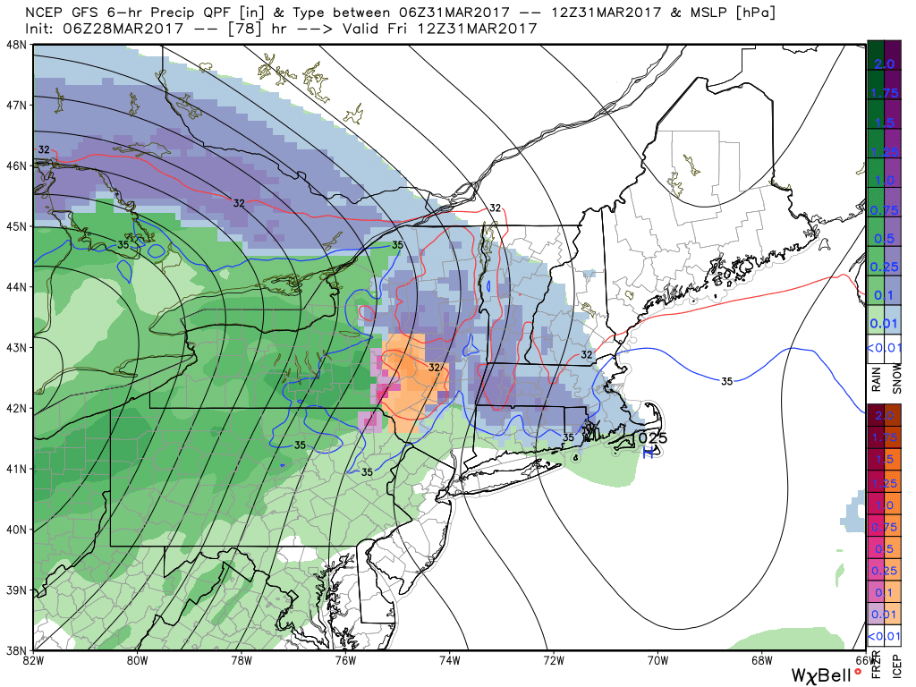 Then some heavier rainfall is possible by Friday night into Saturday morning, if latest GFS and ECMWF models are correct with a secondary low forming along Mid-Atlantic coast. Then high pressure from the northwest will be build behind this storm, with more improving weather for the rest of the weekend. Temperatures will be near or slight below seasonal levels with more sunshine on Sunday. Overall this weekend, is currently not looking too bad. This storm system is likely to be more progressive with a fast, active pacific jet. Stay tuned for zone forecast updates this weather for the rest of the week!