-2")
3/29 All Zones Late AM Morning Update: Calm Before Another Storm on Friday
Happy Wednesday! More decent weather is in store for the region for over the next couple days. Cloud cover this morning will gradually clear with drier northwest downslope winds. Temperatures will rise in the mid-upper 50s with more breezy conditions by this afternoon. Winds could gust to around 25mph until early this evening.
Then skies clear out with diminishing winds later tonight, as high pressure from Southeast Canada builds over the region. Temperatures will drop into the low to middle 30s over the coast and into the mid-upper 20s over the Interior and the Pine Barrens.
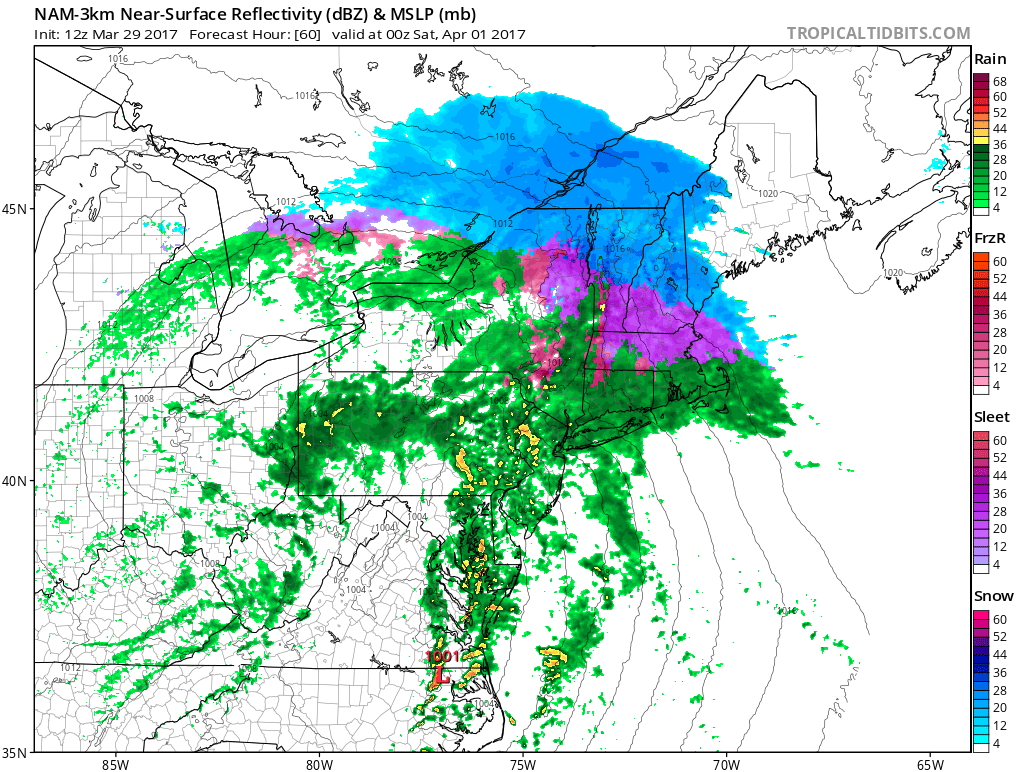
The next storm system we’ve been discussing this week, will begin impacting the region late Thursday night or Friday morning. Low pressure will track into the Ohio Valley on Friday. Mid-level warm advection well ahead of this low will cause clouds to increase Thursday night. Then precipitation could before daybreak on Friday and continue into throughout much of the day on Friday. The airmass will be warm enough for predominately rainfall for much of the region. Then secondary low will take begin to shape along Mid-Atlantic Coast
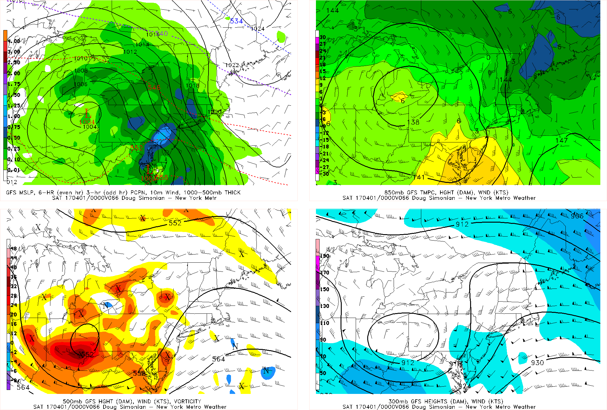
GFS model showing secondary low developing over Delmarva region by Saturday night
A strengthening low-level jet and increasing moisture out of the Atlantic could rainfall heavy at times over much of the region as through early Friday night. This could result in some localized flooding in poor drainage and low-lying areas. Some gusty onshore winds are also possible along the coast. This could lead minor coastal flooding during high tides as well, with the new moon just a couple days before.
However, for Interior areas, especially north I-84 in the Lower Hudson Valley and Connecticut, enough cold may be in place for a wintry mix of snow, sleet or freezing rain. Some snow or ice accumulations are possible before temperatures warm enough for more rain Friday afternoon.
Then as the secondary low deepens and tracks offshore, colder could return over the Interior again for more wintry precipitation Friday night into possibly early Saturday morning. Some additional snow/ice accumulations are possible. But mid-level temperatures may still support a wintry mix of snow, sleet or rain. More individual zone updates may need for these areas by Thursday.
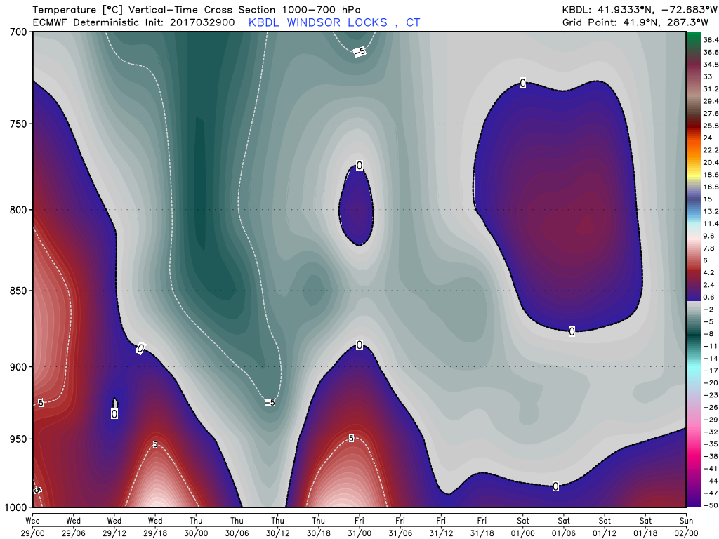
ECMWF crossection over Windsor Locks, CT showing warmer 700-900mb temperatures by Friday afternoon and night support more wintry mix
More improving weather is likely for the weekend, behind this storm. On Saturday, any clouds or linger precipitation in the morning will clear for more sunshine by Saturday afternoon with highs in the upper 40s to lower 50s. High pressure will build over the region on Sunday and remain in control into Monday with more sunshine and high temperatures in the lower to middle 50s.
Then the pattern will continue to be active, with more disturbances moving through region for the for the rest of next week. So there will be more chances for rainfall. Temperatures will likely swing between each disturbance from below to above normal. Stay tuned for more zone forecast updates this week.