-2")
4/03 All Zones AM Update: Heavy Rain, T-Storm, Flooding Potential Late Tonight and Tuesday
Happy Monday! Pleasant weather continues today as high pressure slides offshore this afternoon. Some mid and high level clouds will make their presence known as the day goes on, but sunshine will filter through the clouds until at least the late afternoon hours. This will help temperatures rise into the lower and middle 60s over much of NJ, NYC and even parts of the interior. A light southeast wind may keep high temperatures in the mid and upper 50s closer to the shores, including Long Island.
Clouds will continue to increase and thicken this evening as low pressure tracking into Great Lakes causes a warm front to approach the region tonight. Lift and moisture increasing ahead of this front will aid in the development of rain, which will arrive later this evening or overnight. Enhanced lift from a southerly low-level jet steak and mid-level frontogenesis will cause rain to become moderate to heavy at times after midnight.
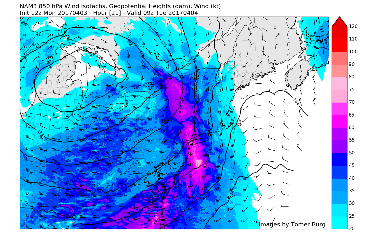
3km NAM model with the 850mb jet streak moving through region around 9z (5am) tomorrow morning
By early Tuesday morning, a weak triple-point low will begin developing along a warm front as it moves northward into the region. Another southerly low-level jet streak may enhance some instability and convergence along this warm front. This could lead to elevated convection on top of a marine airmass at the surface, with embedded thunderstorms and very heavy downpours. A stout low-level inversion is expected to keep stronger winds associated with the low-level jet from reaching the surface, but some isolated wind gusts to around 40mph are possible with any heavy downpours or thunderstorms.
The best forcing will shift north and east of NYC on Tuesday as the triple point low and low-level southerly jet streak moves into Southeast New England. This will cause a lull in the steadier and heavier rainfall sometime during late morning and early afternoon hours on Tuesday. Areas south and west of NYC could see clouds break, with some sunshine and southwest winds helping temperatures rise well into the 60s and possibly even lower to middle 70s tomorrow afternoon.
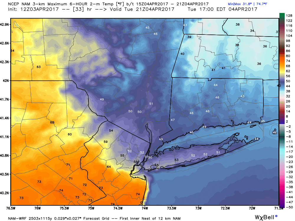
3km NAM keeping the warm front south over Central NJ with temperatures in much cooler temperatures further north tomorrow afternoon
But the warm front will likely be slow to progress northward during the day on Tuesday, due to more northeast winds and rainfall enhancing a marine layer to the northeast. Cloud cover, areas of patchy fog and drizzle could possible stick around into much of the afternoon from NYC on north and east. High temperatures will likely be reached late in the day, possibly in the mid-upper 50s to lower 60s.
Vigorous shortwave energy will move through during the late afternoon and early evening hours with more scattered showers and thunderstorms possible. The aforementioned sunshine and warmer temperatures will result in more surface-based instability along and south of the warm front. A strengthen westerly low-level jet will also enhance shear. So isolated, marginal strong and severe thunderstorms are possible where more instability is realized, over Southern and Central NJ as well as Southeast PA.
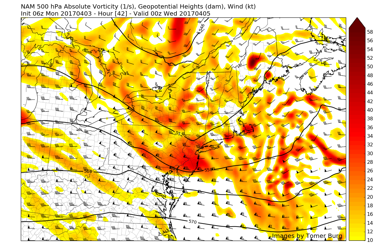
NAM model showing vigorous shortwave energy moving through region during the early evening hours
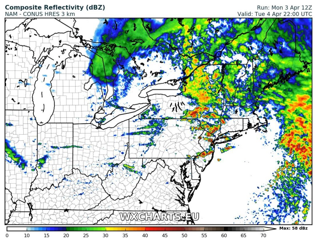
High precipitable water values support rainfall totals between 1″ to 2″ over the region between late tonight and Tuesday evening. Locally heavier rainfall totals are possible, especially with any thunderstorms. This could result in some flooding on roadways and poor-drainage areas. Due to recent heavy rainfall from storm system last week, some flooding is possible around small streams and rivers. For that reason, the National Weather Service has issued a flood watch for the Lower Hudson Valley and Northern half of New Jersey.
This storm will finally exit the region with skies clearing later tomorrow night. Drier northwest winds with weak high pressure and upper-level ridging will result in pleasant weather again for Wednesday. High temperatures will be in the lower to middle 60s over much of region with mostly sunny skies. Another storm system associated with a large, closed upper-level low over the Great Lakes/Ohio Valley will be the impetus for clouds increasing again Wednesday night. More heavy rainfall is possible on Thursday along with some gusty winds especially along the coast. We will have more zone forecast and other premium updates on this storm system as move closer this week.