-2")
Active pattern continues, impactful late week storm
Happy Monday! Amongst other things, Monday means it’s time for our public post, in which we detail the upcoming weather pattern throughout the country and how we expect it to evolve. The past few public posts have honed in on the development of a very active weather pattern throughout the country, and this will be no different. Multiple storm systems are traversing the United States this week and will each produce their fair share of impactful weather.
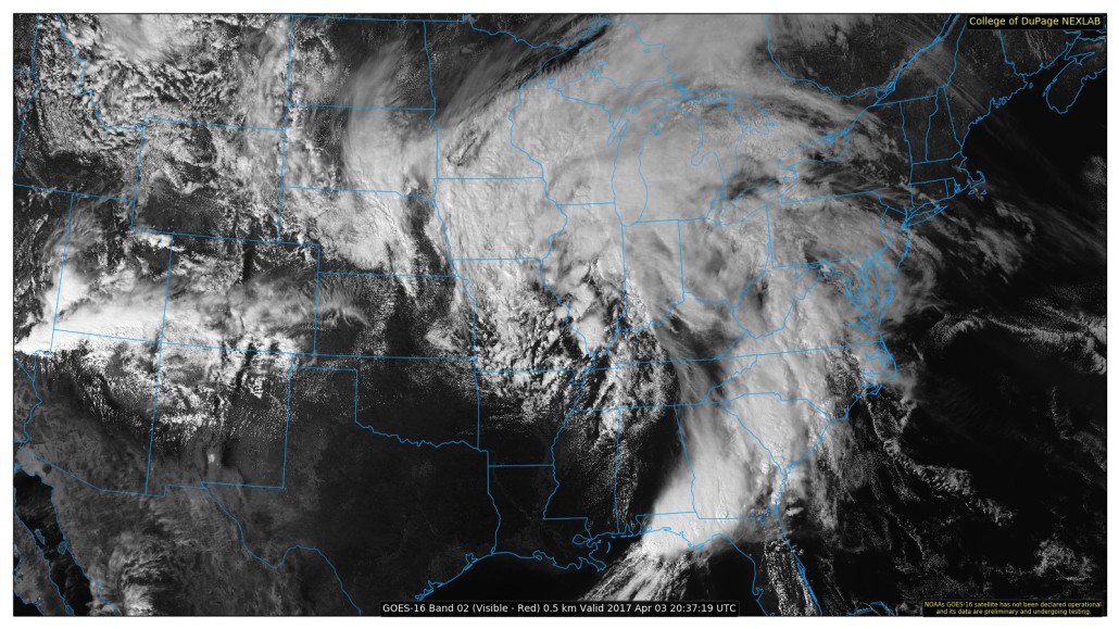
The first is already occurring, as severe weather and unsettled conditions spread from the South/Central United States into the Southeast states today. This very same storm system will spread unsettled weather into the Eastern United States and Northeast on Tuesday, bringing periods of rain with it – and the outside potential for thunder in some areas as well.
As this storm moves offshore later Tuesday and Wednesday, a larger and more significant storm will be organizing back over the Central United States. As shortwave energy deepens and amplifies, a surface low pressure system is expected to strengthen from the Central United States into the Mississippi and Ohio River Valleys on Thursday. This same low pressure will eventually move into the Northeast States Thursday afternoon.
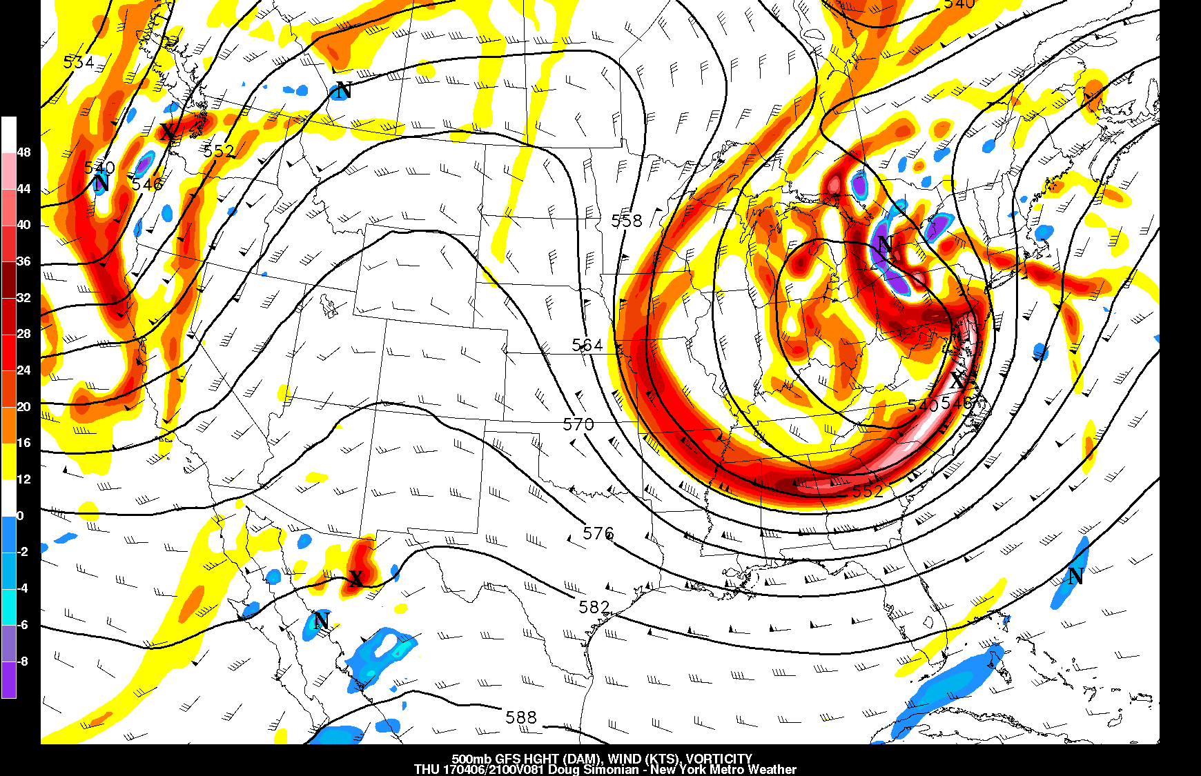
Today’s GFS model valid for Thursday afternoon shows the storm becoming a large cutoff low in the middle of the atmosphere. These setups often produce our heaviest rains.
The low pressure is associated with a strong mid level disturbance which eventually will strengthen further and “close off” in the mid and upper levels of the atmosphere. This occurs when the disturbance “closes off” from the rest of the jet stream and becomes its own entity. As this occurs, the low pressure will strengthen at the surface and dynamics in the mid and upper levels will become enhanced over the Eastern US.
Strong southerly winds ahead of the low pressure will lead to a warm, unstable airmass surging northward into the Mid Atlantic and parts of the Northeast United States. But the northward progress of this airmass is currently in question. It remains to be seen how far north a warm front will progress on Thursday. Forecast models currently suggest its northward progress may be slowed in Eastern PA and New Jersey as the front interacts with colder, marine influenced air to the north.
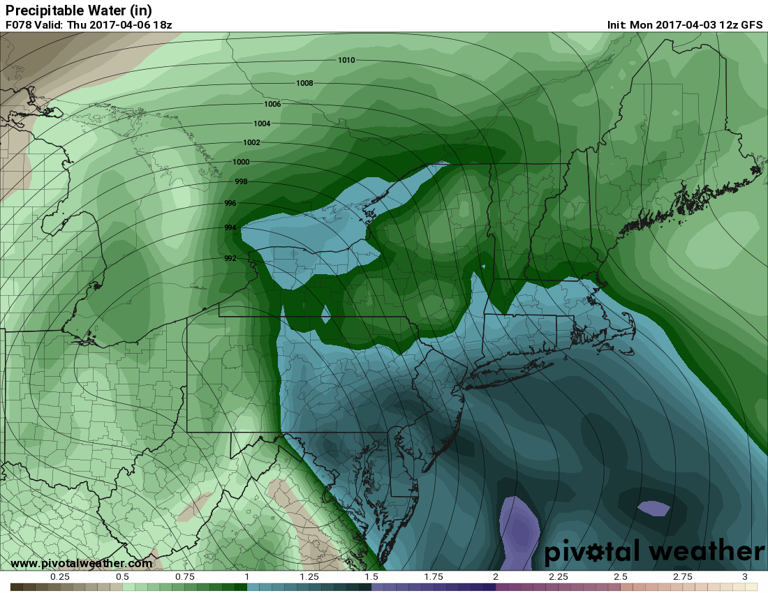
Today’s GFS model valid for Thursday afternoon shows precipitable water values well over 1″, which is very favorable for heavy downpours (Pivotal Weather).
South of this warm front, in what is called the “Warm sector”, the atmosphere will become unstable thanks to the mentioned southerly winds with moisture and daytime heating. This instability will eventually juxtapose with incoming strong wind fields, leading to the potential for strong and severe thunderstorms across the Mid Atlantic States later Thursday. Again, the northward extent of this severe weather will be in question and dependent on the warm front’s placement.
Regardless of severe weather, heavy rain looks increasingly likely on Thursday and possibly even into early Friday. The southerly winds will advect in anomalously warm air, with precipitable water values (the amount of moisture in the atmosphere) well above normal for this time of year. Torrential downpours could lead to localized flooding, especially with an already wet ground environment from the active weather pattern in place.
For more information and posts like this one, make sure you sign up for Zone Forecasts — where multiple detailed articles, videos, and interactives are posted each day. Also, come interact with our staff and many other weather enthusiasts at 33andrain.com!
Have a great week!