-2")
PM Zones Update: Heavy Rain and Embedded Thunderstorms on Tuesday
We hope you all enjoyed this lovely Monday! This nice weather will be very short-lived as a strong storm system is approaching and clouds will rapidly increase this evening, if they had not done so already. Heavy rain with this storm is likely after midnight tonight and into Tuesday morning, with perhaps a lull in the action followed by scattered thunderstorms in the afternoon.
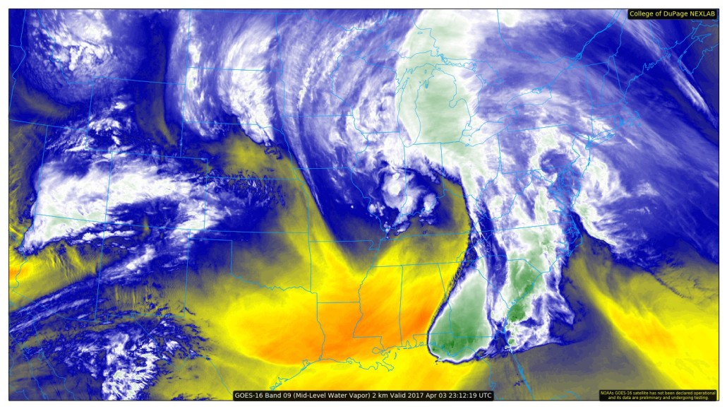
This is the same storm that has brought tornadoes to the Southeast US and it has an extremely impressive moisture feed from the Gulf of Mexico and Caribbean. The core of the storm will be moving into the Central US and into the Great Lakes, but our placement well out ahead of the storm considering its expansive moisture feed actually places us in the area for heaviest rainfall. This is because the east side of these systems have the strongest wind fields; and in this case the strongest low-level jet for further moisture transport. Additionally, lift will be fueled by a warm front that will be pushing into our region ahead of the storm as well.
The combination of the warm front creating plenty of frontogenesis, the low-level jet quickly advecting warm and moist air from the warm sector into the cold sector which can then lift further, and very high precipitable water values — around 1″ or greater — moving into the region during the overnight will allow for heavy downpours generally between 2:00am and 8:00am. Anywhere from 0.5″ to 1.5″ of rain may fall during this time. Elevated instability may also lead to some rumbles of thunder with this batch of heavy rain.
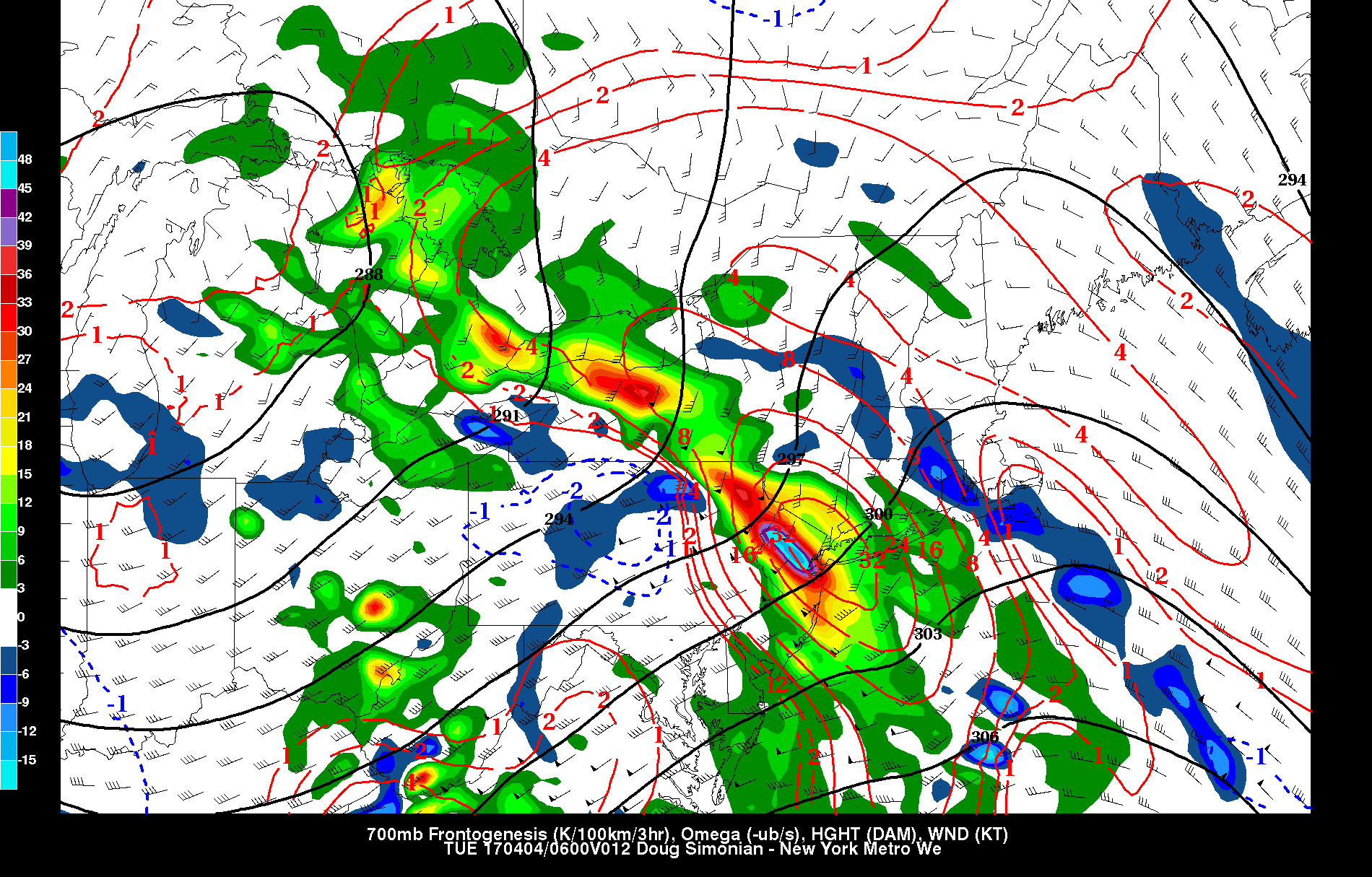
Today’s NAM model valid for 2:00am Tuesday morning shows a strong juxtaposition of frontogenesis and vertical velocity at the 700mb level. This helps lead to very heavy rain.
There is still some uncertainty with how far north the warm front will make it on Tuesday morning. Regardless, when the front pushes north, the frontogenesis will weaken and we will get into a bit of a lull in the activity. As the morning goes on, however, winds aloft will be shifting somewhat westerly, creating some directional wind shear with height for the formation of thunderstorms. Additionally, the surface “jet” will remain southerly on the shore and just offshore, but will also shift more westerly in areas to our west, creating additional convergence near where the warm front stalls. Assuming the warm front can penetrate northward enough to get us into the warm sector with more warmth and instability, this will be a decently ripe atmosphere for more showers and thunderstorms in the afternoon.
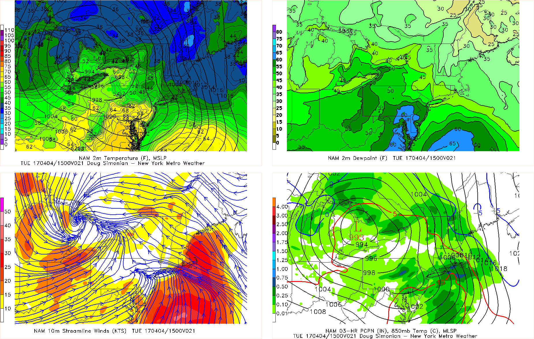
Today’s NAM model valid for late Tuesday morning shows the warm front trying — but struggling — to push north, but also a very strong convergence boundary for more pop up showers and thunderstorms.
It may end up being three rounds of rain — the first being from the initial frontogenesis and the warm front pushing through during the overnight/early morning hours, the second being from the more defined convergence boundary with a tad bit of instability later in the morning, and the third being from more true instability when the warm front tries to push through and warm sector us later the afternoon — though with less actual convergence making that threat less widespread. The video below has more details on Tuesday’s rain and the evolution supporting it:
We will also have to watch for a powerful storm with a higher ceiling than Tuesday’s moving into the area on Thursday. It will have more true synoptic deepening, positive vorticity advection, be larger in coverage, and actually cut off aloft near the area, leading to more prolonged periods of heavy rain. It will also still have a similar LLJ that Tuesday’s rains will have as well as precpitable water values even higher than on Tuesday. Widespread 2″+ rainfall amounts are becoming increasingly likely. We will write a more detailed article focusing on just Thursday’s rain after Tuesday’s storm passes.
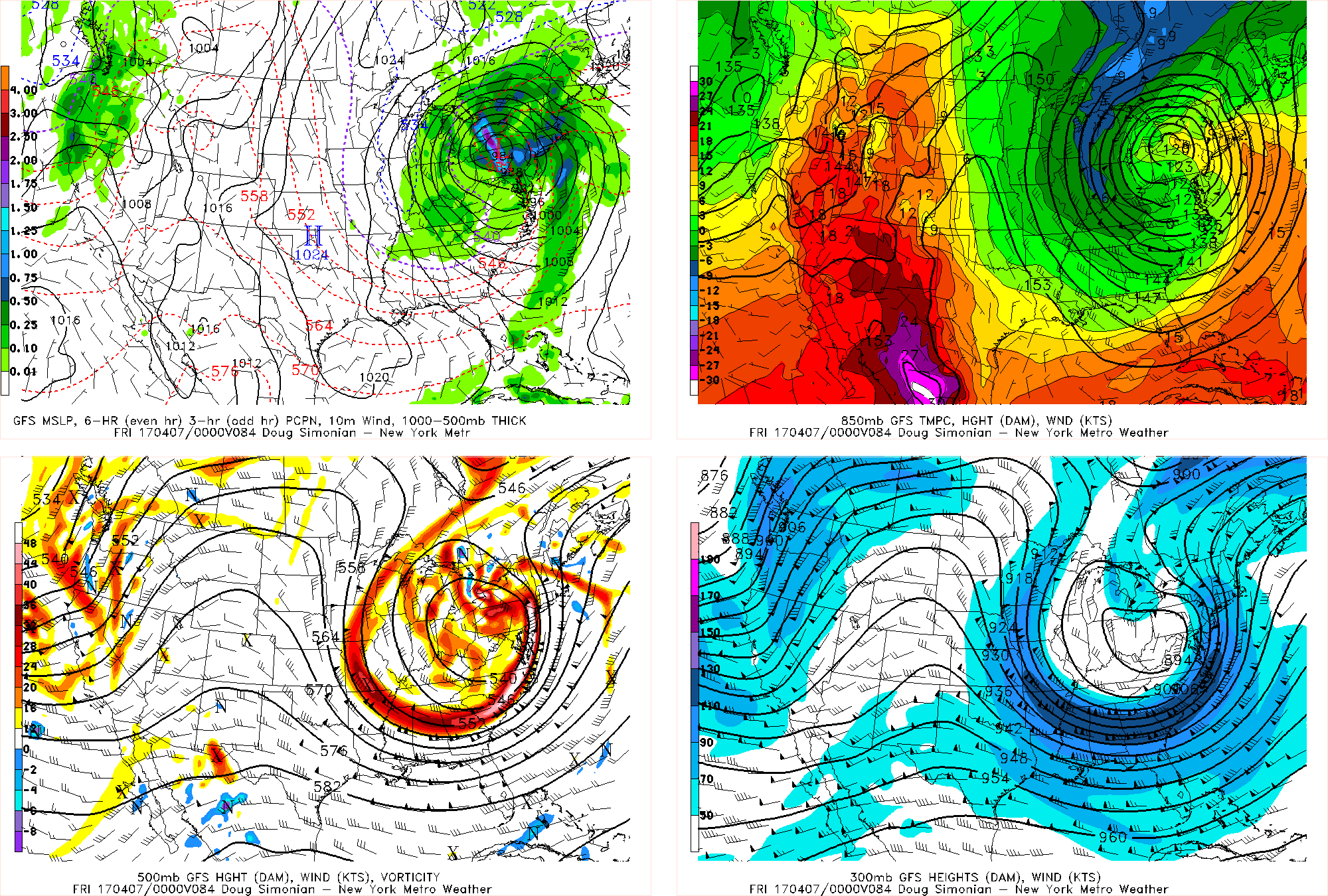
Today’s GFS model valid for Thursday afternoon shows a very strong storm system cutting itself off from the atmosphere and rapidly deepening at the surface. This will lead to widespread heavy rain on Thursday.