-2")
All Zones Late AM Update: Cooler for Late Week, Warmer with Possible T-Storms Easter Sunday
Happy Wednesday! More clouds and scattered showers are likely over the region, as a cold front and shortwave trough move through. Some weak instability could lead to some isolated thunderstorms and heavy downpours. There is a low chance that the Yankees vs Rays game in the Bronx could be delayed today. But most of this activity, may remain just north and west of NYC, where forcing is likely to be stronger.
Then skies will begin clear again later this afternoon with drier west-northwest downslope winds. Temperatures will rise into upper 60s to lower 70s over the region. Some urban areas NYC could reach the middle 70s with enough sunshine. A cooler airmass settles into tonight as high pressure from Canada begins building to region. Overnight lows will be mostly in the 40s, except some mid-upper 30s are possible for Interior Valleys and Pine Barrens.
High pressure from Canada will mostly be in control, with more seasonably cool and fair weather through Thursday and Friday. Another weak cold front and shortwave will be coming through Thursday afternoon and evening with some more clouds mixing with sunshine. But a dry passage is expected with a lack of lift and moisture.
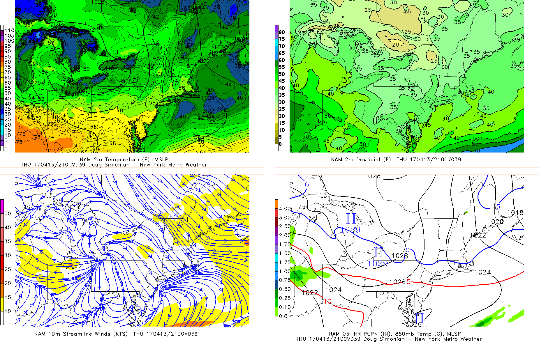
6z NAM showing temperatures in upper 50s to lower 60s tomorrow afternoon.
More sunshine is likely on Friday on the backside of a shortwave trough. Temperatures will be closer to seasonal levels with highs ranging from upper 50s to middle 60s for most of the region, on both days. Overnight lows will be in the 30s in lower 40s for the region, with mostly clear skies and light winds.
High pressure will shift off the Mid-Atlantic coast on Saturday with more southerly winds on Saturday. Mid-level heights will allow for more warmer airmass aloft. But a warm front approaching the region, will cause more clouds to increase by the afternoon hours. So these clouds along with southerly wind off the ocean may keep, areas like Long Island and Connecticut from rising out the mid-upper 50s on Saturday. While areas further west and inland are rising well into the 60s with some sunshine still mixing with cloud cover.
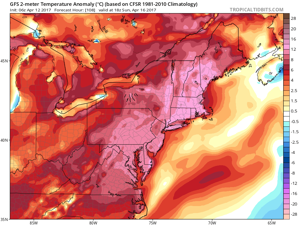
Some widely scattered showers and thunderstorms are possible as the warm front moves through region later Saturday afternoon or Saturday night. The main threat will some locally heavy downpours with low instability and high precipitable water values. Then much warmer than normal temperatures are likely again on Easter Sunday with a deeper southwesterly flow. Some subsidence with mid-level ridging will likely allow clouds to mix with some sunshine. Temperatures will likely rise at least into the 70s over much of the region. Sea-breezes and southwest winds off the ocean could keep areas closer to shore a little cooler.
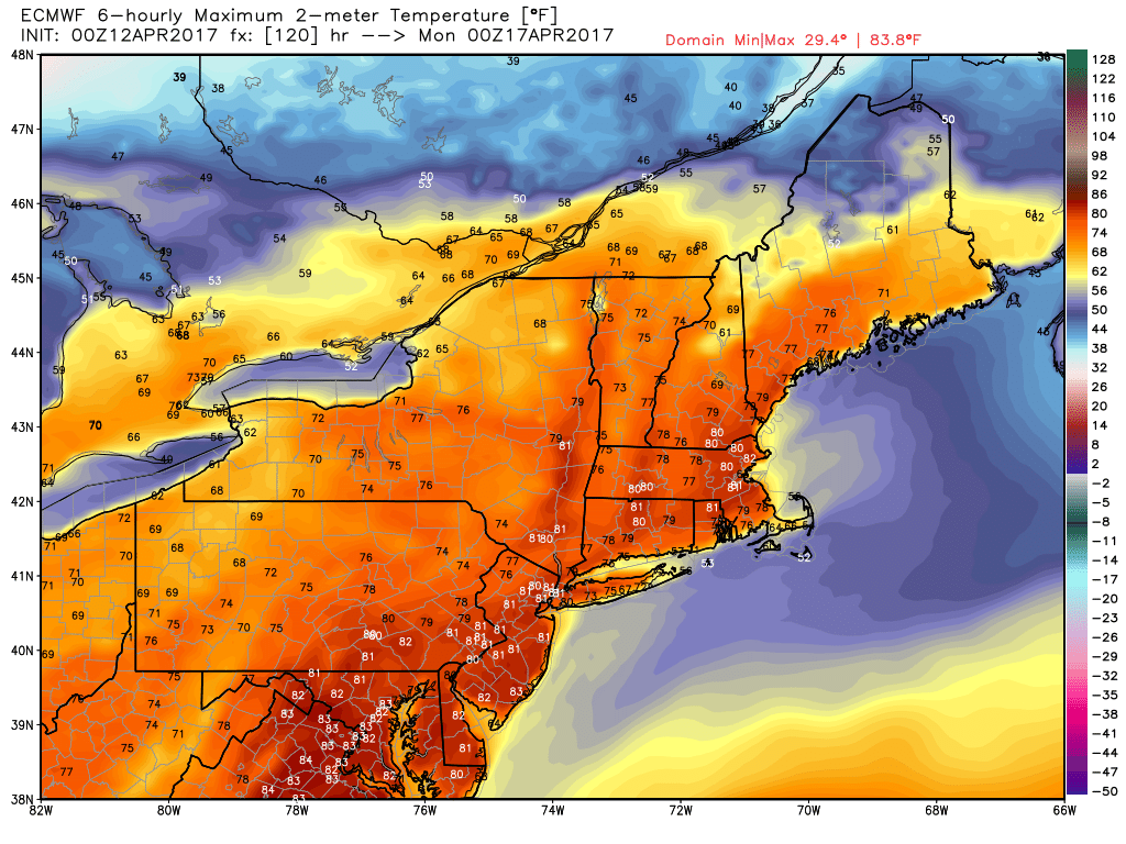
Overnight ECMWF model high temperatures on Eastern Sunday for the Northeast US
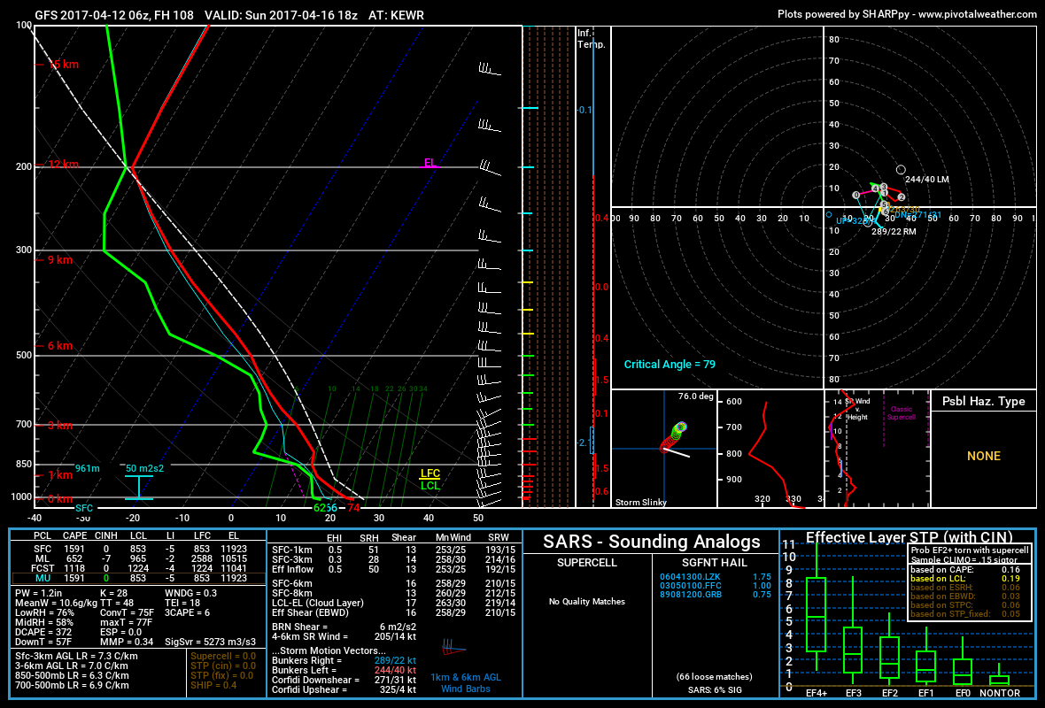
Then a cold front approaching the region may trigger more scattered showers and thunderstorms late Easter Sunday afternoon or evening. There is still some concern that any thunderstorms may become marginally strong to severe with more instability (SBCAPE and low-level lapse rates) increasing underneath a modest EML (elevated mixed-layer) over the region. The main threat will be for some isolated strong, gusty winds.
However, as we’ve been discussing, the EML the atmosphere may remained capped. Which may prevent more convection for developing over the region, without enough lift to break the cap. This may allow for more sunshine and dry conditions during the afternoon hours with temperatures rising into low to mid 80s again over inland areas. Overall, even if there are thunderstorms, a more organized severe threat is not currently anticipated with a lack of both deep-layered shear and upper-level forcing, over the region.
Some cooler temperatures are likely behind this system early next week. But the pattern remains active and progressive with multiple disturbances moving through Northeast and Mid-Atlantic region.. Overall temperatures are expected to remain near to above normal with some chances for more showers or rain later next week. Stay tuned for another zone forecast update late this afternoon or evening on the weather going into Easter weekend!