-2")
AM Zones Update: Cooler Weather, Easter Warmth & T-Storm Threat, More Changes Next Week
Happy Thursday! Some cooler weather returns today will remain over the region through the end of the week. Some high clouds, mostly cirrus will be around filtering sunshine today. But overall it will be another pleasant early Spring day, with a light northwest breeze. High temperatures will reach upper 50s over northern-most interior areas to lower to middle 60s over the rest of the region. Light northwest winds may allow for some weak sea-breezes to push inland along the New Jersey shore later this afternoon.
A weak mid-level disturbance passing through may cause more mid-high level clouds around early this evening. But then high pressure building from Southeast Canada should cause skies to clear again later this evening and some light winds overnight. This will allow more radiational cooling with temperatures to fall into upper 30s to lower 40s in many of the suburbs and mid-upper 40s for the urban areas.
On Friday, high pressure will be in control with mostly sunny skies again, temperatures will rise into the lower to middle 60s for highs during the afternoon. Friday night will be similar to Thursday night with more clear skies and light winds causing temperatures to fall again into the upper 30s to lower 40s in many of suburbs and mid-upper 40s for the urban areas.
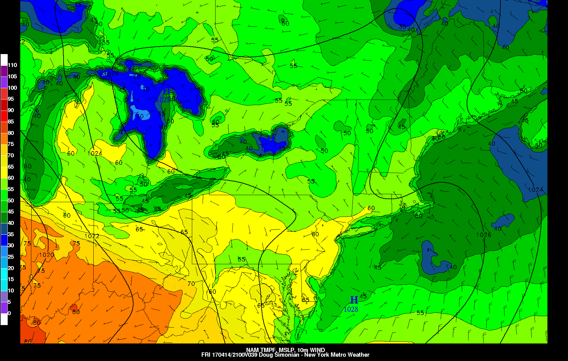
NAM 2m temperatures late Friday afternoon at 2pm
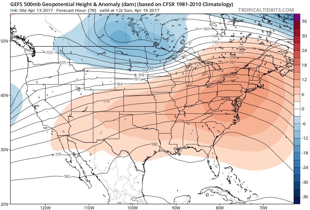
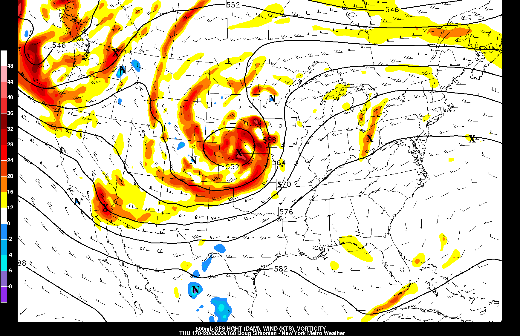
Then mid-level ridging builds into Northeast and Mid-Atlantic regions this weekend, out ahead large upper-level low/trough moving over Northern Plains and Great Lakes. This will allow for a much warmer airmass to move back into the region by Sunday. But this trough will cause the ridge to breakdown over the Northeast by Monday and Tuesday as the it moves into Southeast Canada. So this taste of summer warmth on Easter Sunday will be short-lived again.
At the surface, high pressure will be off the Mid-Atlantic coast with more southerly winds on Saturday. A warm front will also begin approaching from the southwest, with clouds increasing well ahead of it over the region, as the day goes. But some sunshine still likely to break or filter through especially during the morning and early afternoon hours. This will help temperatures to reach the lower to middle 60s for much of New Jersey, Lower Hudson Valley and New York City. While more southerly winds off the ocean and south will help keep areas further east over Long Island and Connecticut in mid-upper 50s.
As the warm front moves closer later in the day, some showers may develop over parts of the region. However, stronger mid-level ridging will likely keep most of these showers away from the coastal plain, until at the least the evening hours. Then warm front will lift northward through the region with skies becoming partly cloudy for rest of Saturday night. Temperatures will likely be mild Saturday night with more southwest winds and region in the warm sector.
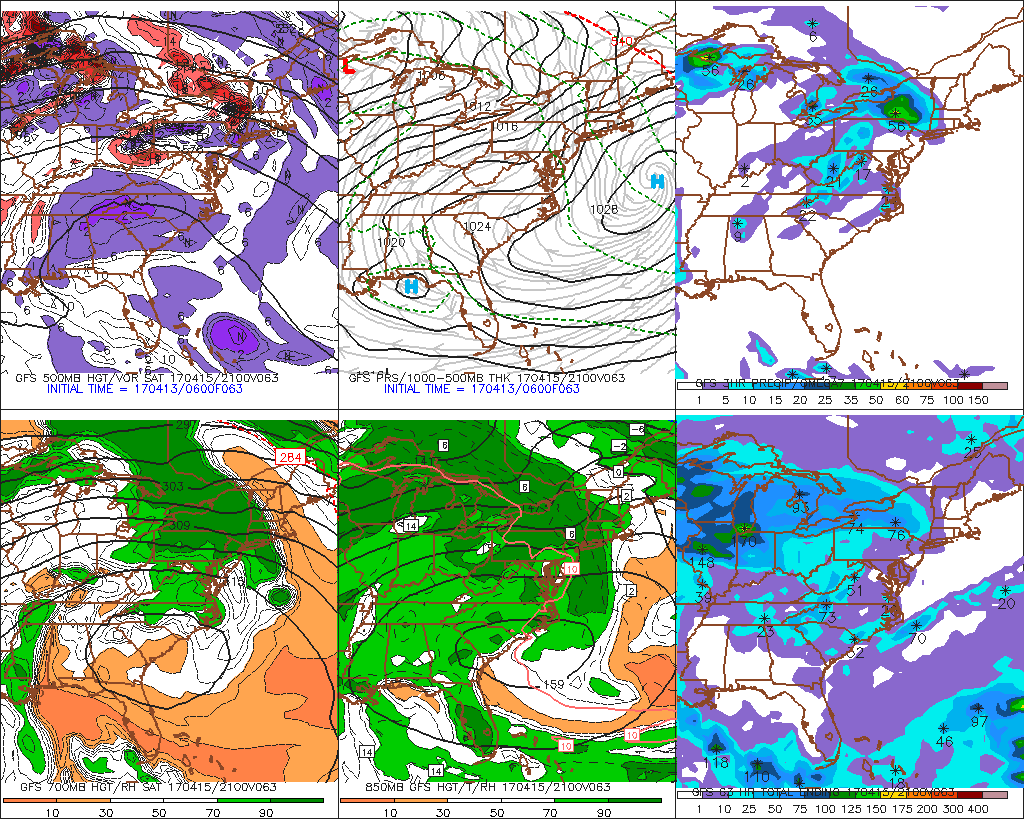
GFS model for Saturday afternoon showing showers moving over the Interior Northeast on top the ridge
On Sunday, more sunshine than clouds are likely, more subsidence capping with an EML over the region. Temperatures are likely to rise into the low to mid 80s over much of the region with west-southwest winds. Some sea-breeze in afternoon could temperatures in the upper 60s or 70s along coastal areas.
However a cold front will begin approaching the region late in afternoon and evening. Some shortwave energy, weak upper-level diffluence and moderate instability could help the front trigger some showers and thunderstorms. Sounding indicate dry-air mid-level and steep low lapse will support thunderstorms with strong downdrafts that could lead some gusty winds.
But stronger shear and forcing with upper-level trough and jet streak will remain well northwest of the region until later Sunday evening and overnight. Instability will likely be diminishing somewhat after sunset. So we don’t anticipated more organized severe threat, unless aforementioned better kinematics (shear and forcing) trend a little faster into the region. We will continue to monitor this threat closely.
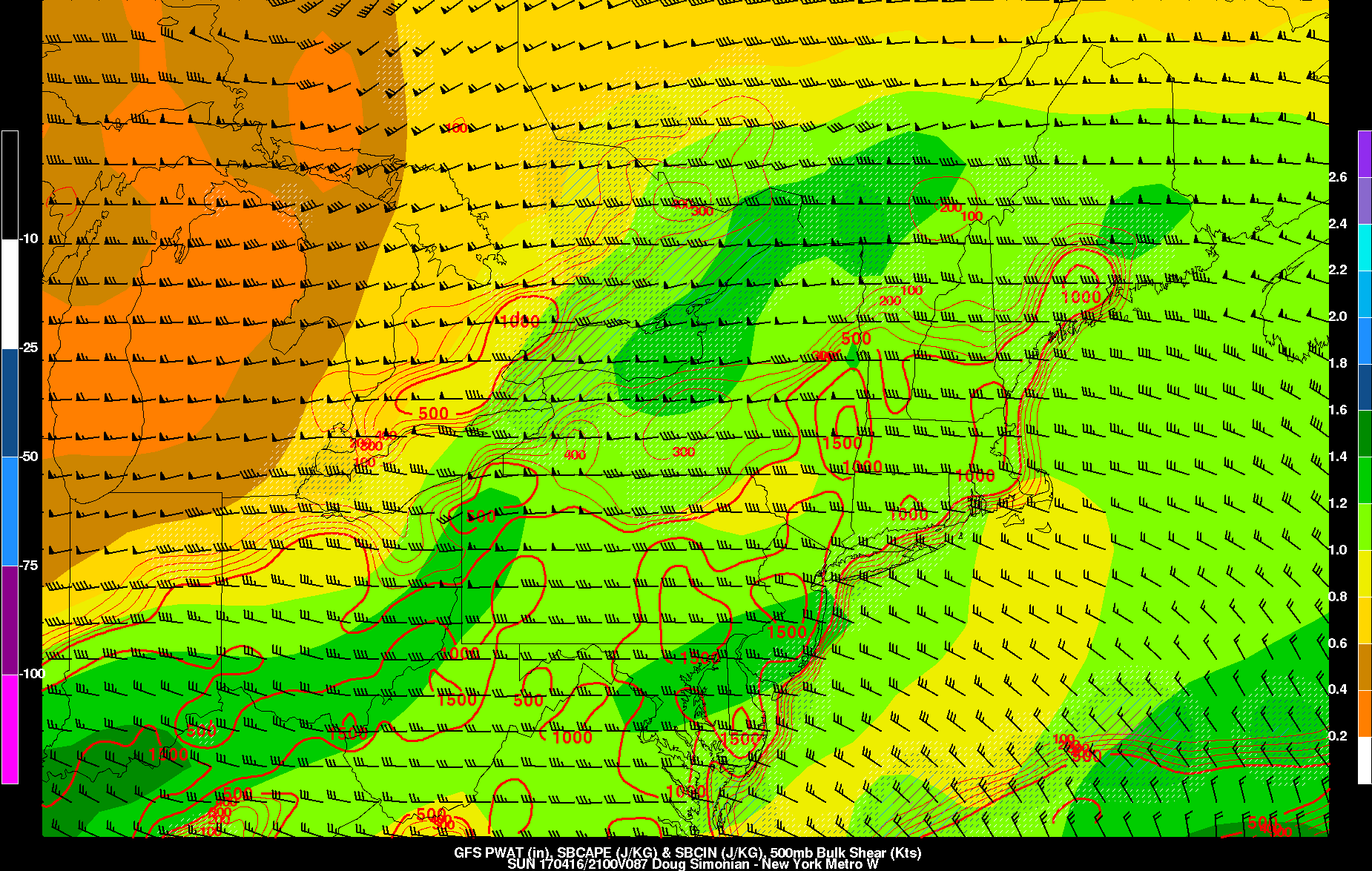
GFS model SBCAPE, 500mb bulk shear and precipitable water values support some scattered t-storms over region late Easter Sunday afternoon, if there is enough lift to break the cap
On Monday, a cooler Canadian airmass will begin moving into region behind the cold front. But daytime high temperatures may still be above normal in upper 60s or lower 70s., with deeper mixing and downsloping northwest winds. Another cold front associated with mid-level shortwave energy will move through Monday night and Tuesday with another reinforcing shot of cooler air behind it. But no significant rainfall is anticipated out this system.
However, more rainfall is possible with multiple disturbances phasing over Central US during the later half of next week. Most model and ensemble guidance shows a large closed surface to upper-level developing over Northern Rockies and Midwest then tracking northeast into Canada.. Mid-level ridging building into Northeast and Mid-Atlantic region, ahead of this system. But if high pressure is centered to north and east, this could support a frontal boundary (possible backdoor cold front) to remain further south, some cooler and possibly wetter over the region.
Overall, we have very low confidence in forecast for later next week. A fast, active pacific jet and some residual Atlantic blocking will likely give the model guidance some trouble over next several days. So more details are way too early for us, to determine, at this time. Stay tuned for more zone forecast and main dashboard updates going forward, on the weather this weekend and for next week.