-2")
Midday All Zones Update: Some Unsettled Weather Continues
Happy Thursday! After some showers around the region earlier this morning, some unsettled weather continues. Some clouds will still be around for rest of the day, with frontal boundary over the region. But some dry-air with a northwest flow developing aloft will allow for more breaks of sunshine this afternoon.. This will help temperatures rise further into the mid-upper 60s to lower 70s much of the region by late this afternoon. Onshore winds and more low clouds will still keep some coastal areas from rising out of the mid-upper 50s.
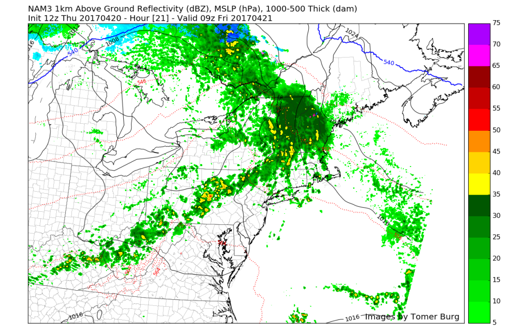
Low pressure tracking over the Great Lakes will cause another warm front to approach the region later tonight. Some scattered showers and isolated thunderstorms are possible, ahead of this front. Some heavy downpours and lightning are possible. But no significant flooding or hazards are anticipated. Temperatures will be the 40s or 50s much of the night, with mostly cloudy skies and marine airmass moving back into the region.
Mostly cloudy skies are likely again for much of tomorrow with a cool, moist marine airmass over the region. Some patchy fog and drizzle are also possible. Then as warm front begins lifting northward, skies may begin clearing over Southern NJ and Southeast PA during the afternoon. Sunshine with more southwest winds will help temperatures rise into the 70s. Elsewhere more cloud cover and southeast winds will keep temperatures from rising out of the 50s or 60s.
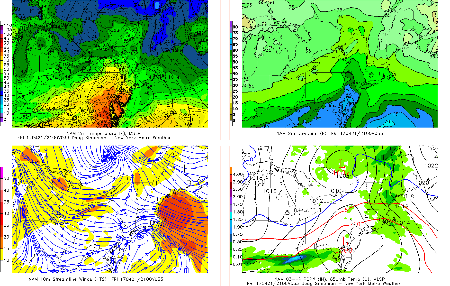
NAM model forecast for 5pm Friday
Tomorrow afternoon and evening, a weak-triple point low will develop along a warm front stalling over Southeast PA/Southern NJ. A cold front will also be approaching from the west. Some isolated or widely scattered showers and thunderstorm possible with more instability and convergence mainly southwest of NYC. Some heavy downpours, lightning and gusty winds are possible. But a lack of upper-level forcing and mid-level cap, will inhibit more organized convection.
The cold front will move south through region later Friday night. This will allow for weak high pressure to build into the region with more pleasant, dry weather on Saturday. But more clouds may begin increase again as later in the afternoon or evening, as shortwave trough approaches and weak wave develops along the cold front stalling to the south. Deep mixing with downsloping northwest winds and some sunshine will still support high temperatures on Saturday in the low to middle 60s over much of the region.
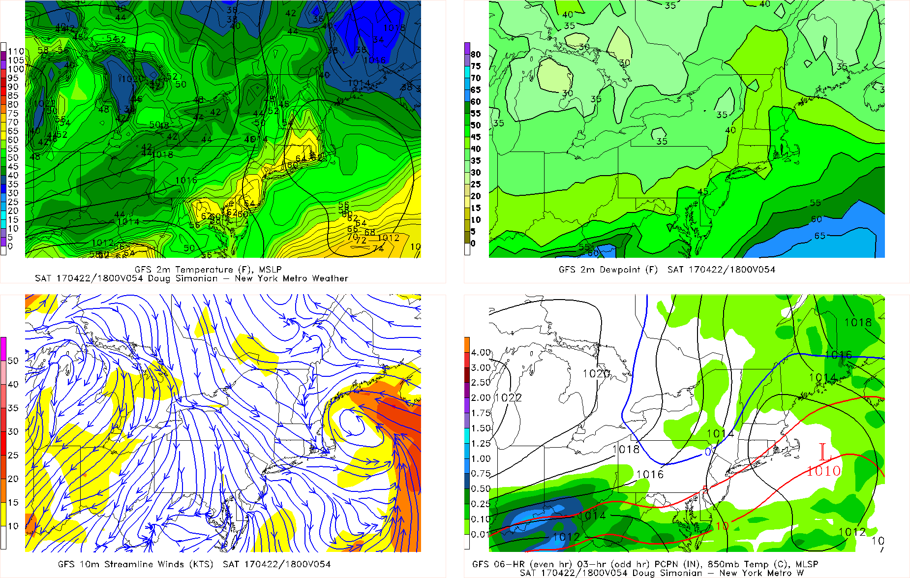
GFS model forecast for 2pm Saturday afternoon
Then some uncertainty continues for the rest of the weekend and into early next week, as a cut-off low develops over the Southeast US. Latest guidance continues suggest this low will stay far enough to spare region any major impacts from heavy rain or winds. But waves of moisture from this system may northward up the Mid-Atlantic coast. This may support some moderate rainfall for the southern zones, mostly south of NYC. While weak high pressure supports drier weather over more of the northern zones. Stay tuned for more updates weather through the weekend and early next week by this evening.