-2")
5/2 AM Zones Update: Cooling Trend, Closed Low with Heavy Rain Likely Friday
Happy Tuesday! Showers with a cold front early this morning have moved offshore. More sunshine mixed with some clouds will be around for rest of the day, as high pressure begins building into the region. High temperatures will be in the upper 60s to lower 70s across much of the region. It will also become more breezy today, behind the front. West-northwest winds will increase to between 15 to 25 mph with some higher gusts around 35 mph possible this afternoon.
A cooler, Canadian airmass begins settling over the region with clear to partly cloudy skies tonight. Overnight low temperatures will likely be in upper 40s or lower 50s over most NYC and urban areas. While many of suburbs will likely drop further down into 40s. Some of areas of interior valleys, may see temperatures drop into the upper 30s.
High pressure from Canada will be provide more pleasant but cooler weather Wednesday and Thursday. Temperatures will be several degrees below normal. Daytime highs will be in upper 50s to lower 60s over most of region. Clear to partly cloudy skies are expected again Wednesday night. Calmer winds may will lead to more radiational cooling. So low temperatures will be in mid-upper 40s around NYC and urban areas. Many of the suburbs drop down into the 30s.Then clouds will increase more Thursday night, as high pressure moves offshore and next storm system approaches. More cloud cover will keep temperatures from dropping out of the upper 40s to lower 50s for overnight lows.
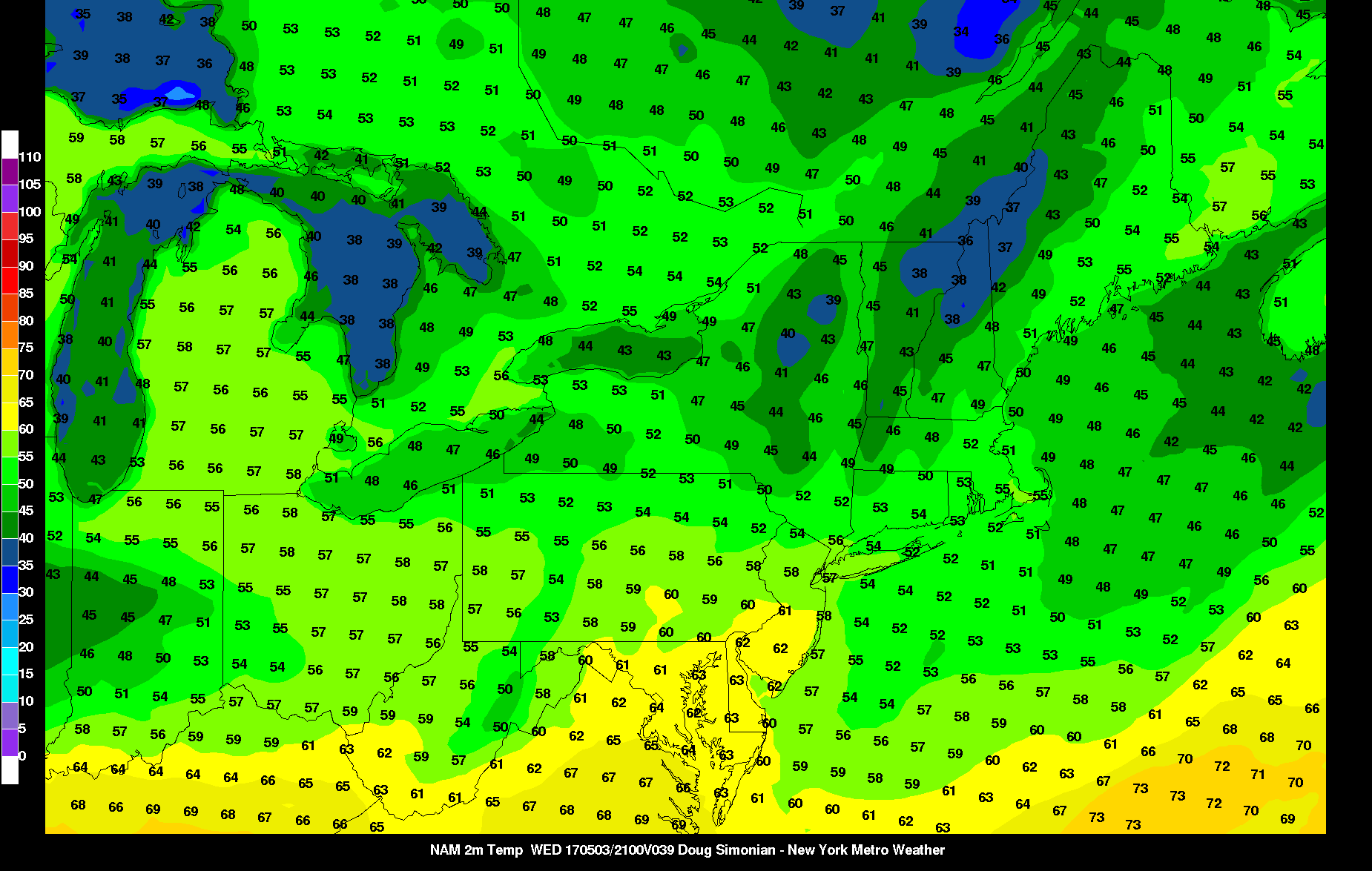
NAM model temperatures for 5pm Wednesday
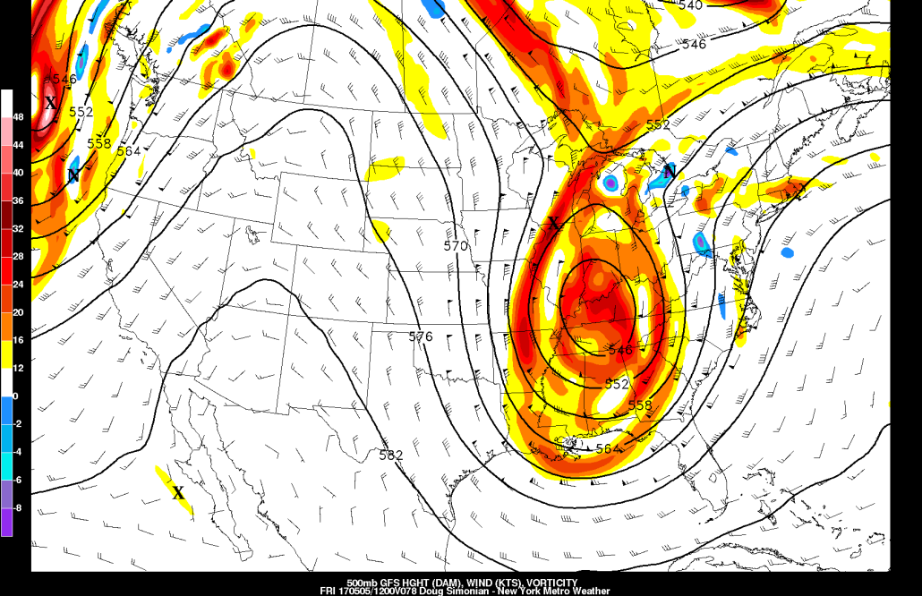
A large closed low tracking northward through Ohio Valley will begin impacting the region with some rainy and windy conditions on Friday. Despite this low taking a track well to the west, some heavy rainfall is likely, across the region with a firehose 50kt low-level jet and subtropical moisture streaming off the Atlantic Ocean. There are some indications that a weak triple-point low will be developing over Mid-Atlantic region. If that happens, it will further enhance instability and convergence for some elevated convection or thunderstorms with at least some very heavy downpours over the region.
Overall, we anticipate, widespread rainfall totals between 1” to 3” over the region. This could some result localized flash flooding on some area roadways and poor drainage areas. Especially over parts of Northeast NJ, where flash flood guidance shows around 0.50” to 1.50” is need for flash flooding. Low-level inversion should keep stronger winds aloft with the low-level jet from mixing down. But tighter pressure gradient will still cause sustained winds southeast between 20 to 30mph with gusts up to around 40 mph possible, especially along the coast.
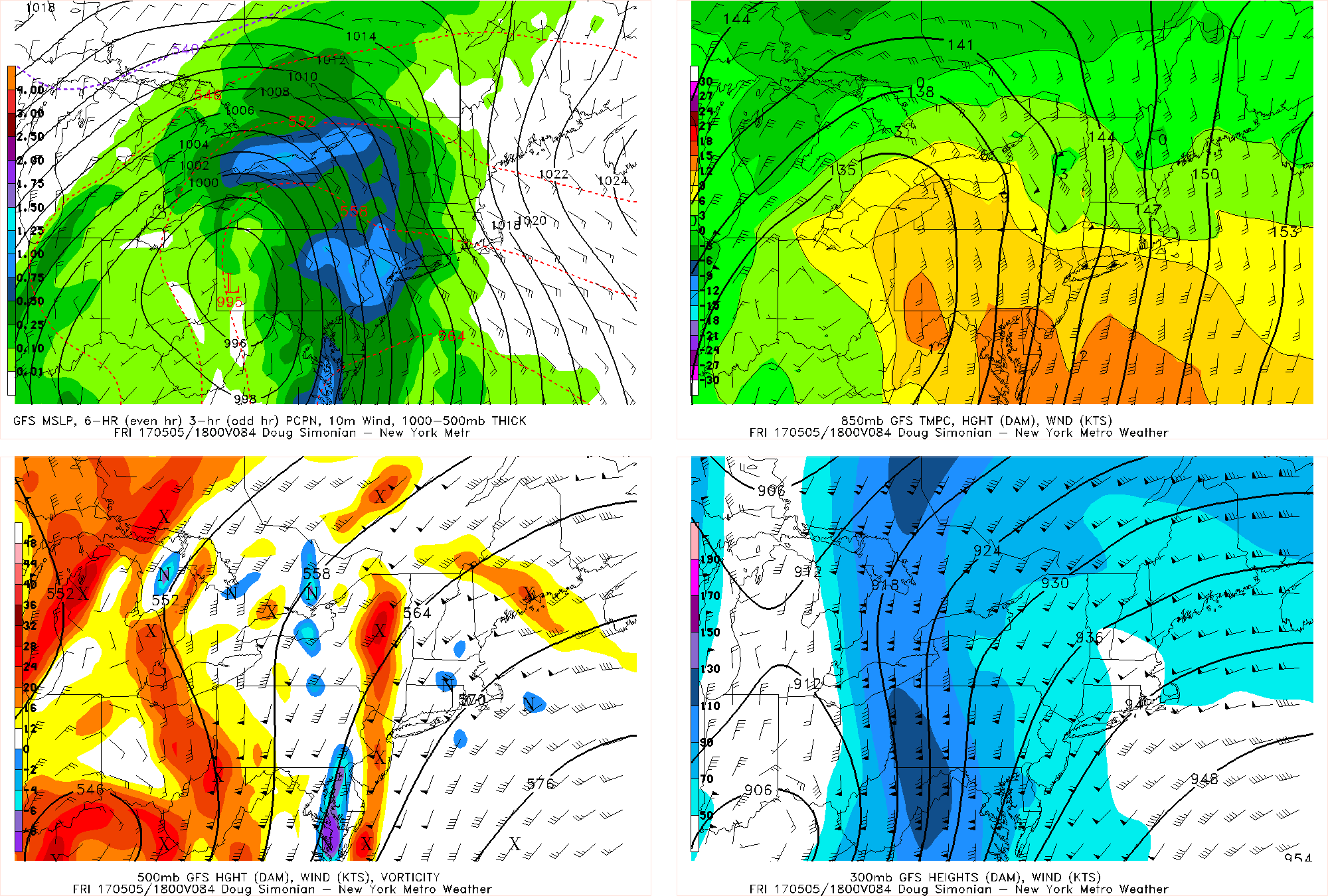
GFS Model for Friday afternoon showing heavy rainfall associated with strong low-level jet
The firehose jet will be shifting northward into New England Friday night. This will cause steadier, heavier rain to taper off showers. But the high-latitude blocking retrograding over Greenland/Davis Strait will cause the closed low to cut-off and then meander over the Northeast and Mid-Atlantic regions through this weekend and into early next week. Lobes of short energy swinging around the cut-off low could result more unsettled weather remain with some scattered showers around each day. Temperatures will be at least several degrees below normal with cooler over the region. It may even cold and unstable enough for some isolated snow over the interior locations.
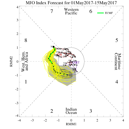
A somewhat cooler, active or unsettled pattern may continue, after this cut-off low eventually departs or decays. This is as ensemble guidance still shows some residual high latitude blocking, and West Coast ridging, keep some troughiness over Northeast and Mid-Atlantic region over next couple weeks. The MJO also foretasted to be in phases 8/1 over next two weeks gives also more credence to this pattern as well. So it doesn’t look like we will be seeing much more summer-like warmth after this week. Stay tuned for more zone forecast and other updates on the more cooler and unsettled weather pattern developing again over next couple of weeks.