-2")
5/11 AM Zones Update: Coastal Storm on Saturday, Warming Trend Next Week
Happy Thursday! Sunshine will be mixing with more clouds today, as disturbance passes to the south and west of the region. Some showers from this disturbance may move into far western and southern parts region today. But a confluence backside around the upper-level low over the Gulf of Maine should keep the rest of the region. High temperatures will be in the lower to middle 60s over most of the region with mostly light and variable today.
Weak high pressure from New England, in nose into more of region tonight. So more clear to partly cloudy skies are expected tonight with lows in mostly in the 40s across the region. Then more onshore winds from the east-southeast, will result more low cloud cover than sunshine on Friday. Some spotty areas of drizzle are possible by the end of day. Clouds cover and onshore winds overall may keep temperatures mid-upper 50s near the coast, to lower 60s inland on Friday.
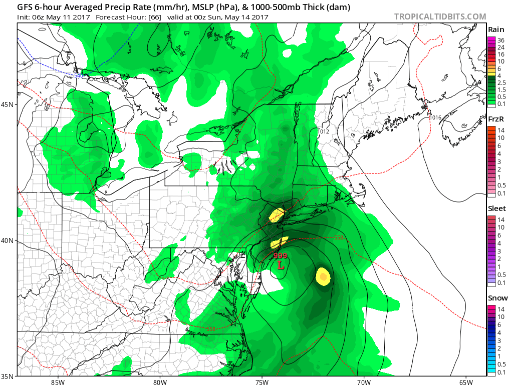
High pressure begins to loose to control Friday night. Low pressure will begin organizing and begin moving northward along the Delmarva coast. Isentropic lift and low-level moisture from onshore flow will be increasing, ahead of it. So rain will likely begin spreading from southwest to northeast, across the region late Friday night and Saturday morning. Then northern and southern stream energy phasing will cause a deep trough to amplify and take more negative tilt. This will result in low pressure intensifying as it moves northward along or just off the New Jersey coast on Saturday.
The region will be underneath of right-rear entrance region of upper-level jet streak with precipitable water values above normal. This will result in rain becoming moderate to heavy at times, by afternoon and early evening hours, across the region on Saturday. While a more stable marine airmass will likely preclude any convection. Some torrential downpours and very heavy rainfall in short-period of time, are still possible as area of strong frontogenesis and positive vorticity advection moves through region. This could result some localized flash flooding in poor drainage areas and low-lying areas. Take more precaution, if you have to drive on roadways during this time frame.
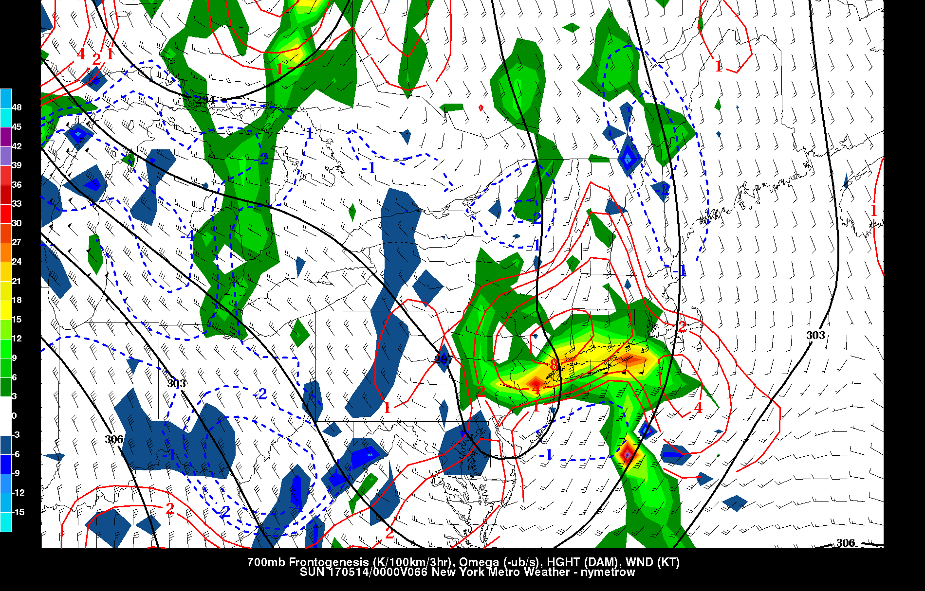
GFS showing mid-level frontogenesis and velocities moving through region early Saturday evening
Winds will also be increasing throughout the day and evening hours on Saturday, as a 40-50kt easterly low-level jet moves the region. A marine inversion will keep some of these stronger winds aloft, from mixing down to surface. But sustained winds 20-35 mph with gusts up to around 45 mph are possible, especially along the coast. Some minor coastal flooding during high tides Saturday evening is also possible with strong onshore flow. But lower astronomical tide cycle between the full and half moon, should mitigate more coastal flooding.
Rain will quickly taper off and end for most of region later Saturday evening or overnight, as the low moves further away from the region. Rainfall totals somewhere between 1” to 3” are likely for much of the region during this period. Flash flood guidance also suggest on around between 0.5 to 1.00” of rainfall will be need for small streams or rivers to overflow their banks, particularly over Northeast NJ. So this will be monitored closely. But significant river flooding is not currently anticipated, after this storm is over.
More cool, unsettled weather is likely for Mother’s Day Sunday.The coastal storm will begin to occlude as it becomes vertically stacked with mid-level low over the New England coast. Some dry air intrusion may allow for clouds to break for some sunshine at times each day. But more scattered showers are possible, especially during the afternoon and evening hours. It will also be windy, especially Sunday with a tighter gradient and behind this storm. Downsloping northwest winds, will be gusting to near 40mph at times, on Sunday. High temperatures each will range from upper 50s over Interior to lower to middle 60s near the coast.
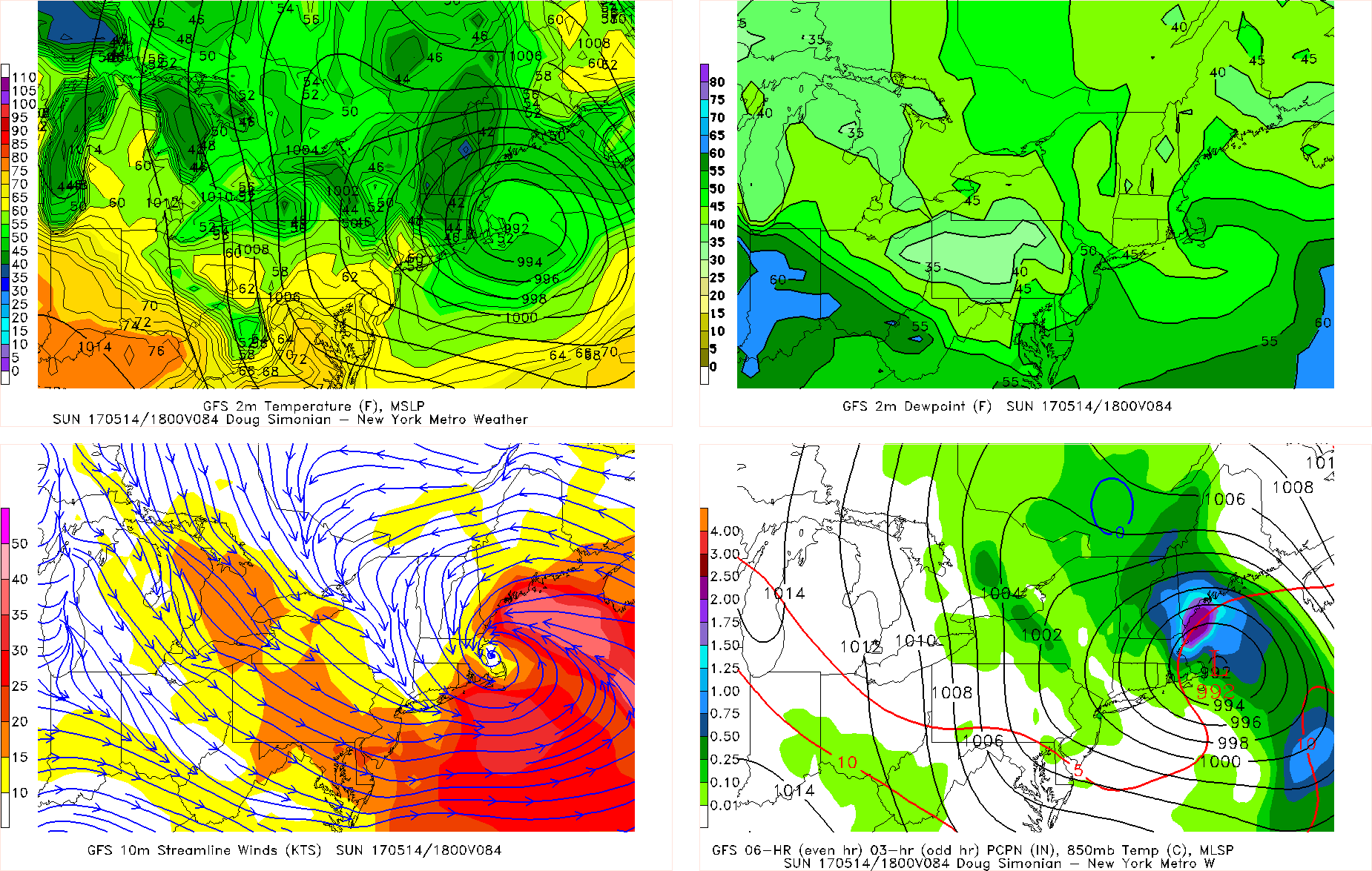
GFS model forecast for Mother’s Day Sunday
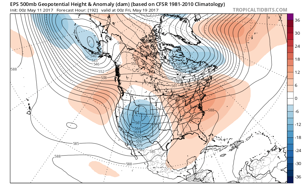
So more cool, unsettled weather may continue into Monday, as the upper-level remains over the Northeast. Then some bigger pattern changes are likely for for mid-later part of next week, as the pacific jet begins to become more active. This jet will help carve out a trough over Western US and in turn cause a ridge to build over Central and Eastern US, by the end of the week. This will result more improving weather and warming trend in temperatures to above normal by late week. Some summer-like warmth could return again by mid-late next week, with latest model guidance showing highs well into the 70s and then 80s starting on Tuesday.
Some residual high-latitude blocking, split flow and confluence with a troughiness over Southeast Canada, will likely remain. So will have to watch for a backdoor cold front to potentially mitigate this warm-up, for parts of the Northeast over the next couple weeks. But overall is looks like the pattern, with more active pacific jet will support some more longer periods of warmer, drier weather to return again, as we towards Memorial Day weekend. Stay tuned for more zone forecast updates over next few days on the coastal storm Saturday and the warming trend for next week.