-2")
5.19 Midday Zones Update: Pleasant, Cooler Weekend…Heavy Rain Possible Monday
Happy Friday! More hot weather continues today. A cold front will cause winds to turn more west-northwesterly and humidity to decrease this afternoon. But more west-northwest downsloping winds will support high temperatures in the upper 80s to lower 90s, over much of the region, again this afternoon. Even near the coast temperatures will be very warm, as sea-breezes will be held back by west-northwest winds this afternoon.
A few isolated or widely scattered showers and thunderstorms are still possible, with the cold front this afternoon and evening. Main threats again heavy rainfall and frequent cloud to ground light. Some moderate levels of instability and shear will also support a marginal risk of some isolated damaging wind gusts and large hail, especially over Central and Southern New Jersey and Southeast PA. But overall lack of lift and moisture along the front is still expected to mitigate more organized or widespread convection throughout the region.
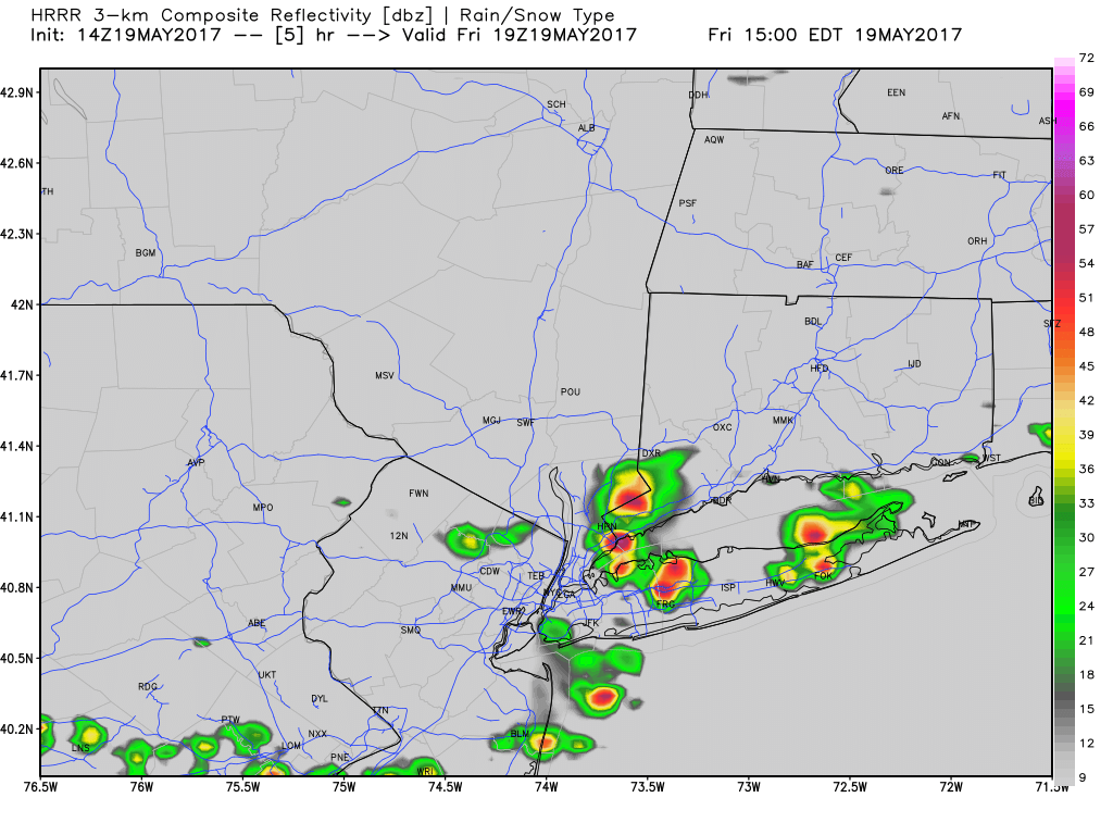
HRRR model showing a few widely scattered showers and thunderstorms over the region this afternoon
Behind this front, more northerly winds will cause clearing skies later this evening and temperatures to drop into the 50s overnight, over the much of the region. Then high pressure building in from Southeast Canada will be provide more pleasant, cooler weather the weekend. Some sunshine mixed with clouds are expected each day with highs in the upper 60s to lower 70s for daytime highs each day. Saturday night will be partly cloudy with temperatures upper40s to lower 50s throughout the region. On Sunday, winds more southeasterly and could areas near the coast a little cooler.
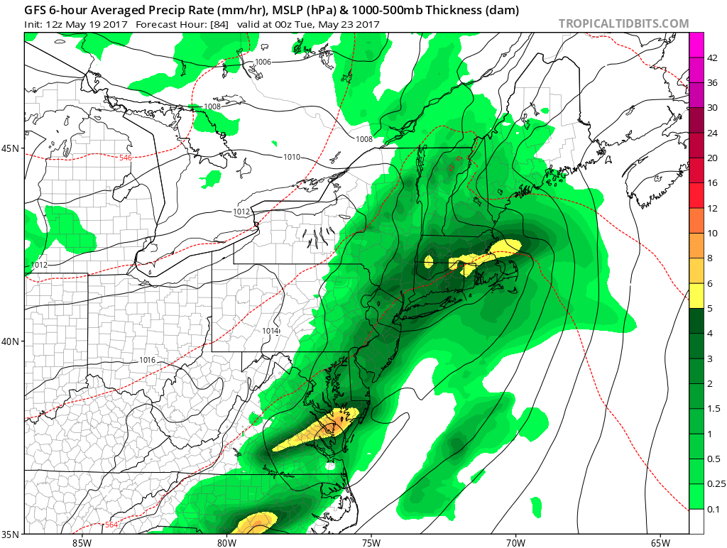
By Sunday night and warm front will approaching with increasing clouds. Some scattered showers are possible by late in the night. Then latest guidance indicates the warm front will lift northward through region on Monday. This will lead more southerly winds, but temperatures will depend on how much clouds break for sunshine. Then a cold front approaching the region the west, will likely cause more showers and thunderstorms by Monday afternoon and evening. Strong southerly jet and plume of subtropical moisture streaming northward up coast, will support some heavy rainfall. But severe weather will likely be mitigated by lower instability with cloud cover and marine influence near coastal areas.
ECMWF model showing some high precipitable water values, ahead of the cold front over the region on Monday
The cold front will move through later Monday night and Tuesday. More west or northwest downslope flow behind this front may support may more pleasant, seasonable warm and dry weather on Tuesday. Then more unsettled weather is likely later next week as large, complex storm system with primary low pressure over the Ohio Valley, develops. More significant rainfall is possible, as confluence, from residual blocking, results in a secondary low developing somewhere over Mid-Atlantic region. Stay tuned for more updates on this potential storm system for late next week, this evening and over the weekend.