-2")
5.24 Midday Zones Update: Heavy Rainfall, T-Storms, Coastal Flooding Possible Thursday
Good afternoon. Low pressure that brought some light early this morning, is moving further offshore. This will allow for clouds to clear for more sunshine this afternoon. This will help temperatures rise into the upper 60s to lower 70s over much of the region, especially inland. A northeasterly flow may keep some coastal sections a little cooler in the lower to middle 60s.
Then clouds will increase again this evening and overnight, as larger storm system from the Ohio and Tennessee Valleys , that we’ve been discussing over the past few days with these zone forecast updates, finally begins moving into the region. As more lift with mid-level warm advection and isentropic lift increases ahead of warm front, some may start developing form southwest to northeast across the region, very late tonight. Cloud cover will likely support low temperatures drop into 50s over most of the region.
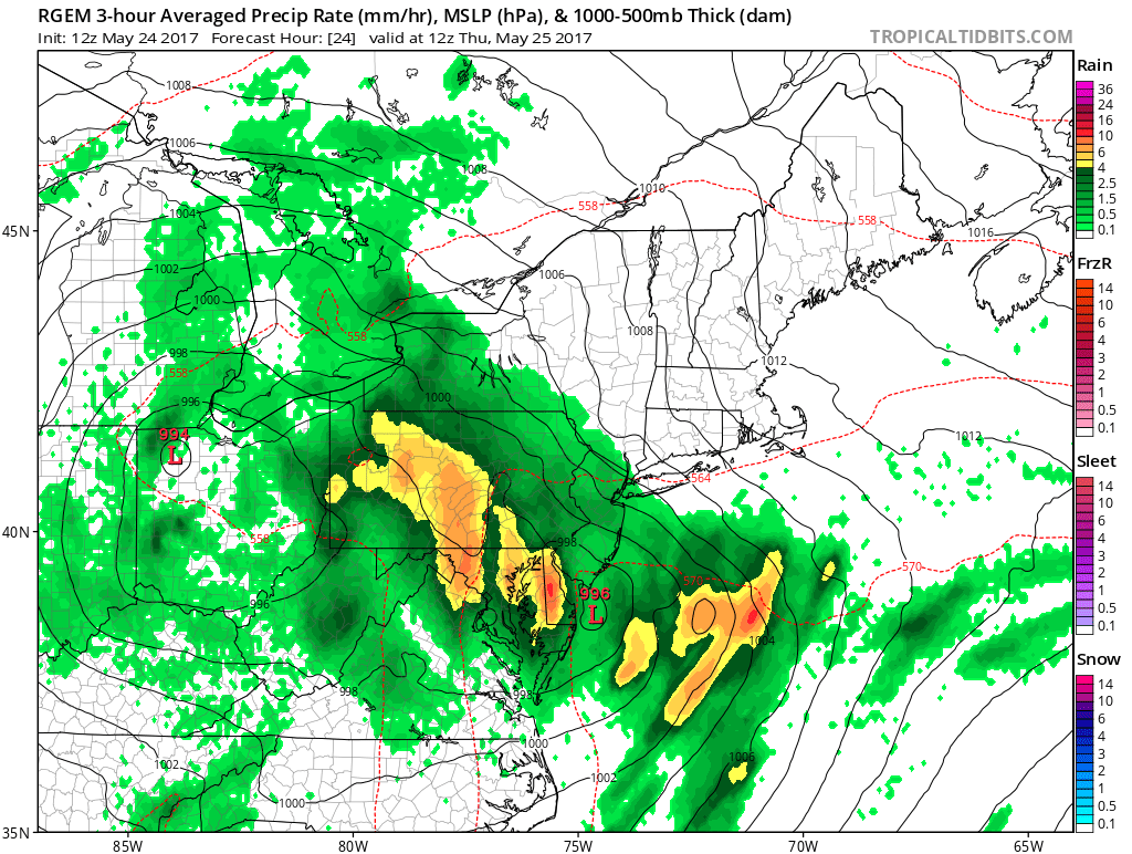
A couple of waves of rainfall, associated with some mid-level frontogenesis will move through parts of the region tomorrow morning. This system is still somewhat disjointed with dynamics over region. So confidence is lower in heavy rainfall totals for entire. But where dynamics do come together, rain could be moderate to heavy at times, with some deep subtropical moisture feeding into region. Some elevated instability will also be increasing ahead of the warm front. This might result in a few thunderstorms with torrential downpours, especially during the mid-late morning to early afternoon hours tomorrow. Localized flash flooding in poor drainage, low-lying areas is possible with these thunderstorms. Otherwise not much more than some typical ponding on roadways is anticipated, across the region.
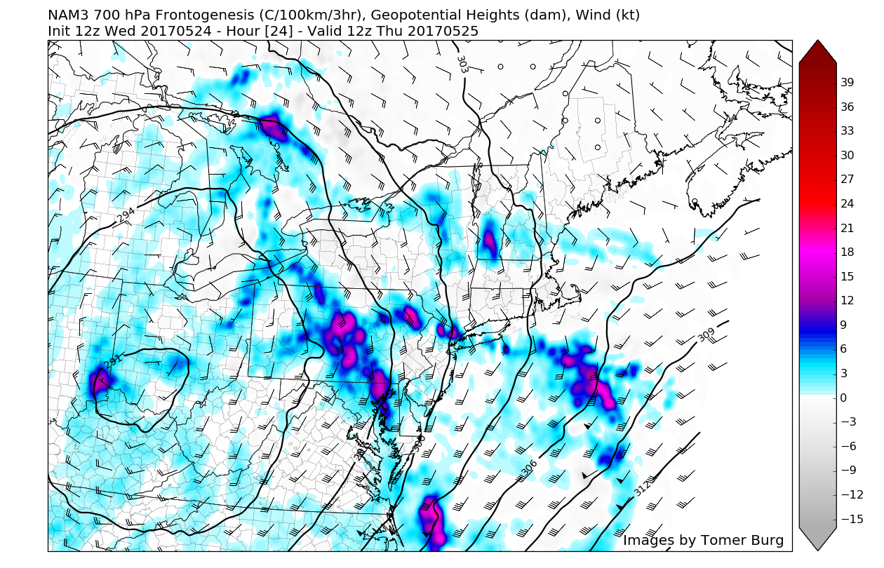
3km NAM showing some 700mb frontogenesis over the region tomorrow morning
Then a mid-level dry slot will move through during later in the afternoon. This will cause steadier rain to probably taper to a few scattered showers for a few hours into early evening hours.. Skies will likely remain mostly cloudy, temperatures may rise into 60s by early evening. But shortwave energy rotating and amplifying upper-level low, will result into low pressure over the Ohio Valley weaken and transfer to secondary low developing along the Mid-Atlantic. More showers and thunderstorms are likely over region later tomorrow evening and overnight as the coastal low moves northward and deepens over New Jersey. This low help also push warm front further north, causing more instability. So this could lead to a few isolated strong thunderstorms gusty winds and some small hail.
Outside of any stronger thunderstorm, a tighter pressure graident may cause winds to gust to between 30-40mph, especially near the shore. Otherwise synoptic winds aren’t expected to be significant hazard threat with this system. But a Super New Moon on Thursday, will result in some highest astronomical high tides of the year. So a persistent onshore flow, will likely lead to some minor to possibly moderate coastal flooding during high tides, over the next few days. The biggest threat of some locally moderate coastal flooding will come during Thursday evening high tide cycle, where the astronomical high tides will be at their highest this week.
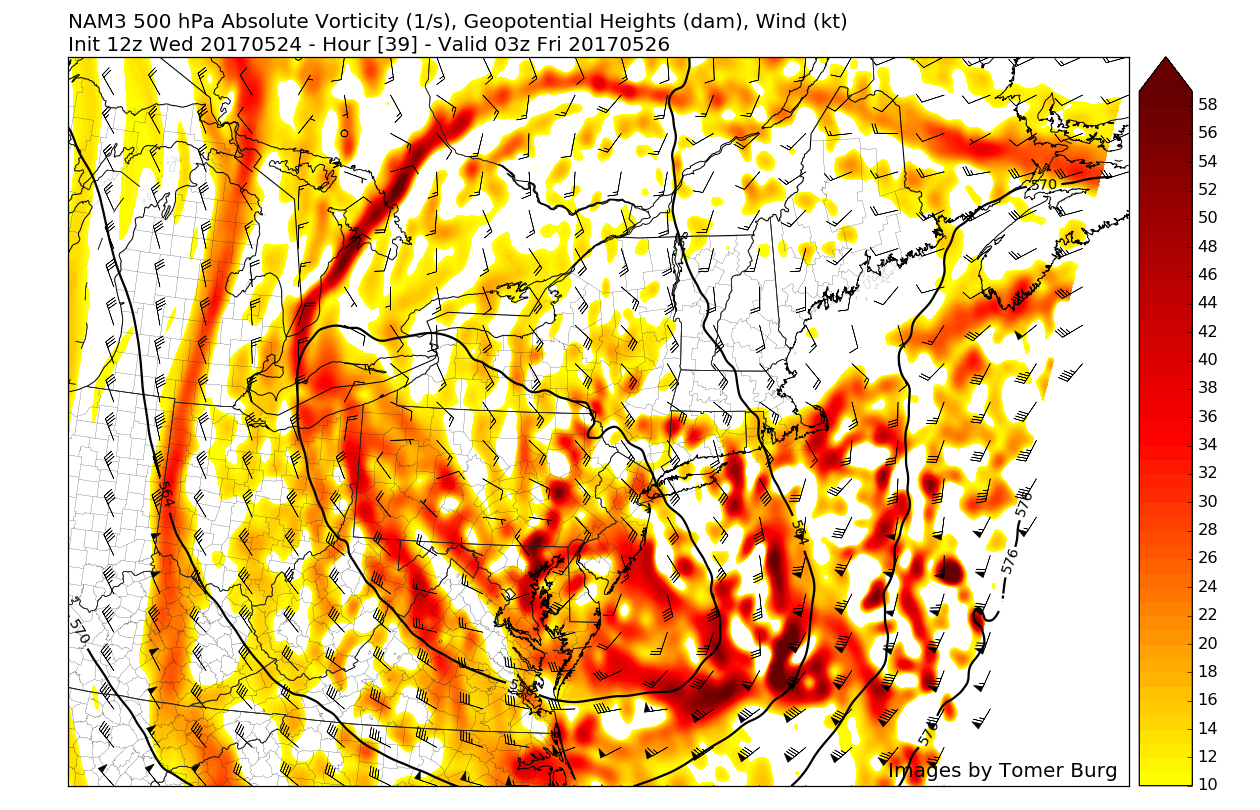
Shortwave energy digging into Mid-Atlantic region tomorrow evening causes the upper-level low to take a negative-tilt, support a secondary low along the Mid-Atlantic coast.
On Friday, the low pressure will continue moving northeast away from the region, into New England. This should cause steadier rain taper off from southwest to northwest, during the morning. Then clouds will break for some sunshine with a drier northwest flow, during the afternoon hours. But a cold pool aloft, with the upper-level low will still result in unstable airmass with more daytime heating. So some scattered showers and thunderstorms could develop again later in the afternoon and early evening. Some of these thunderstorms could still be capable of producing gusty winds or small hail. High temperatures will be in the upper 60s to lower 70s across much of the region.
Weak high pressure and mid-level ridging builds more for Saturday. This will support more sunshine to mix with clouds over the region. High temperatures are expected to be in lower to middle 70s. One fly in the ointment is that some of the latest models today, are indicating a mid-level disturbance over Northern Mid-Atlantic region. If this disturbance track near us and there is enough moisture, some scattered showers may develop again later in the day. But at this time we keeping the forecast dry for Saturday.
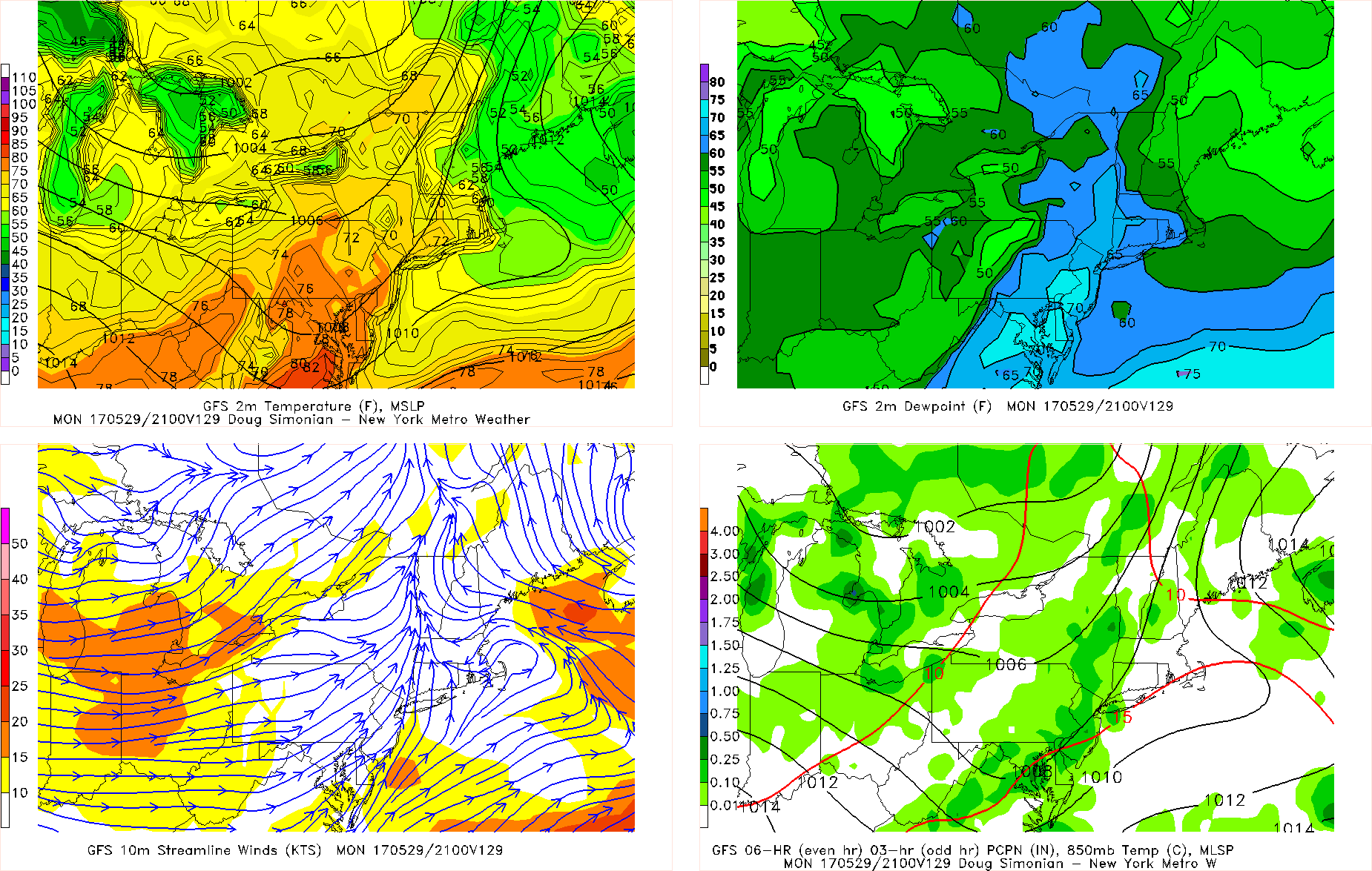
GFS model forecast with showers or thunderstorms moving late in the day on Memorial Day with the next storm system
More scattered showers and thunderstorms are more likely to be around for Sunday and Memorial Day a low pressure tracking over Great Lakes send a couple of frontal boundaries through region. However, much of time will likely be dry with some sunshine and mixing with clouds each day. This will temperatures get into at least into the upper 60s and 70s through the region. Sea-breezes may keep coastal sections a little cooler. So no washouts are still expected for the holiday weekend. Stay tuned for more zone forecast and other updates for into Memorial Day weekend tonight!