-2")
Public Analysis: Heavy Rainfall Likely Tomorrow, Unsettled Weather Continues
Good Evening!
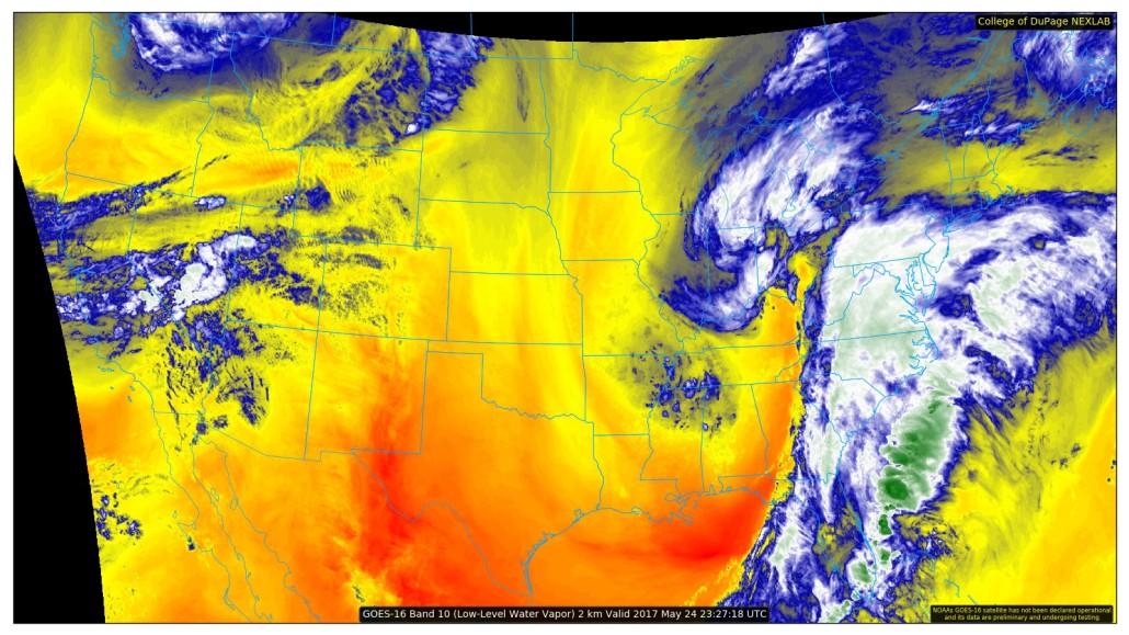
An area of low pressure and its associated moisture moved through our area this morning and brought some light to moderate rain for most locations. While the low pressure and the abundance of moisture was handled well by our computer guidance, the amount of mid-level forcing associated with a weak frontal system was severely underestimated, therefore leading to most, if not all computer guidance not showing any measurable precipitation during this time period. Once this front and its associated dynamics began to move away from our area and started to decay, the rain and cloud-cover began to gradually decrease leading to partially sunny skies. Despite the rain and prolonged overcast, temperatures were able to rise back into the mid to upper 60’s and lower 70’s for most of the area.
Cloud cover has once again begun to increase as a large area of low pressure located in the Ohio Valley continues to drag a copious amount of moisture northwards, directed at our area and will likely impact the next thirty-six hours or so. Cloud cover should begin to increase steadily this evening, and winds increasing from the east will allow temperatures to drop into the 50’s for the entire region, which will once again be below-normal for our area. With increasing moisture ahead of a warm front down to our south, some showers may be possible very late this evening and early this morning as forcing associated with the warm front begins to steadily increase.
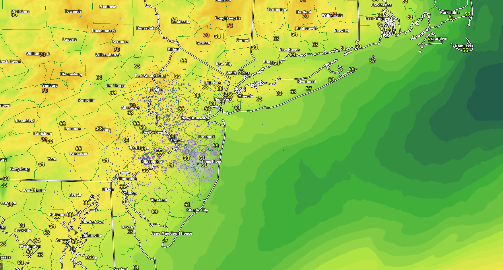
This evenings latest temperatures and regional radar mosaic, showing mostly dry and comfortable conditions over much of the area.
Thursday Into Friday
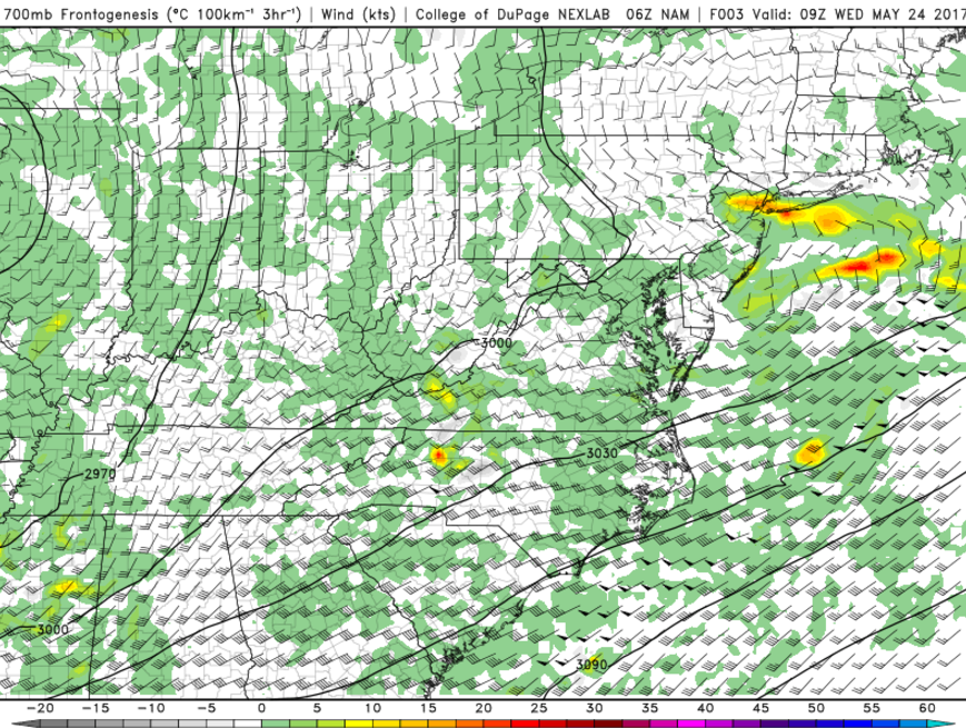
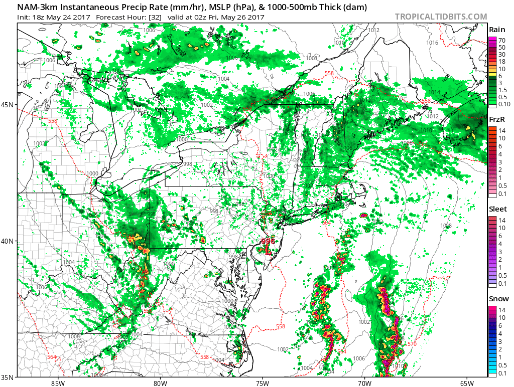
The latest short-range model guidance continues to hint that the first wave of rainfall associated with the large and anomalous area of troughing/area of low pressure will likely continue to spread northwards during the very early morning hours tomorrow, moving over portions of Virginia, Delaware, and Maryland. This batch of rain should begin to move into southern New Jersey and southern Pennsylvania by 6am or so, and continue moving northward through the morning, likely reaching New York City around 8am While the overall dynamics of the system have trended more disorganized than they were forecast, there is a very solid transport of deep tropical moisture, so some areas that do see the more favorable dynamics could see some locally heavy downpours early tomorrow morning.
In addition to locally favorable conditions for heavy downpours, the addition of some weak instability associated with the warm front may also bring he chance of some convection/thunderstorms, which would only work to increase the potential for heavy downpours tomorrow morning. Localized flash-flooding in poor drainage, low-lying areas is possible with these isolated thunderstorms. Otherwise not much more than some typical ponding on roadways is anticipated across the region.
As we work our way into the afternoon hours, more dry air will begin to move its way in behind the heaviest rain, which should be able to gradually reduce any remaining rain to isolated showers and drizzle, possibly lasting into the early evening hours. With the potential for heavy rain, overcast through most of the day, and increasing easterly winds off of the cool Atlantic, highs tomorrow should be uniformly stuck in the 60’s across the entire area. Temperatures in the 50’s may be possible during some of the more intense downpours, in which cooler air from a few thousand feet up is brought down to the surface.
Later in the day, the original low pressure system over the Ohio Valley will begin to decay and die-off. This will allow a transfer of energy just off the New Jersey coast. where a secondary low pressure will gradually become established. This new, developing low pressure system will bring another chance at some isolated showers and thunderstorms across the area into late tomorrow evening as the system continue to strengthen due to a hefty amount of upper level energy rounding the base of the large upper level system that we have been talking about for well over a week now. As this low continues to deepen over the evening hours, it will begin to advect warm air northwards, which may help to increase instability locally enough for a few storms to have some gusty winds and possibly some pea-sized hail.
Overall, tomorrows rainfall totals will likely range quite a bit, mostly depending on whether or not convective rains can develop and just how long these rains can stick around. Additionally, a tightening pressure gradient from the developing coastal low and a high pressure system in Canada will cause winds to increase a bit during the afternoon and evening hours, to around 25-40 mph. While these winds are not all that impressive, they will last a while near the coast, and this will promote a heightened threat of some coastal flooding due to the complications from an astronomical high-tide. the National Weather Service has issued a Coastal Flood Advisory for the potential for minor flooding of the most vulnerable waterfront locations.
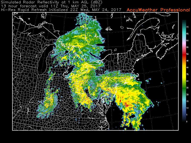
This evenings High Resolution Rapid Refresh Model, showing a batch of very heavy showers and isolated thunderstorms moving across the area during the morning commute hours
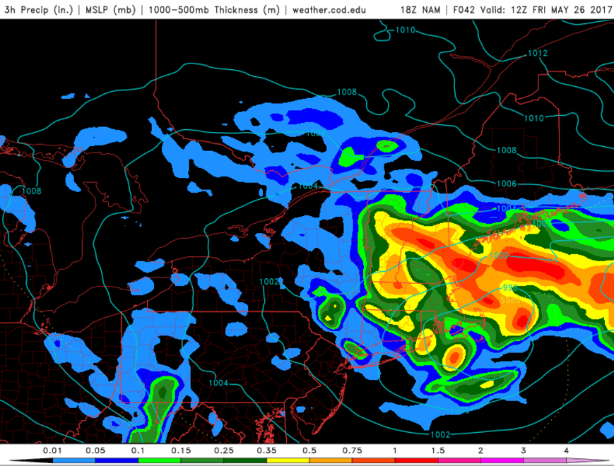
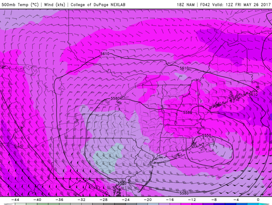
Friday Into Saturday
Once we move on to Friday, the low pressure will continue to linger over much of the Northeast, gradually meandering into portions of New England. As this low slowly moves away from our area, this will likely cause steadier rain taper-off from southwest to northwest during the morning commute. Clouds will likely start to break as a stout northwesterly flow begins to develop from Canada, ushering in cooler and drier air. Some scattered showers and thunderstorms could develop again later in the afternoon and early evening due to colder air in the mid levels of the atmosphere and heating occurring near the surface, especially for any locations that see prolonged sunshine. Some of these thunderstorms could potentially produce gusty winds and some small hail . High temperatures will likely reach the upper 60s to lower 70s across much of the region, with slightly higher temperatures likely for those locations that see earlier/prolonged clearing.
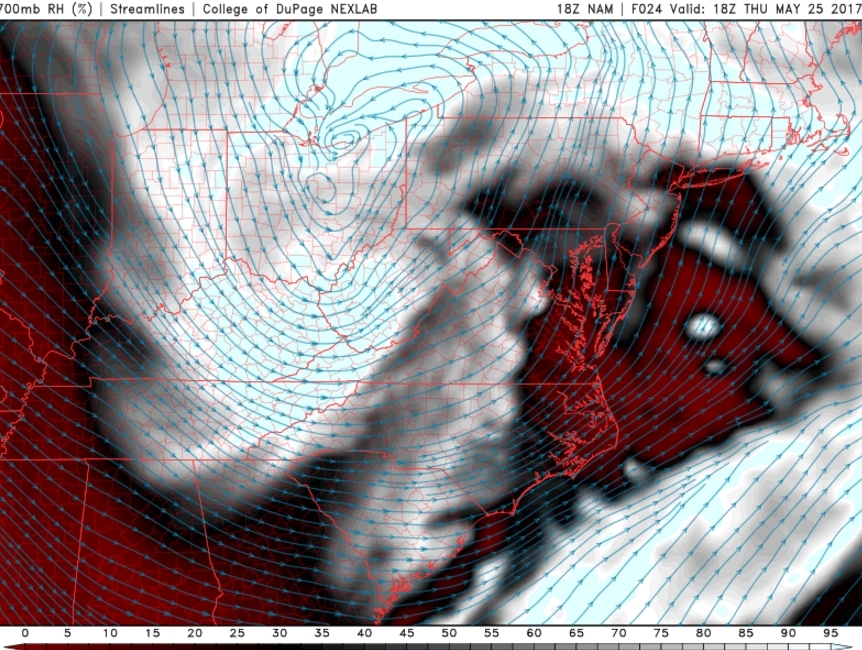
An area of weak high pressure and mid-level ridging will likely build over the region on Saturday, this will support more sunshine to mix with clouds over the region. High temperatures are expected to be in lower to middle 70s. One fly in the ointment is that some of the latest models today, are indicating a mid-level disturbance over Northern Mid-Atlantic region. If this disturbance track near us and there is enough moisture, some scattered showers may develop again later in the day. But at this time we believe that this is unlikely for now, but will be monitoring this system very closely over the next few days.
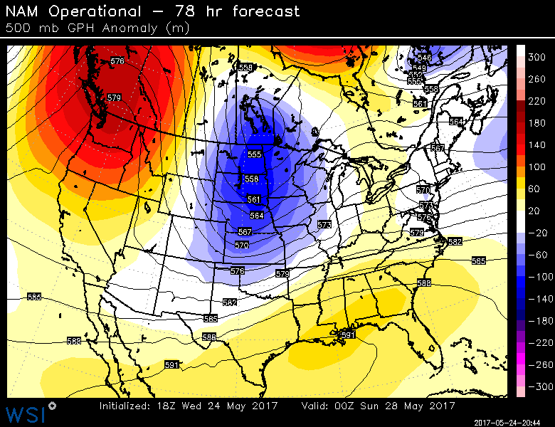
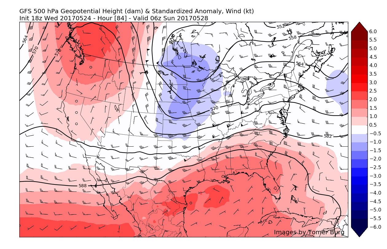
This evenings North American Model Showing yet another upper level system approaching the region over the weekend
More scattered showers and thunderstorms are more likely to be around for Sunday and Memorial Day a low pressure tracking over Great Lakes send a couple of frontal boundaries through region. However, much of time will likely be dry with some sunshine and mixing with clouds each day. This will temperatures get into at least into the upper 60s and 70s through the region. Sea-breezes may keep coastal sections a little cooler. So no washouts are expected for the holiday weekend as of now.
Make sure to stay tuned for more detailed updates regarding the Memorial Day weekend!
For more information and posts like this one, make sure you sign up for Zone Forecasts — where multiple detailed articles, videos, and interactives are posted each day. Also, come interact with our staff and many other weather enthusiasts at 33andrain.com!
Have a great evening!
Steve Copertino