-2")
Public Analysis: Unsettled Conditions Persist, Another Cool Shot Looming?
Good Evening!
After a very dreary past two days, mostly due in part to a stalled front to our south and persistent cool winds coming off of the Atlantic, today was finally a nice change with highs finally climbing to just below seasonable levels! More seasonable conditions should persist through the end of this week and into the beginning of the weekend, but this should be rather short-lived as a complex disturbance from Canada dives down our way and brings a chance at some increasing clouds and showers once again by late Sunday into early Monday. Beyond that, there are hints that below normal temperatures and more rain threats will likely persist into at least the first half of June, as high-latitude blocking near Greenland and Central Canada take shape once again!
———–
After seeing overcast and mostly cloudy skies with some patches of drizzle embedded in some spots this morning, a cold front moving past the region ushered in a drier Canadian air-mass. This dry air in the mid levels of the atmosphere worked to significantly weaken the cloud deck across much of the area, which allowed most areas to start to see breaks in the clouds. As the afternoon progressed on, these breaks became more numerous, and most locations broke out with full-blown sunny skies. These sunny skies, light winds from the south, and warmer temperatures aloft allow for highs today to make quite the rebound, with most areas seeing temperatures rise into the mid-upper 70’s, with low 60’s to lower 70’s across some coastal locations. These cooler readings were felt primarily along the south-facing shores of Long Island and Connecticut, but even these locations managed to see clearing take place at one point or another during the day.
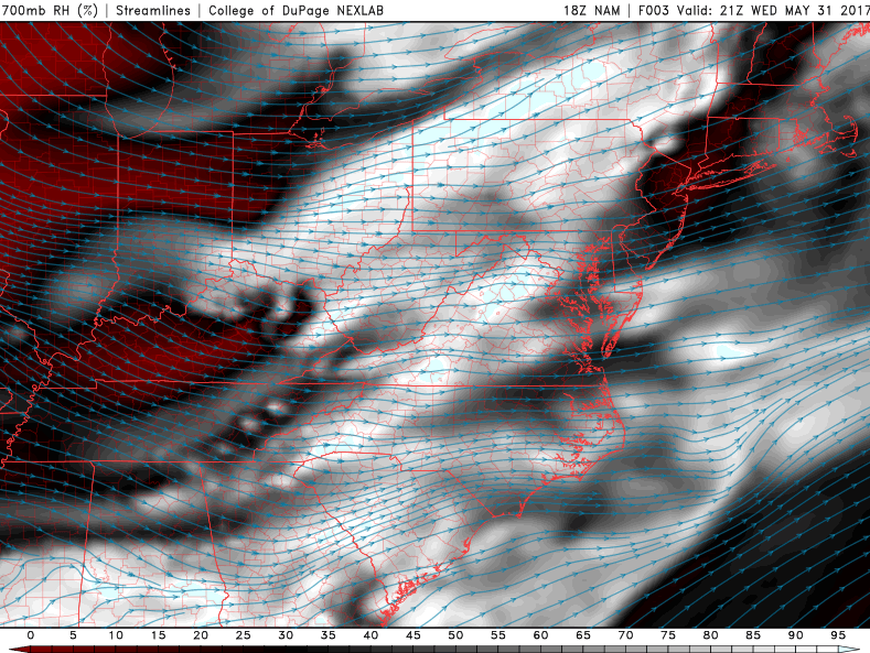
With this clearing taking place this afternoon, in addition to some more moist air being lifted over north and west portions of the area, we have also seen the return of summer-time thunderstorms developing ahead of yet another cold front. The environment over the area this afternoon has been characterized by rather marginal instability and some decently strong wind shear. There is also a piece of energy swinging through portions of Pennsylvania that will act as a trigger to set off any potential storms later this afternoon and into this evening.
The best chance for any organized severe thunderstorm activity will likely be north and west of the city, but it would not be impossible to see some residual activity work its way down into the New York City metro area, as some short-range models are hinting at. The main risks with these storms will likely be some gusty winds around 50 mph, small hail, and frequent lightning. The Storm Prediction Center in Norman Oklahoma has placed locations north of the city in a Severe Thunderstorm Watch until 9pm this evening. As night falls, any residual storms should begin to rapidly weaken, and any storms that happen to approach the coast will also begin to rapidly weaken due to a much more stable airmass in place over those locations.

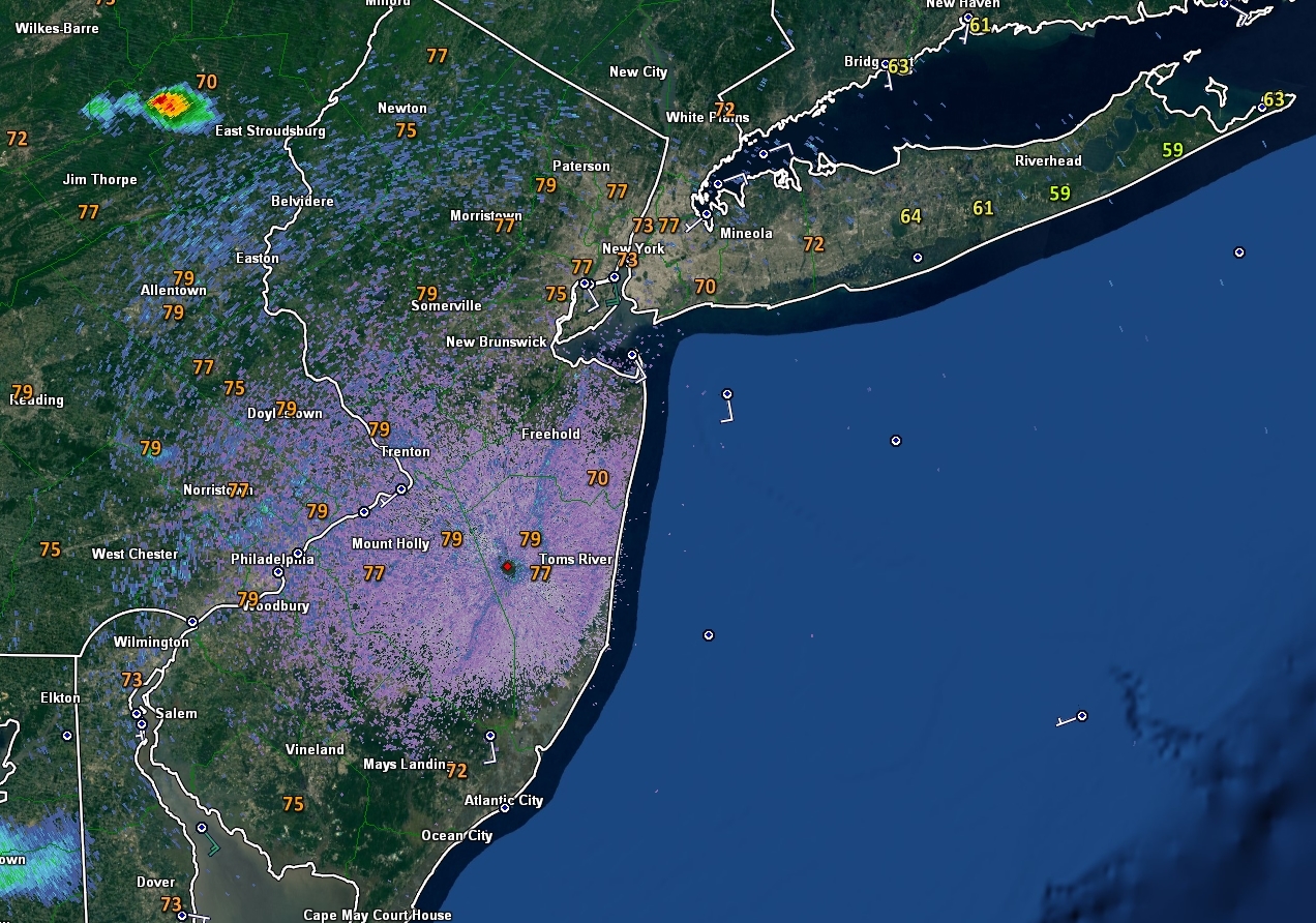
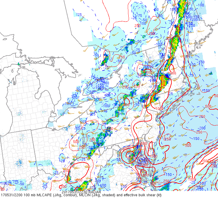
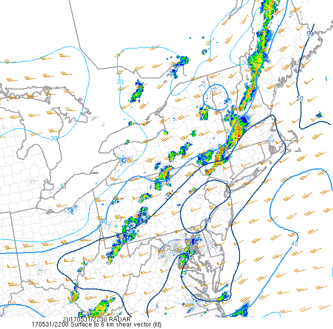
This afternoons latest regional radar mosaic, surface observations, visible satellite imagery, and watch/warning information. Note the yellow boxes and lines, which delineates Severe Thunderstorm Warnings (solid) and Watches (lines)
Thursday and Friday
The cold front that is responsible for these showers and thunderstorms will begin to overspread the region very early tomorrow morning, around 5-8am. More dry air will likely be reinforced over the area as an area of high pressure also works its way towards the Northeast, thus giving way to mostly sunny conditions. These dry and relatively calm conditions tomorrow will allow highs to once again reach into the mid to upper 70’s, with some inland locations likely reaching into the 80’s by late-afternoon. Though things look rather tranquil, there is a very slight chance that some showers or thunderstorms could pop-up during the afternoon hours as another piece of energy embedded in a large upper-level low over our area rotates through. Any shower activity would likely be very limited in coverage and quite short-lived.
Much of the same is expected on Friday, with highs likely staying in the same range as Thursday, but the shower threat may be slightly increased as there will be some more available moisture and lift to trigger possible thunderstorm/thundershower development across the area. However, another cold front looks to push through the area later in the evening, so this shower threat does not look like it will have much potential to linger around at all, as a dry and stable air-mass will likely establish itself and remove any lingering activity.
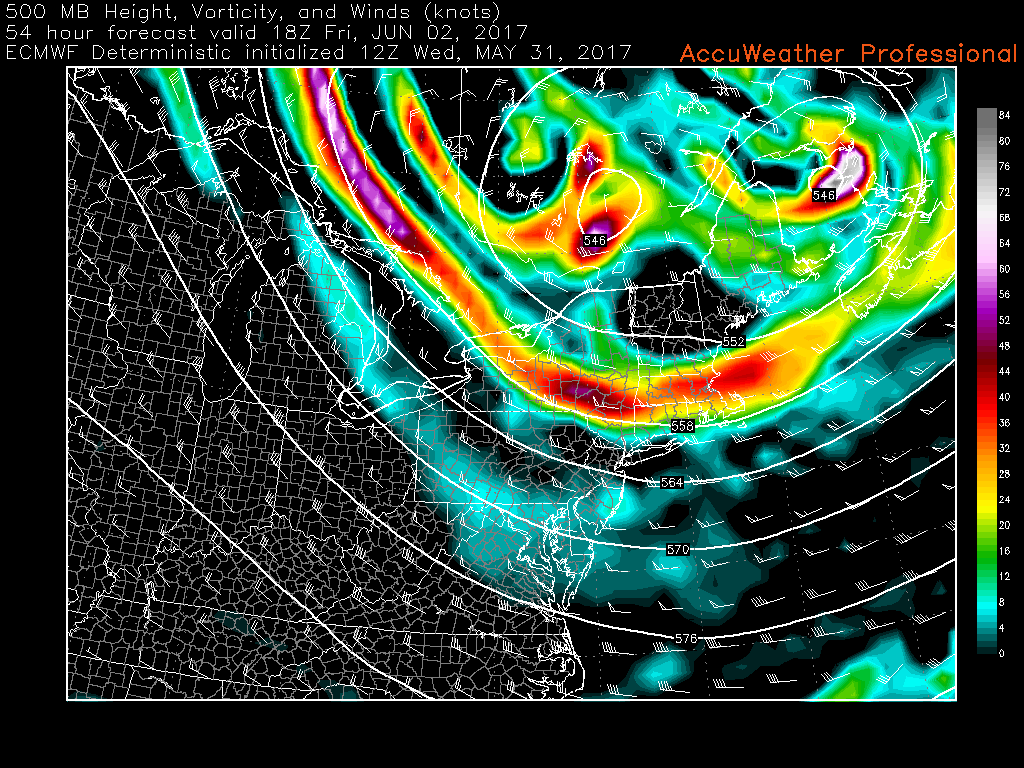
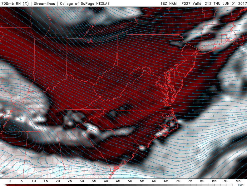
This afternoons European model showing a closed upper level low sitting over the region on Friday, with associated pulses of energy rounding the base of the trough, which may provide a chance at some afternoon thunderstorms (Valid Friday 2pm)
This Weekend and Beyond
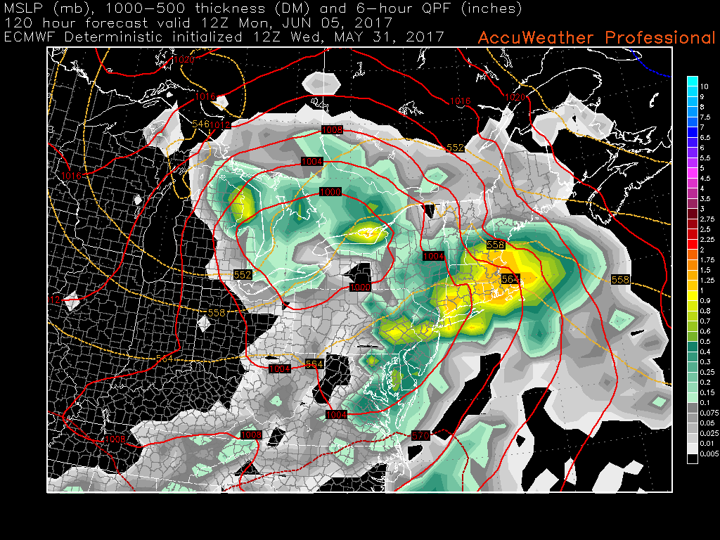
More unsettled weather is likely later this weekend and into early next week as a frontal boundary will be draped to the south of the region with an upper level jet streak placed in a favorable spot to provide divergence in the upper levels, which looks to support at least multiple waves of low pressure developing along the boundary and affecting the area with the potential for more moderate to heavy rain. This afternoons model guidance is quite bullish with the development of a rather large area of low pressure that then begins to transfer to the coast with time. This would provide the area with quite a bit of heavy rain, but other computer models diverge with the handling of this system, but it does seem like we may have to watch the period of early next week for our next heavy rain threat.
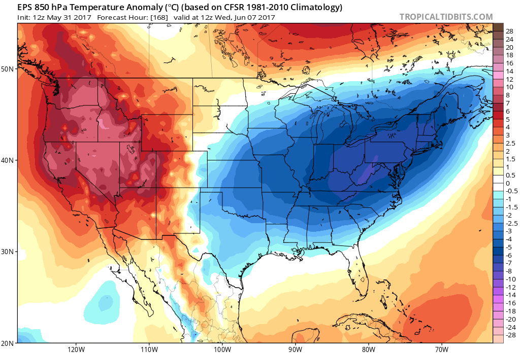
Unfortunately, it seems like any prolonged period of summer-like warmth will be denied once again due to high-latitude blocking over Greenland and Central Canada providing yet another cool shot for the eastern half of the country starting next week. The long range ensemble models have been holding onto this period of below-normal temperatures and increased precipitation for what looks to be the first half of June. While the details are very far from final right now, the overall atmospheric pattern that we are in, combined with what has happened the past few weeks would support such an event.
We will continue to update you on the next possible heavy rain threat next week in addition to the potential cool shot looming next week!
or more information and posts like this one, make sure you sign up for Zone Forecasts — where multiple detailed articles, videos, and interactives are posted each day. Also, come interact with our staff and many other weather enthusiasts at 33andrain.com!
Have a great evening!
Steve Copertino