-2")
Transitional weather will continue this weekend
Meteorological summer began today, and it did so without much fanfare. An unsettled and transitional weather pattern, which has existed throughout the Northeast states over the past few days, has remained stout and looks to continue to do so into the first and possibly second week of June. In the short term, this means continually unsettled weather with temperatures averaging near or slightly below average for this time of year.
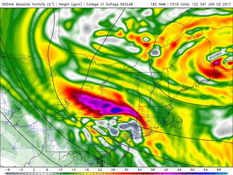
Showers and thunderstorms were a common theme over the past few days, with one day in particular featuring severe thunderstorms and an EF-1 tornado in Dutchess county. But colder air aloft is now settling into the Northeast states, in response to an upper level low which will meander in our region over the next few days. This has, in addition to the unsettled weather, been a common theme since May — high latitude ridging is forcing these upper level lows southward and into Southeast Canada and the Northeast.
A disturbance moves through the area Saturday morning, and additional isolated showers are possible in the afternoon. But the second half of the day is expected to be pleasant overall.
As mentioned, the upper level low meandering across the Northeast United States will keep unsettled weather around through the foreseeable future. Saturday, however, looks like a salvageable day. After a few isolated to scattered showers and storms this evening, a break in the action is anticipated tonight. This will then give way to more showers late tonight into Saturday morning, in response to a decaying convective complex back to our west.
Later in the day, however, sinking air behind this disturbance will lead to improving weather conditions overall. Another potent shortwave drives southward through the Northeast States, and may touch off some additional isolated showers and maybe a rumble of thunder, but these will be very isolated in nature. By and large, Saturday afternoon and evening should be pleasant with temperatures near or slightly below normal and the presence of at least partial sunshine.
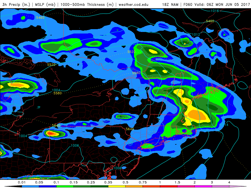
Another disturbance brings showers and storms Sunday Night into Monday morning.
Unsettled weather returns again by Sunday afternoon as a potent disturbance approaches the area from the west. Lift in the atmosphere will increase along a warm front, and another weak cold front back to our west. Marginal instability in the atmosphere and the presence of strong lift and moisture should lead to showers and storms, some of which could be strong on Sunday afternoon and evening — particularly over Southeastern PA and much of Southern and Central NJ.
With an upper level low meandering, still, into early next week, the weather looks unsettled with periods of showers and storms on Monday and Tuesday once again. Any breaks in the active pattern will be short-lived through next week as additional disturbances quickly approach the region from the west.