-2")
Public Analysis: Increasing Heavy Rain Threat Thursday, Seasonable Conditions Likely This Weekend
Good Evening!
We hope you had an excellent holiday weekend over the past few days and managed to dodge any showers and thunderstorms that popped up during Monday and Tuesday!
After some relatively hot and humid days on Monday and Tuesday, today was quite the improvement as a weak area of high pressure off of the Northeast coast moved offshore this morning and ushered in winds from the ocean, which were able to drop dewpoints by quite a bit across the area. A frontal boundary rode northward through the area earlier this morning and into the afternoon hours, which increased clouds briefly, but with the easterly winds coming off the Atlantic, the atmosphere was able to stay relatively stable and prevented the development of showers. The cooler marine airmass and relatively sunny skies allowed temperatures to climb into the upper 70’s and middle 80’s across the region this afternoon, which is just slightly below normal for this time of year.
The rest of the evening looks to be quite pleasant as any lingering mid-upper clouds gradually dissipate with time, which should allow most of the area to be under partly cloudy skies just in time for sunset. After dark, the marine influence being fed in from the east will lead to a gradual increase in clouds as a stable boundary layer becomes established, which should trap any left over low level moisture. This will be especially true for coastal locations as low clouds keep low temperatures in the middle 60’s, and areas removed from the coast see more clearing, which will likely allow temps to fall into the upper 50’s/lower 60’s this evening.
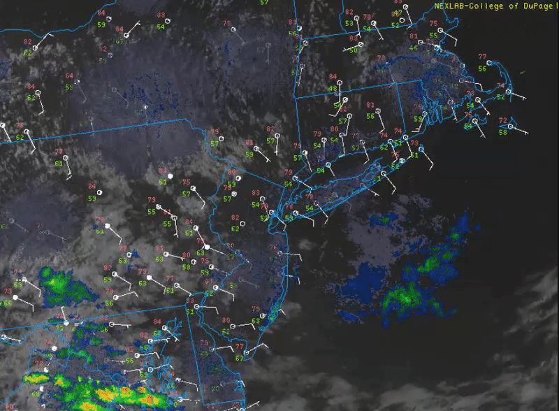
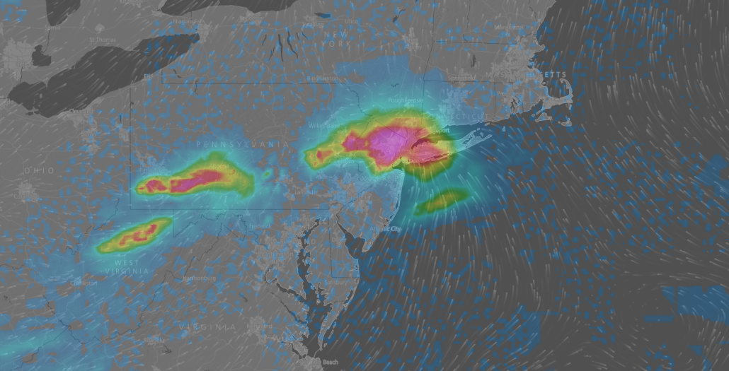
This afternoon/evenings latest regional radar mosaic, surface observations, and high resolution satellite imagery loop. Note the easterly winds along the NJ/CT/LI shores making for a rather pleasant day (Courtesy of College of DuPage)
On Thursday, the area of high pressure will continue to back to the east during the early morning hours tomorrow, which will lead to mostly cloudy skies to start off the day. As we head into the late morning and early afternoon, mid level warm air adevection courtesy of an approaching mid level system will allow temperatures to warm into the mid to upper 70’s, with some lower 80’s possible despite cloud cover. There will be a chance that the increasing mid level energy ahead of the main system over the Mid Atlantic may allow for pockets of sunshine to peak through the clouds, which would allow for slightly warmer temperatures than forecast, but this would likely happen on a very small scale.
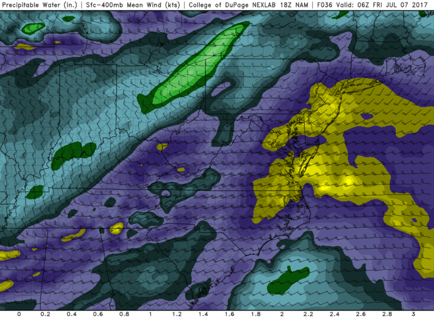
Tomorrow we will be watching a series of frontal systems and mid level disturbances during the day as they will likely have at least a moderate chance of impacting the Metro area into tomorrow evening. The first mid level disturbance will likely propagate through the area during the early afternoon hours tomorrow and bring an increase in low/mid level moisture. This system will have quite meager amounts of lift associated with it, and will likely not be able to break the antecedent stable, marine airmass that will linger around. As the day continues onwards into the late afternoon hours, model guidance suggests that the area of high pressure that had been feeding the marine airmass into our area will lose its grip and will gradually give way to an approaching mid level system currently located over the Tennessee Valley.
This area of mid level energy will be more pronounced than the previous wave that moves through earlier in the day, and will also likely bring an extra last push of moisture with it. As this energy moves towards the region, an area of low pressure is expected to develop over the Mid Atlantic states, possibly sparking numerous heavy showers and thunderstorms. There remains some rather significant differences between the model guidance this afternoon/evening, but the general theme appears to be that with enhanced lift, deep tropical moisture from the south, favorable upper level jet dynamics, and some elevated instability, that areas of moderate to heavy rainfall will likely break out tomorrow evening and into the early morning hours of Friday.
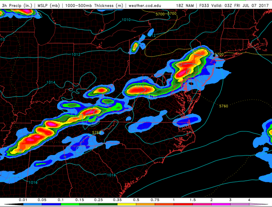
These area of heavy rain will likely be able to put down some impressive rainfall amounts in a short period of time, with the possibility of localized street flooding. If these areas of heavy rain are more convective in nature, then they will likely be more concentrated/narrow than most models have, with some locations seeing torrential rain, while another location ten miles to the north or south may see light to moderate rain. Regardless, make sure to monitor your local NWS office for any potential alerts tomorrow, and do NOT drive through water no matter how deep you think it may be!
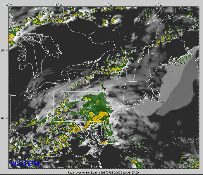
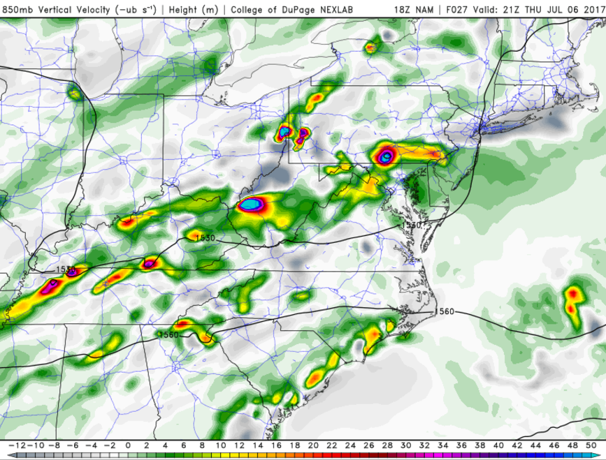
This evenings latest high resolution Rapid Precision Model showing the development of an area of heavy rain and possible thunderstorms associated with a vigorous mid level system. (Courtesy of WSI)
Conditions should improve quite a bit by the mid morning hours on Friday as the area of low pressure and all the associated showers and cloud cover gradually move out of the area. A frontal boundary associated with the mid level trough that spawned the initial area of low pressure looks to move through during the afternoon hours, which may spark some isolated showers and thunderstorms if there is any residual moisture around and the sun is able to create modest levels of instability.
Otherwise, Friday should be somewhat nice with southwesterly winds and increasingly humid. Depending on just how much the sun can make an appearance during the afternoon will ultimately determine high temps, but as of now highs should range in the mid to upper 80’s, with lows falling back down into the mid 60’s to lower 70’s.
This weekend will likely be dominated by a building ridge of high pressure in the west, which will lead to the development of an area of troughiness over the eastern third of the country. The models and their ensembles diverge on this situation quite a bit with regards to magnitude and duration, but this should lead to more seasonable weather for the weekend, mixed in with some more chances at scattered convection
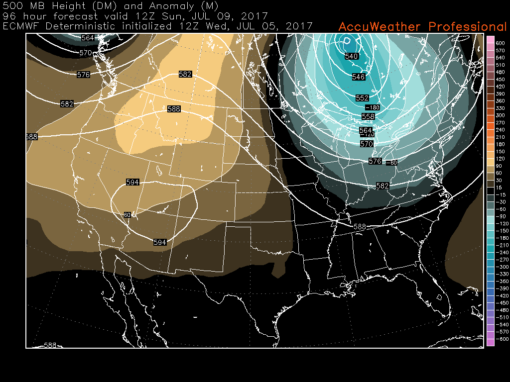
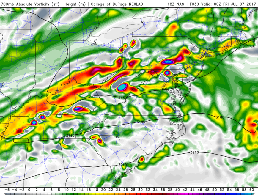
This afternoons European model showing an increased potential for an area of troughiness to develop over the Ohio Valley and Northeast later this weekend (Courtesy of Accuweather Pro)
For more information and posts like this one, make sure you sign up for Premium Forecasts — where multiple detailed articles, videos, and interactives are posted each day. Also, come interact with our staff and many other weather enthusiasts at 33andrain.com!
Have a great evening!
Steve Copertino