-2")
AM Update: Calm start, but transitional weather ahead
Good morning and Happy Monday to you all! As you make your way out the door this morning, you’ll notice a change to the sensible weather conditions in place throughout the majority of the Northeast states. You can thank a strengthening south/southeasterly flow for that — it has replaced the cooler, northwest breeze with a warmer and slightly more humid airmass. Warmer and more humid air will advect into the Northeast states for the remainder of today.
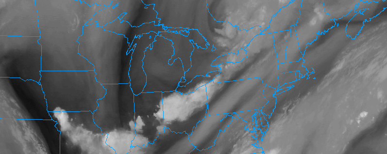
Near the coast, these southeasterly winds have already resulted in the presence of some stratus clouds along the shores of Long Island and even parts of New Jersey — with some localized fog in other locales as well. This will burn off as the day goes on, but the progression of disturbances in the mid and upper levels of the atmosphere will bring more unsettled weather into the picture by this afternoon.
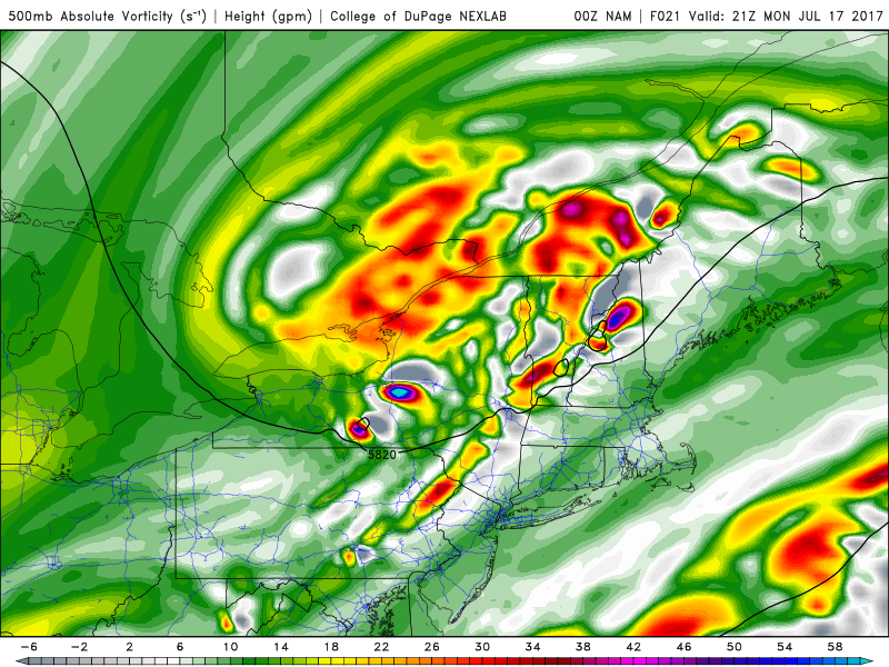
Mid level vorticity and height show a very notable disturbance moving through New England on Monday, the impetus for the development of strong and severe storms.
As a weak disturbance approaches parts of interior New England and New York State, increasing instability is expected to develop later today, owing to the mentioned advection of warmer and more humid air. The weak disturbance will provide just enough lift for showers and thunderstorms to develop throughout the Northeast states this afternoon. Areas further north, however, will be juxtaposed with moderately favorable wind shear.
This is critical to the development of storms as it allows them to become more organized. In the presence of supportive instability, a few of these storms could become strong or severe and pose the potential for damaging winds. This threat is expected to be less further south in the Mid Atlantic and near the coast where both instability and wind shear are weaker.
Accordingly, the NWS SPC has placed parts of interior New England and New York State in a Slight Risk for severe thunderstorms later today. Their discussion details the threat, which as mentioned mainly focuses on the potential for strong winds in scattered thunderstorms including the potential for frequent lightning and heavy rain. While storms are possible throughout the Northeast this afternoon, the Slight Risk area is where the greatest concentration of impactful weather is anticipated.
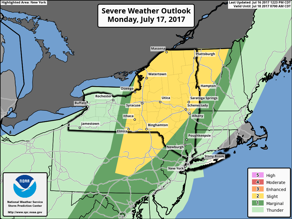
The SPC had placed parts of NY State, PA and New England in a Slight Risk for severe thunderstorms today (as of early this morning)
The week ahead looks likely to feature more transitional weather, with opportunities for storms continuing over time. The mid-week period looks relatively calm, but chances for strong and severe thunderstorms may return by the weeks end. In addition, temperatures will gradually warm as a ridge from the Central US begins to build eastward. More on the week ahead coming up in our mid-day and afternoon updates and weekly planner.
For now, have a wonderful morning!