-2")
Mesoscale Update: Strong storms in the interior northeast
Good afternoon! As Saturday rolls on, thunderstorms have developed in earnest throughout the interior Northeast States. These storms have generally remained near or slightly below severe-limits, but a strengthening trend has been observed over the past 30 to 60 minutes. The storms have formed within a marginally favorable environment, but are expected to move into gradually more favorable conditions over the next hour.
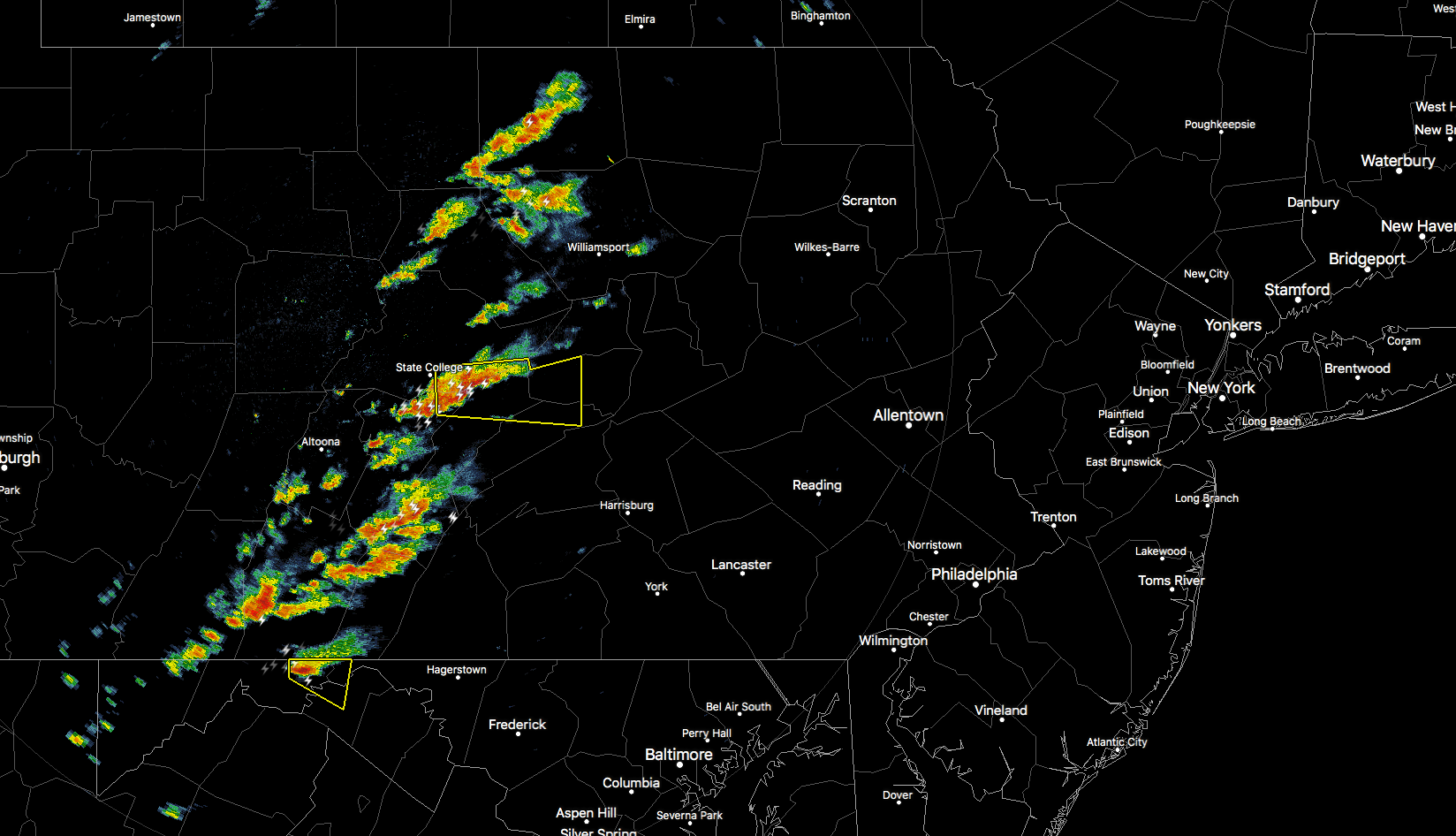
Regional observations from Central Pennsylvania and Southeast New York suggest increasing instability, with CAPE values over 1500 j/kg. While lapse rates remain somewhat meager, limiting storm strength, mesoscale analysis from the Storm Prediction Center this past hour showed 45 knots of shear in the 0-6km layer.
This shear is critical as it will likely allow thunderstorms to become more organized as they track eastward. As storms strengthen, the potential for strong winds, lightning and hail will evolve across Central Pennsylvania and Southern New York. This threat should gradually persist further eastwards through the later afternoon and early evening hours.
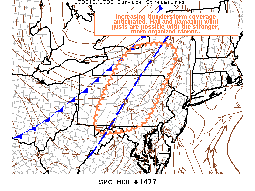
The Storm Prediction Center’s latest mesoscale discussion suggests the potential for a severe thunderstorm watch in these areas, especially near the mentioned juxtaposition of instability and shear. The orange area serves an overview of the focus of strong and severe thunderstorms today — and where the best potential for hail and some strong winds will be.
Thereafter, storms are expected to weaken as they move towards the Delaware River and parts of New Jersey. Heavy rain and the potential for a few embedded stronger storms will continue into the evening, but a more stable airmass near the coast should limit impacts in the big cities and near the shores of the Mid Atlantic.
Stay tuned over the next few hours and keep a close eye on the Premium Dashboard for the latest information.