-2")
More Tranquil Weather Returns, Harvey’s Remnants Possible for the Weekend
Good morning! After a cloudy, wet day on Tuesday, today will much improved, as a Nor’easter moves farther into the Atlantic. Mostly sunny skies are expected with dry westerly winds by this afternoon. These conditions will help temperatures rise into the middle to upper 70s, with some spots possibly reaching 80 degrees. These temperatures are near or slightly below normal.
Clear skies and light winds are expected for most of the night. This will lead to some radiational cooling with temperatures dropping into the 50s over the Interior Valleys and Pine Barrens and into the lower to middle 60s over more urban and coastal areas. Then a cold front associated with a shortwave trough will be moving through the Northeast on Thursday. More clouds are likely to mix with sunshine with temperatures rising into the upper 70s to lower 80s, ahead of the cold front.
Strong wind fields and lowering heights associated with a shortwave trough will support some precipitation on Thursday afternoon. But moisture and instability will be limited, as there is no southerly or southwesterly connection to the Gulf or Atlantic — the wind fields are almost entirely due westerly or northwesterly and thus a dry component. So only some isolated or widely-scattered showers and thunderstorms are expected as a shortwave trough and cold front move through during the afternoon and early evening hours. No organized severe weather or heavy rainfall hazards are anticipated.
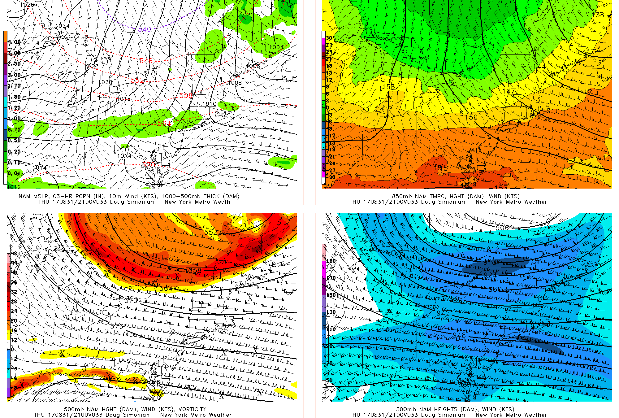
Today’s NAM model valid for Thursday afternoon shows a dynamic system but with limited moisture triggering some scattered showers and thunderstorms.
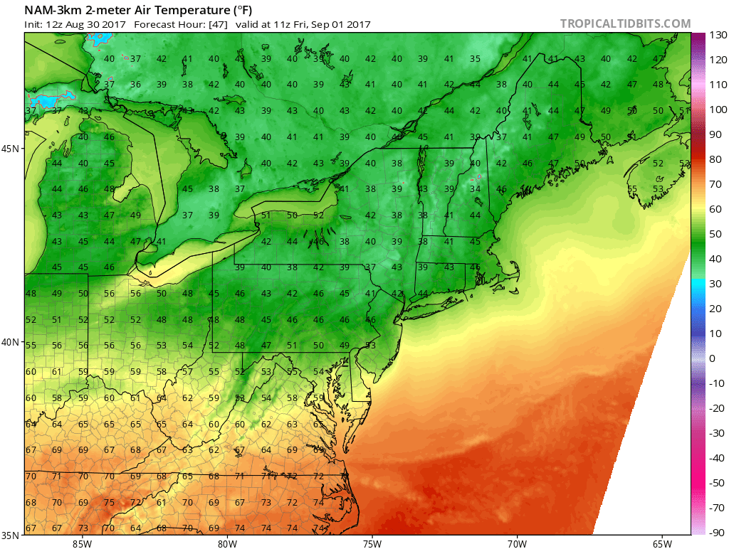
Then high pressure from Central Canada builds into the Northeast and Mid-Atlantic region on Thursday night and Friday, behind this system. Fair weather with mostly clear skies is expected. But a much cooler airmass will support temperatures below normal, as the airmasses behind these dynamic systems with strong wind fields can often be quite crisp and Autumnal. Friday morning may get off to a chilly start, especially over the Interior with many low temperatures in the upper 30s and 40s. High temperatures Friday afternoon will likely only be in the upper 60s to lower 70s, despite full sunshine. It will be a perfect day for an Autumn-like preview hike.
High pressure will remain in control Friday night with more fair and chilly weather, especially over the Interior. Then over the weekend the remnants of Tropical Storm Harvey will be coming up from the southwest along with another shortwave trough from the Great Lakes. Clouds will likely increase on Saturday, as high pressure begins moving offshore. Some showers from the southwest could arrive by late in the day.
Then more periods of rain are likely Saturday night into Sunday, with both systems moving through. There is potential for some areas of heavy rainfall leading to localized flooding, depending on how organized Harvey’s remnants are moving through parts of the Northeast and Mid-Atlantic. It’s also possible that Harvey’s remnants remain disorganized and the interaction with the Great Lakes shortwave trough is sloppy, and thus the rain bands, while heavy, may be very scattered and disorganized. Overall, more unsettled weather this weekend will continue to support temperatures remaining below normal.
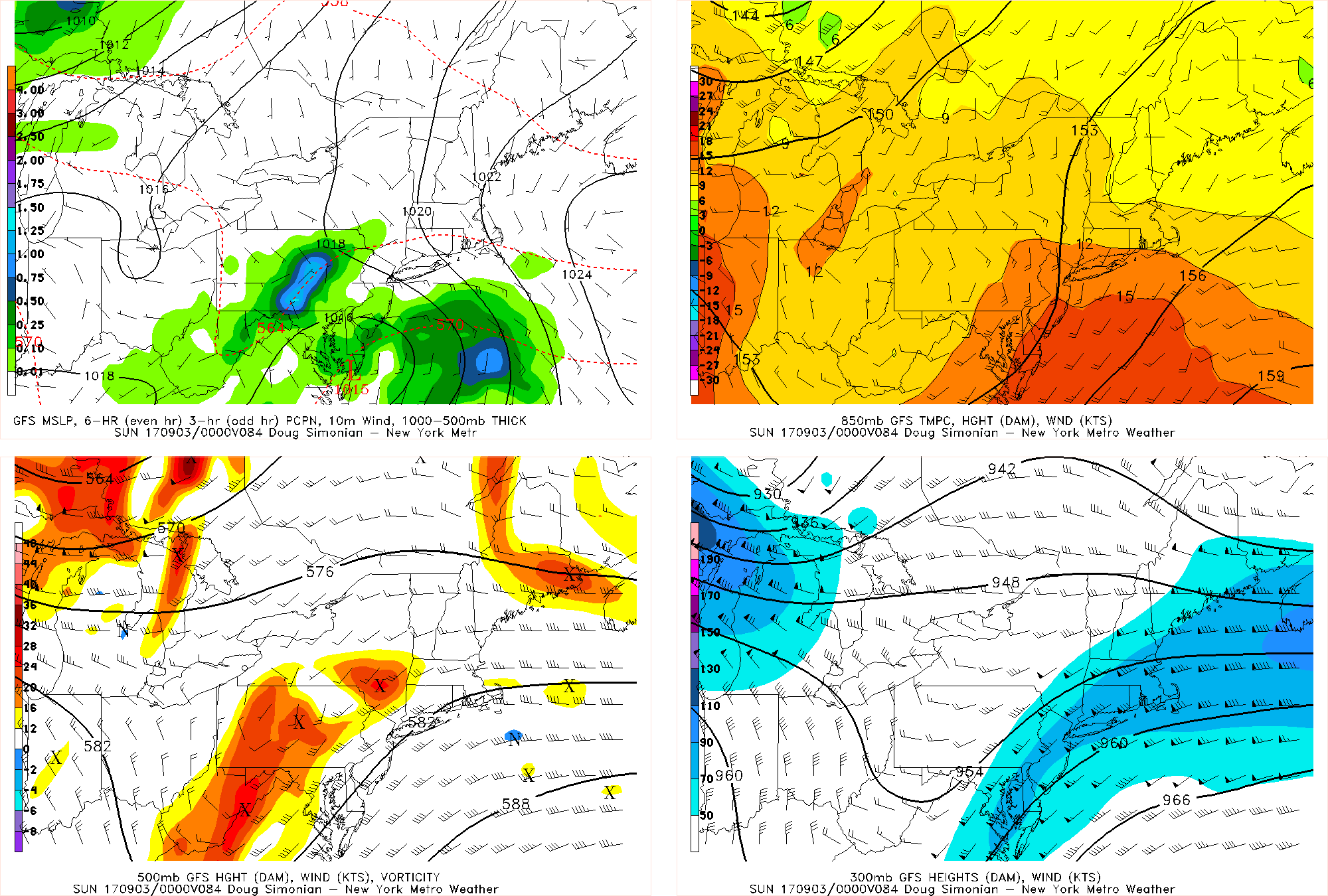
Today’s GFS valid for Saturday evening shows Harvey’s remnants approaching the area, but in a much weakened state compared to what’s been going on in Southeast Texas.
But the good news is that this system appears to moving fast enough to clear out for Labor Day on Monday. So some improving weather is expected. Temperatures with more southwest winds and sunshine could briefly rise to slightly above normal with highs in the lower to middle 80s. Currently Labor Day looks like the best day for any outdoor plans, especially along the shore and beaches.
Another cold front and upper-level trough may bring more showers and thunderstorms to the Northeast by Monday night or Tuesday. Then another cool, Canadian airmass arrives with below normal temperatures returning for the middle and later part of next week. More details on cooler risks in September are in our previous article. Stay tuned for more premium forecast updates on the main dashboard with articles to come.