-2")

Major Hurricane Irma and Its Potential Future
Good evening! After the devastation and catastrophic flooding from Harvey meandering over South Texas and Southwest Louisiana over the past week, we were finally relieved to see that that storm has now moved out of the Western Gulf of Mexico region. Heavy rainfall will continue over the next few days over the Tennessee Valley from the remnants of Harvey, before it becomes absorbed into a frontal system developing over the Northeast. But as we approach the peak of hurricane season, more tropical threats are rising. One such threat is Hurricane Irma which is becoming a powerful hurricane already today.
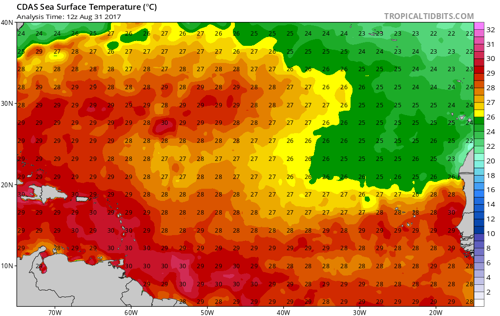
Irma has been rapidly intensifying over very warm waters and a favorable atmospheric environment, since it became a tropical storm on Thursday. It is now a major Category 3 hurricane with maximum sustained winds at 115mph. Irma will continue moving on a west-northwest path over the Eastern Atlantic over next few days. It will be moving over slightly cooler waters (still sufficient for maintenance at around 26 C) and some mid-level dry air from ridging, which might at times slow down the rate of intensification over the next 2-3 days. But overall, an upper-level anti-cyclone will support low shear and more upper-level outflow over the hurricane. So Irma will likely continue to strengthen into a Category 4 by early next week.
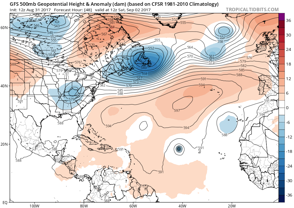
As for where Irma will be in the future, a tropospheric rossby wave-breaking event this week will result in a large, deep closed upper-level low over the Canadian Maritimes and North Atlantic this weekend. In response, stronger upper-level ridging will build between this low and Irma, in a southwest to northeast fashion. This will cause Irma to move in an unusual, west-southwest direction this weekend over Central Atlantic. Thus, while Irma will initially gain enough latitude to place itself in a position that is unlikely for landfall, this southwest trajectory may then place it in a spot that is historically favorable for landfall. Irma could then threaten the Lesser Antilles by early next week, as it continues in this direction. As Irma nears the Lesser Antilles, it will also be moving over even warmer ocean waters again and underneath an anticyclone adjacent to a TUTT (tropical tropospheric upper tough) lifting out of the Western Atlantic. So Irma could strengthen into a extremely powerful category 5 hurricane, capable of causing catastrophic damage.

Euro ensemble tracks for Irma over the next 7 days, showing a threat to the Lesser Antilles after an unusual west-southwest movement.
Afterwards, the future of Irma is more uncertain, with model and ensembles showing various solutions in handling the pattern over the CONUS. Whether or not Irma becomes a threat to the United States down the road currently appears to depend on the extent and orientation of a large, full mid-latitude trough over the Eastern US and how strong a blocking ridge will be over the Western Atlantic, in about 7-10 days. This pattern again is the result of a recurving typhoon over the Western Pacific that will enhance another, stronger tropospheric Rossby wave-breaking event over the Western Hemisphere, leading to an Aleutian low/trough and a downstream strong West Coast ridge. This results in below normal to much below normal temperatures over much of the Central and Eastern US later next week.
If this full-mid-latitude trough remains deep into the Southeast or Gulf of Mexico Coast when Irma reaches about 70W, it will likely begin recurving between the United States and Bermuda. But if this trough starts lifting out or splitting — especially if the southern part of the split leads to a cutoff low — this will for allow more ridging to return over the Western Atlantic. This would leave the door open for Irma to track towards the United States mainland, perhaps next weekend or during the following week. At this time, more reliable ECMWF ensemble guidance indicates that the trough will be at least be in the process of lifting out with some ridging rebuilding over the Western Atlantic. So if this pattern trend continues, Irma will bear a lot of watching for the United States next week.
In fact, some model runs today are showing a large cut-off low forming somewhere over the Eastern US and enhancing another blocking ridge over the Western Atlantic. This would be a very dangerous steering pattern for a major hurricane to hit the United States along the East Coast or Gulf of Mexico coasts. This solution is plausible given how the high-amplitude block is initially over Western Canada. Shortwave energy will dig on the downstream side of the ridge. Then a fast pacific jet will cause the ridge to begin collapsing and rolling over into Central and Southeast Canada, forcing the shortwave energy to cut off underneath it, since the trough will have nowhere to go with higher heights building/rolling in to its north. However, there will likely be some volatility between model runs, as intricacies with the pattern will be difficult to resolve out beyond 5 days. So a precise track and intensity for Irma on models should be taken lightly.

ECMWF model forecast 500mb pattern surrounding Irma and possibly another tropical cyclone developing behind it next week over the Central Atlantic.
So we will continue to monitor Irma carefully through the Labor Day Weekend and into next week. Right now, all you to need to know is that there is major hurricane, but way out in the Atlantic. If you are planning a trip or vacation in the Lesser Antilles next week, you should be able to make preparations to evacuate or move to stronger shelters, just in case. It’s too early to tell with high confidence if the storm will threaten or make landfall in the United States further down the road. But there are indications today that a pattern may develop that would increase the probability of that occurring. Stay tuned for more premium articles or video updates on Irma during the next several days. You can also visit our tropical weather dashboard for more information multiple times a day on Irma and other potential tropical systems to form in the Gulf of Mexico and Central Atlantic by next week.