-2")
Heavy Rain and Storms Possible Tuesday through Thursday
Happy Labor Day! We are finally enjoying some warm, sunny, summery conditions after a few days of chilly and unsettled weather had dominated the region. This is because a large, full-latitude, but short wavelength trough has moved into the Central US, which is a direct downstream response to the amplified wavebreaking that occurred from a recurving typhoon in the Western Pacific. This amplified pattern has also helped/reinforced a very strong, blocking ridge in the Atlantic, and it’s this trough’s interaction with the blocking Atlantic ridge that could lead to a few rounds of heavy rain and thunderstorms, though not necessarily a washout. Also, our area initially being downstream of this deep trough has led to strong southwesterly flow out ahead of it, and thus a large warming trend in the Eastern Seaboard.
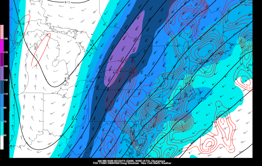
In our Weather Education video, we detailed the importance of jet streaks. Once again, a large jet streak will very much come into play on the downstream side of this amplified trough, as its meridional flow into a large ridge creating a strong gradient will allow for a strong jet streak to tap into some tropical moisture.
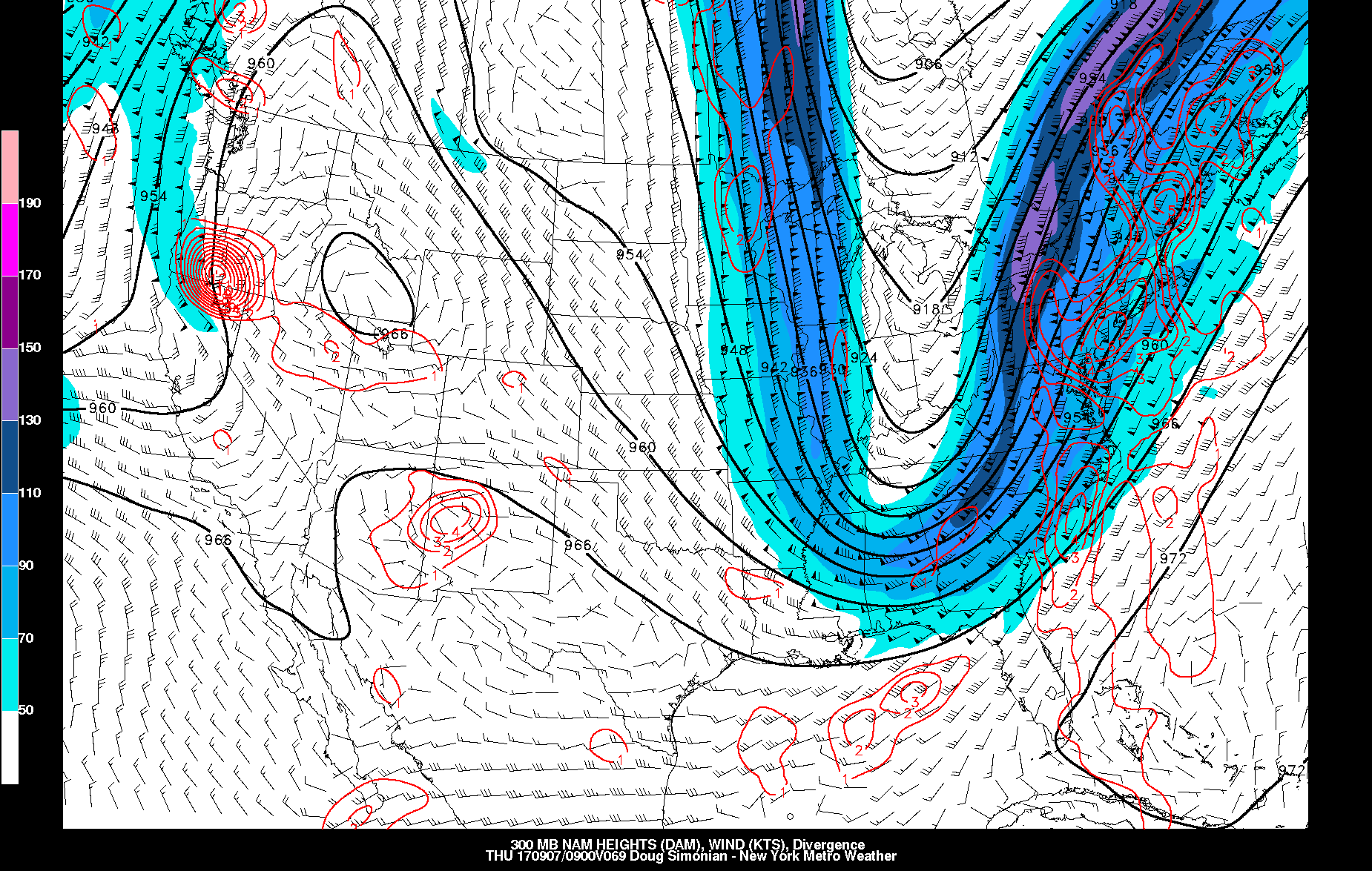
Today’s NAM model valid for Wednesday night shows a potent jet streak leading to a lot of upward motion in the atmosphere, good for bands of heavy rain.
Within the core of the trough, we have a chilly, Autumnal airmass, but just east of the trough, we have a warm and humid airmass. This large gradient is associated with a strong cold front, and it will get slowed down because it’s approaching the large Atlantic ridge/block. These stalled frontal boundaries within the right-entrance region of a strong jet streak are often responsible for some significant precipitation events, all throughout the year. A wave of low pressure will develop along this front, and could bring multiple bands of moderate to heavy rain on Wednesday into Thursday. It does appear that the deepest moisture convergence will pass offshore, as the front may be just to our east at this point, so the truly tropical downpours of 2″+/hour may miss our area to the east, but some moderate to heavy rain in stratiform orientation still does appear likely.
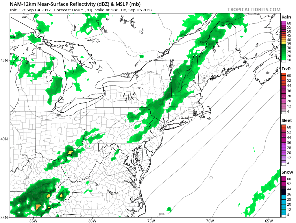
Today’s NAM model valid for Tuesday evening shows a lot of moisture convergence, which is favorable for training clusters of storms and flash flooding.
When this jet streak first arrives on Tuesday while the frontal boundary is still to our west, it may be able to trigger some clusters of showers and thunderstorms — perhaps strong — on Tuesday night. With the front initially to our west, we may be able to generate more moisture convergence for training bands of showers and thunderstorms, and thus flash flooding may be a threat. The training also becomes more likely with a very meridional trough, which results in the wind shear vectors being nearly south to north — parallel to the cold front. What may be able to prevent widespread flash flooding is that there will be a pretty good amount of wind shear in the atmosphere thanks to the strong jet, so the storms should be moving quickly, even if they somewhat train on top of each other. However, the stronger wind shear also allows for more storm organization, and thus the potential for strong to severe storms, particularly just west of the city where the instability, wind shear, and moisture convergence may juxtapose themselves during peak daytime heating.
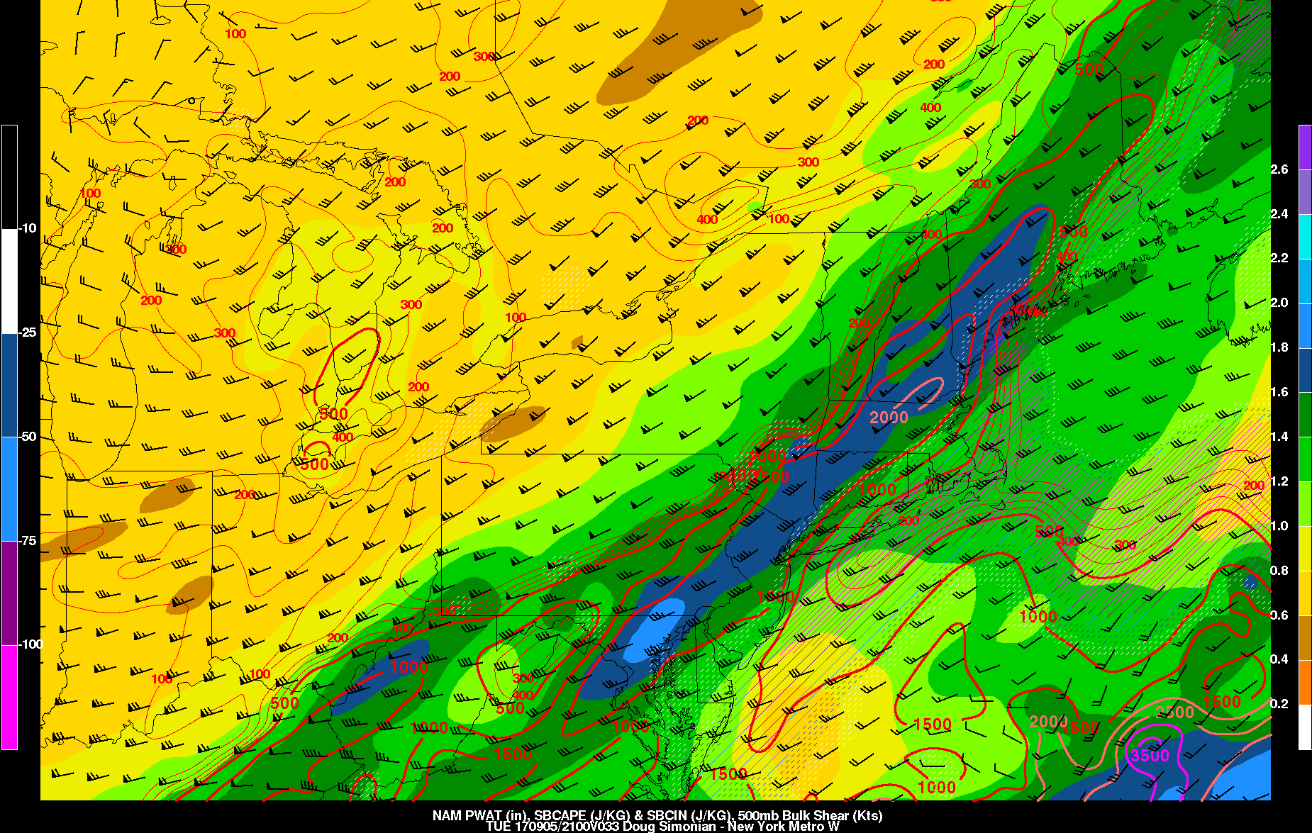
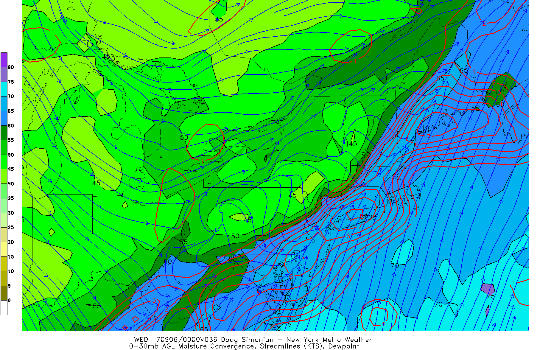
Today’s NAM model valid for Tuesday evening shows a sufficient amount of CAPE and wind shear for strong to severe thunderstorms. High precipitable water values also support heavy downpours.
High precipitable water values with these storms also further support the idea for heavy downpours. So Tuesday evening’s activity will be more convective in nature with instability and moisture convergence with jet streak support — so less overall coverage but a higher ceiling for strong storms and heavier rain. Wednesday into Thursday’s activity will be a bit more widespread with more of a synoptic element with a stalled frontal boundary just to our east, plenty of jet streak support, and a wave of low pressure — but without the same deep moisture with us then being on the cool side of the front, the ceiling of rainfall rate will not be as high.
Overall, we are expecting anywhere between 1-2″ of rain in the Tuesday evening through Thursday morning period, with locally higher amounts in any areas that are on the high side of the rainfall amounts in Tuesday’s storms as well as areas that get a good soaking from Wednesday into Thursday’s activity.