-2")
Maria Meandering Offshore, Summer Temps Return In the East!
Good Evening!
The tropics are still quite active with both Hurricane Maria and Lee out over the Atlantic this evening, with both storms at Category 1 intensity. Back on Friday, we talked about how Lee was located in a very favorable environment for quick strengthening due a favorable baroclinic background in addition to its very small structure. Lee did in fact intensify quite quickly the past weekend into a strong Category 1 hurricane with winds around 90 mph over the open-Atlantic, thousands of miles away from land. Lee has been a very interesting storm to follow, as it resembles more of the norm that we have seen over the past few hurricane seasons where a disturbance or weak storm will wait until reaching around 20-25N before really beginning to strengthen. Regardless, Lee should remain in a relatively favorable environment for the storm to at least sustain itself for another two days before shear dramatically increases and sea surface temperatures become quite cool. Lee should eventually become absorbed by a larger non-tropical system in the north Atlantic in about 5 days as it gradually heads north at around 10 mph.
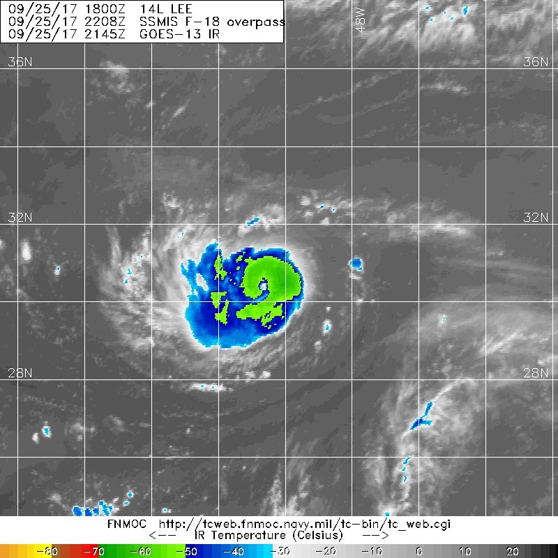
Satellite Imagery of a very small Hurricane Lee with winds up to 85 mph
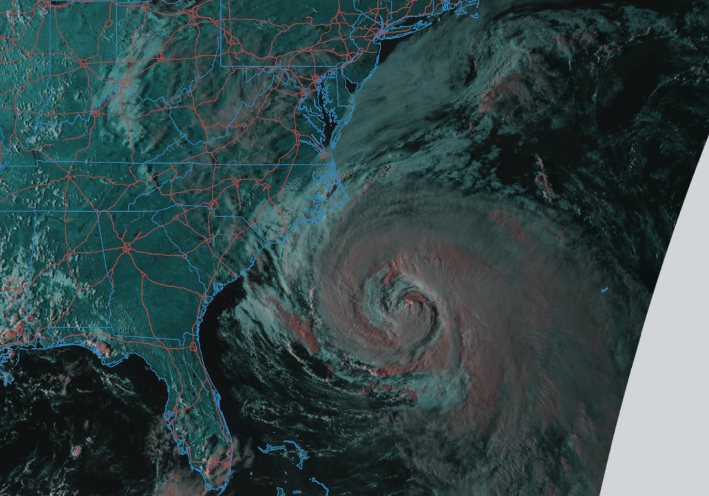
Closer to home, we have Hurricane Maria located off of the southeast United states with winds of around 80 miles per hour. Maria has been exposed to the cool wake left behind by Hurricane Jose which was over the same region just about a week ago. This cool wake has led to the storm losing its once very deep convection and this has in turn led to the inner core of the storm to spread out into a larger and broader circulation with tropical storm force winds extending far away from the center. This is causing a large section of the east coast to experience very dangerous rip currents and increased wave action. Maria should continue to move northward over the next couple of days as it round the side of a large area of high pressure over the western Atlantic. Maria’s forward speed should also remain rather sluggish as well due to the large area of mid level ridging over the Northeast.
Maria will come close enough to the Outer Banks of North Carolina by tomorrow afternoon and evening that tropical storm force winds may occur with any bands of rain that may try and work their way close to the islands. As Maria is just off the coast of North Carolina, a deep trough coming in from the west will begin to affect the hurricane and cause the storm to speed up a bit. As it speeds up, the trough will also pick Maria up and begin to kick it out to the northeast, and finally away from land. At this time, Maria is not a huge threat to land other than rip currents and gusty winds in the Outer Banks, but please follow your local National Weather Service and the National Hurricane Center for more information on this storm over the next few days. Also, please head any warnings at the beaches this week as rip currents and strong waves could possibly be life-threatening if not taken seriously!
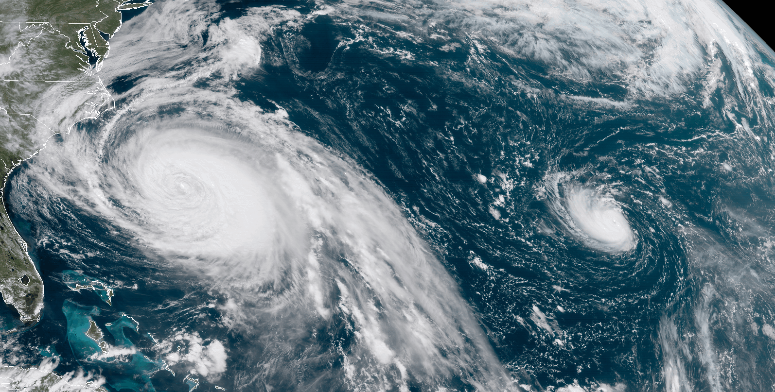
GOES 16 loop of both Hurricanes, Maria and Lee churning out over the Atlantic today (Credit: NASA/CIRA)
Summer-like Weather Returns…For How Long?
The area of strong mid level ridging parked over much of the Northeast continues to bring very warm temp[temperatures for this time of the year to the region, with many stations across the area seeing highs in the upper 80’s to lower 90’s-which is around 10-20 degrees above normal for this time of year. This area of ridging will also provide clear skies and prevent any chances of rain over the next few days, despite an increase in dewpoints over the past thirty-six hours. Temperatures through Wednesday should remain in the middle to upper 80 range, with some locally higher temperatures expected away from the coast. With the increased low level moisture, there will also be a risk for fog each evening, which could reduce visibility down to less than a quarter-mile at times. Lows will be generally mild through the middle of the week, with temperatures remaining in the middle 60’s to lower 70’s.
Later in the week, a large mid level trough will swing down from Canada and kick out the ridge that has been providing the area with summer-like temperatures for the past few days. This trough should deliver a nice cool-down as the Canadian air really begins to settle in towards the start of the weekend. Highs will likely fall back into the 70’s across much of the area, with low in the 40’s and 50’s, which should make things feel a lot more like fall. As of right now there does not appear to be any significant precipitation events over the next 5 days, but will be monitoring any trends over the next few days!
There are some indications in the medium range guidance that more summer-like temperatures may try and return to the east for the first week of October, but we will cover that in more detail later this week as the exact details and timing become more clear!
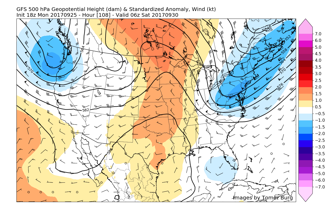
ECMWF model showing a mid level trough working into the Northeast this weekend with another ridge hot on its heels (Accuweatehr Pro)
For more information and posts like this one, make sure you sign up for Premium Forecasts — where multiple detailed articles, videos, and interactives are posted each day. Also, come interact with our staff and many other weather enthusiasts at 33andrain.com!
Have a great evening!
Steve Copertino