-2")
Summer-Like Warmth Continues, Hurricane Maria Stays Offshore This Week
Good morning! More summer-like weather from the weekend will continue today, as strong mid-level ridging continues to be over the Northeast and Mid-Atlantic. It will be hot and humid for late September with plenty of sunshine for today. More sea-breezes developing this afternoon, may keep temperatures a little cooler than on Sunday, especially closer to the coast. But high temperatures will likely reach the mid-upper 80s in many areas again. Some inland spots could reach around 90 degrees again. These temperatures will likely be a few degrees short of record highs for today.
Clear to partly cloudy skies are expected for this evening. Some low clouds and fog may begin pushing inland from off the ocean along the New Jersey and Long Island shores, with the southeast flow. Then more low clouds and patchy fog will likely develop for more areas later tonight, as low-level moisture becomes trapped underneath nocturnal and subsidence inversion. Some locally dense fog with reduced visibilities below a quarter mile are possible with calmer winds closer to daybreak. Some pockets of drizzle are possible. Overnight low temperatures with more cloud cover overnight should generally be in mid 60s over Interior to near 70 over urban and coastal areas.
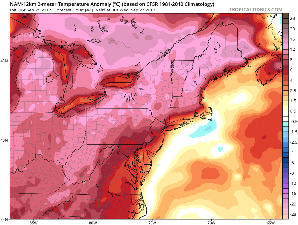
NAM model showing temperatures remain well above normal over the Northeast on Tuesday
A large mid-upper level rough over the Western US will gradually shift east, and begin to break down the ridge over Northeast and Mid-Atlantic for rest of the week. However, temperatures will still remain warmer than normal with some humid conditions on Tuesday and Wednesday. A tighter pressure gradient between Maria off the Carolina coast and high pressure to northwest, will cause onshore flow to persist with more northeast winds.This will likely some more low clouds with some patchy fog and drizzle, during the morning hours each day, before clouds try to break for more sunshine during afternoon. This may keep coastal sections a little cooler than over the past few days. But high temperatures are still expected to be at least in the lower to middle 80s, especially over inland areas.
Then a cold front associated an embedded shortwave inside the upper-level trough, will move through Wednesday night. Latest models suggest little interaction between this front and tropical moisture from Maria over the Northeast. Hence, moisture and dynamics overall appear limited with this front. But with the left-front quad of upper-level jet moving over Northeast and some weak instability, some scattered showers are still possible by Wednesday afternoon or night. Behind this front, more pleasant dry weather returns, with temperatures cooling down somewhat with highs more upper 70s to lower 80s. Another cold front associated with another embedded shortwave will likely move through with more scattered showers possible Friday night.Then high pressure from Central Canada builds into Northeast this weekend with more pleasant but much cooler weather. Temperatures will likely be below normal this weekend.
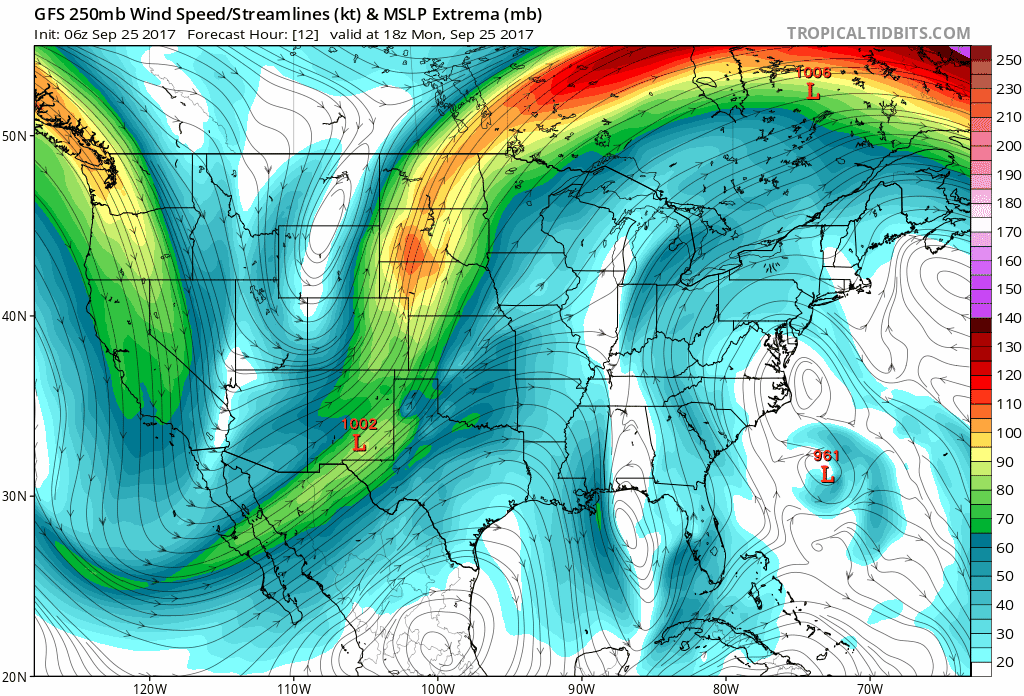
GFS model forecast winds and steering flow in the upper-levels this week
Meanwhile, Hurricane will continue to track to the north-northwest,. between an upper-level low over Southeast US, and perhaps come close enough to produce tropical storm force winds and some rainfall for the outerbanks of North Carolina on Tuesday or Wednesday. Maria will also likely gradually weaken as it moves over cooler water left behind by Hurricane Jose. Then it will sharply recurve out into open Atlantic and weaken further, as a strong westerly flow increases with the trough moving into Eastern US later this week. Highest surf and rip currents along the shore from Maria is likely during the middle of this week. Then seas should calm down by this weekend.
Stay tuned for more forecast updates over the next several days for this week and this weekend! More long range updates on the pattern for October are also coming soon!