-2")
Cooler Weather Returns by This Weekend Over the Northeast
Good morning! Today will be another very warm and humid day, as mid-level ridging remains over the Northeast. Some low clouds and patchy fog again in some spots early this morning, should gradually burn of during the next few hours. Then more sunshine filtered by some high clouds, well help temperatures rise to well above normal again this afternoon. Highs will be the mid-upper 80s, away from the coast. Easterly winds may will keep some coastal sections cooler, perhaps only mid-upper 70s or lower 80s for highs.
A large mid-upper trough moving in from the Midwest and Great Lakes, will finally break down the ridge for rest of the week. A cold front associated with embedded shortwave energy along this through, will be approaching by tonight. Some showers and thunderstorms are still possible with some weak instability building ahead of the front, mainly over Interior parts of the Northeast later this afternoon and evening. But a lack of moisture and dynamics will keep this activity mostly isolated or widely scattered in coverage.
Later tonight and early Thursday morning, model guidance still suggest some more bands of showers and thunderstorms, over parts of Southeast New England, with slightly more moisture interaction with Maria, along the front. This will continue to be monitored for some heavy rainfall. Otherwise, clear to partly cloudy are expected tonight with temperatures will dropping into the mid-upper 60s tonight. Lowering humidity and increasing winds with the frontal passage should prevent more low clouds and patchy fog developing late tonight/early Thursday morning.
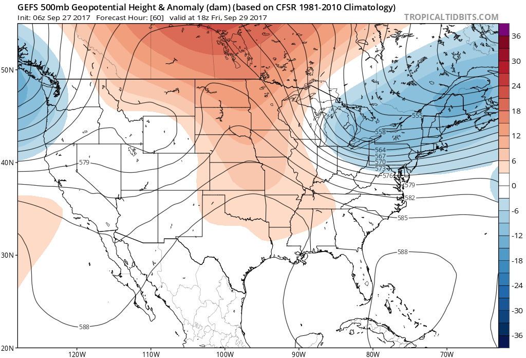
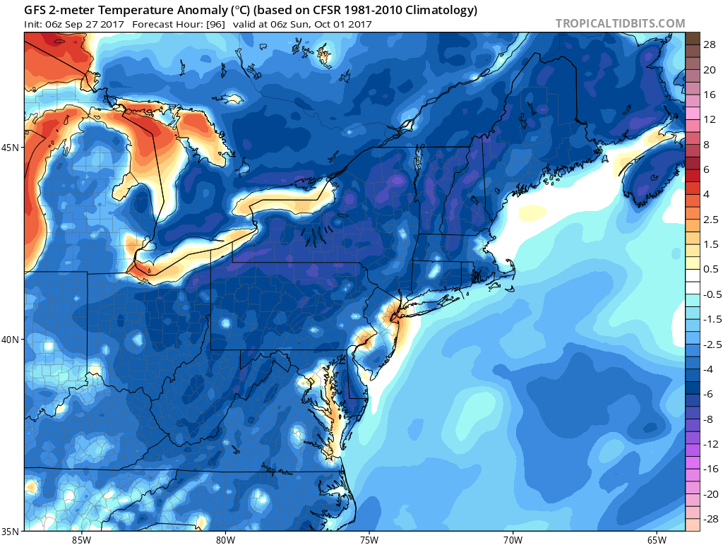
Strong, anomalous ridges over the Western US/Canada and over the Kara Sea will support large troughiness with a much cooler, less humid airmass over much Great Lakes/Ohio Valley to Northeast/Mid-Atlantic rest of the week. Temperatures will be trending closer to normal on Thursday and Friday then to several degrees below normal by the weekend. Model guidance still shows another cold front and embedded shortwave inside the upper-level trough moving through, sometime during Friday or Saturday with some showers possible. Then high pressure from Central Canada builds into Northeast by Saturday night or Sunday with another reinforcing shot of cool air. High temperatures both days of days of the weekend will likely be in the upper 60s or around 70.
GFS model showing cooler than normal temperatures over Northeast this weekend
Then a faster, more active pacific jet returns to West Coast next week. This causes the ridge from over the Western US/Canada to progress quickly into the Central/Eastern US by early next week. However, confluence underneath troughiness lingering over Southeast Canada will support high pressure near the New England coast with more onshore winds Monday and Tuesday. This will keep a maritime airmass over the Northeast. High temperatures generally in the lower to middle 70s are expected early next week, then temperatures may moderate back to well above normal levels later next week, if the more ridging continues to build into the Northeast.
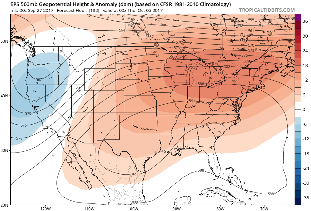
ECMWF ensembles showing a strong ridge over much of Central and Eastern US later next week
Meanwhile Maria is now tropical storm about 150 miles off North Carolina Outerbanks and will be turning east-northeast out to sea by tonight and Thursday. Maria will continue to produce swells, causing higher surf and dangerous rip currents, and some beach erosion, along the shores. Then seas should calm down as Maria begins accelerating well out into North Atlantic on Friday and this weekend. Stay tuned more premium/public updates on the forecast for the next couple weeks.