-2")
Beautiful Weekend on Tap, Changes Coming Next Week
Good Evening!
We’ve certainly seen a nice change in sensible weather over the past two days or so, as the warm temperatures and humidity have been funneled out and replaced with much more seasonable conditions. Today was an extension of this seasonable weather, as light winds from the southwest brought in a mild day with highs ranging in the upper 60’s to lower 70’s across much of the Northeast. This is only slightly warmer than what we’ve seen this week due to a slight increased in mid level temperatures as an area of mid level ridging begins to build in off to our south and west. This area of building ridging will also allow for increased subsidence to overwhelm the area, so this contributed to a mainly sunny day with the exception of just a few high level cirrus clouds. Conditions will remain quite calm and clear throughout the evening hours and into the overnight hours as a weak cold front begins to sag into the Northeast over portions of western New York and Pennsylvania. This front will be moving relatively quick, and will also be quite weak, so no noticeable temperature drops will be likely overnight. With generally clear skies, light winds from the southwest switching to northwesterly, and relatively low humidity, temperatures tonight should bottom out in the middle to upper 40’s west of the metro area, and in the upper 40’s to lower 50’s in the immediate NYC area. These conditions will also be quite favorable to view an ongoing meteor shower occurring right around the club of Orion, with the best viewing times happening just after midnight!
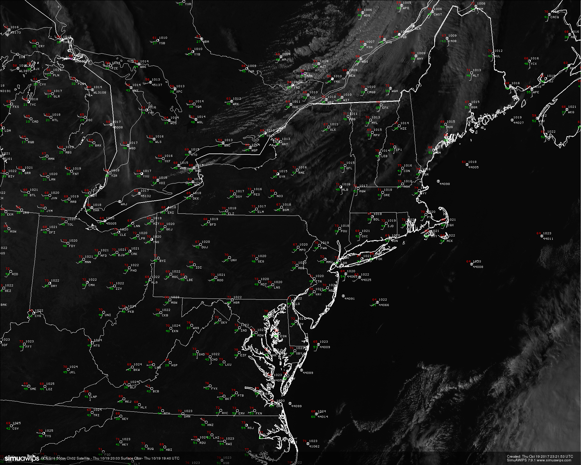
Surface observations and high resolution satellite imagery from GOES 16 showing relatively tranquil conditions over much of the Northeast this afternoon/evening with mild temperatures (Simuawips)
Friday Into the Weekend
Much of the same is likely on Friday, with clear and mild conditions likely starting off the day as the weak cold front quickly passes through during the morning hours. The only notable changes will be a shift in the wind direction from southwest, to northwest, but this should gradually change back as the day progresses. Mid level ridging will continue to build in from the west during the day tomorrow, and this will usher in slightly warmer mid level temperatures over the area. A renewed area of subsidence will also begin to build in, expect a generally sunny day across the entire area with highs in the upper 60’s and lower 70’s once again, with locations closer to the city more likely to see temperatures around the 75 degree mark. Tomorrow should give way to a very nice end to the workweek as the tranquil conditions last into the overnight hours with temperatures likely falling into the upper 40’s and lower 50’s for low temperatures, which is rather seasonable for this time of year.
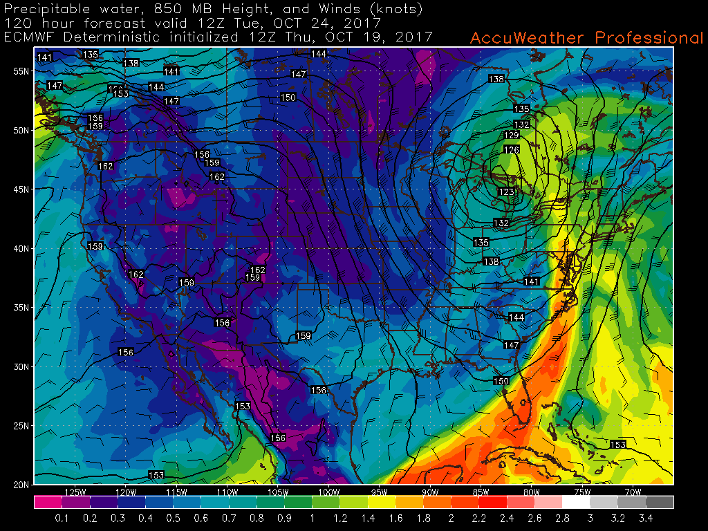
As we head into Saturday, we should begin to see the mid level ridging that has been building to our west really flex its muscles and start to usher in even warmer mid level temperatures during the day, but also working to keep much of the subsidence and dry weather in place over the region as the stormy/active weather remains well north of the Northeast, over Canada. With the warmer mid level temperatures aloft, highs in the middle 70’s are likely during the day, with some locations near the city likely reaching into the upper 70’s, and possibly even around the 80 degree mark during peak heating hours. Much of the same is expected on Sunday as the crest of the mid level ridge will be located right over the Northeast. Sunday is likely to have more sea-breezes with it, but should be another warm and beautiful day nonetheless to get some work done outside, or just enjoy the day in general. Dewpoints will remain quite comfortable as well, which should lead to both evenings being very pleasant while radiational cooling takes temperatures down into the lower to middle 50’s for lows.

This afternoons ECMWF model showing the building mid level ridge over the Northeast on Sunday afternoon. This ridge should lead to very mild conditions this weekend with very little in the way of cloud cover.
Changes Coming Next Week!
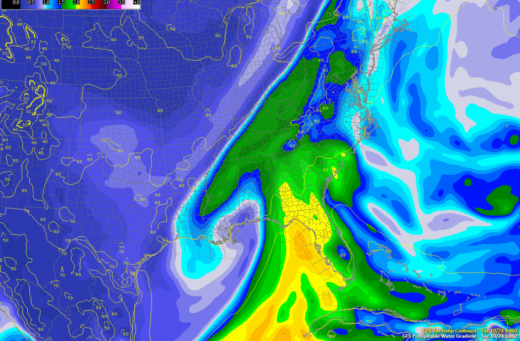
While the ridging over the Northeast may linger into the early part of next week, large-scale changes will begin as early as Monday. A mid level ridge will begin to set up over the west coast, and this will begin to force the remnants of a large mid level trough in the central part of the country. The remnants will likely become cut off from the overall jet stream while these changes occur and begin to dig into the Ozarks and Tennessee valley. As ridging out west continues to amplify, it will begin to pour in rather energetic Pacific energy coming from the active Pacific jet. This energy, in conjunction with the cut off upper level low will begin to round out a trough in the eastern half of the country starting on Monday night and into Tuesday. As this upper level low begins to interact with the incoming trough and cold front, it will cause rich tropical moisture to stream northward into portions of the Mid-Atlantic and Northeast. This moisture should begin to reach the area on Tuesday morning/afternoon as the primary low pressure system heads north in Canada, with a large cold front pushing into the East. Depending on just when the mid level trough phases with remnant cutoff system will determine the overall timing of this system, but we are looking at increased potential for heavy rainfall early next week, with temperatures likely falling into below-normal territory by the middle of the week.
This models begin to diverge on what exactly happens with this system, as increased blocking could potentially allow the system to slow down enough to potentially cut off from the main flow and meander around the region for at least a few days. This solution is somewhat unlikely as ridging in the west breaks down due to the strong Pacific jet, but will be monitored as this could prolong periods of unsettled weather next week.
We will continue to watch this system over the next few days and will have an update by early next week! Enjoy the weekend!
This afternoons ECMWF model showing a large plume of tropical moisture streaming into the east ahead of a large and mature frontal system
For more information and posts like this one, make sure you sign up for Premium Forecasts — where multiple detailed articles, videos, and interactives are posted each day. Also, come interact with our staff and many other weather enthusiasts at 33andrain.com!
Have a great night!
Steve Copertino