-2")
Midday Long Range: Transient warmth followed by big changes
Good afternoon and Happy Monday! Transient warmth remains the story during the better part of this ongoing week. In our morning briefing we discussed the evolution of a broad ridge, which will develop across the Western and Central United States this week. This ridging will shift eastward over the next 5 to 7 days, bringing anomalous warmth eastward with it. Warmer than normal temperatures are expected across a large portion of the United States this week, particularly in the Central and Northern Plains.
With the movement of this ridge eastward, as progressive as it may be in its overall nature, will come a steadily lower than normal GWHDD when compared to 10 and 30 year averages. This has been well reflected in the latest model data and in our forecast packages. We only made minor tweaks to our going forecast in the next 5 days or so. The major changes to the forecast look likely to come during the middle of December.
In our lengthy Sunday update yesterday, we discussed many of the driving forces behind the anticipated pattern change. These begin in the North Pacific and Bering Sea, and continue all the way to the higher latitudes of Greenland, British Columbia, and the Polar Regions, not to mention the stratosphere. For more detailed reading, we recommend taking a look at that post and its breakdown of anticipated changes.
Forecast model and ensemble guidance has not changed very much over the past 24 hours since our breakdown. In fact, ensemble guidance has become a bit more bullish with the potential for cold and lower than normal height anomalies in the atmosphere’s mid and upper levels. The cold is expected to surge into the Central USA first, then quickly bleeding eastward.
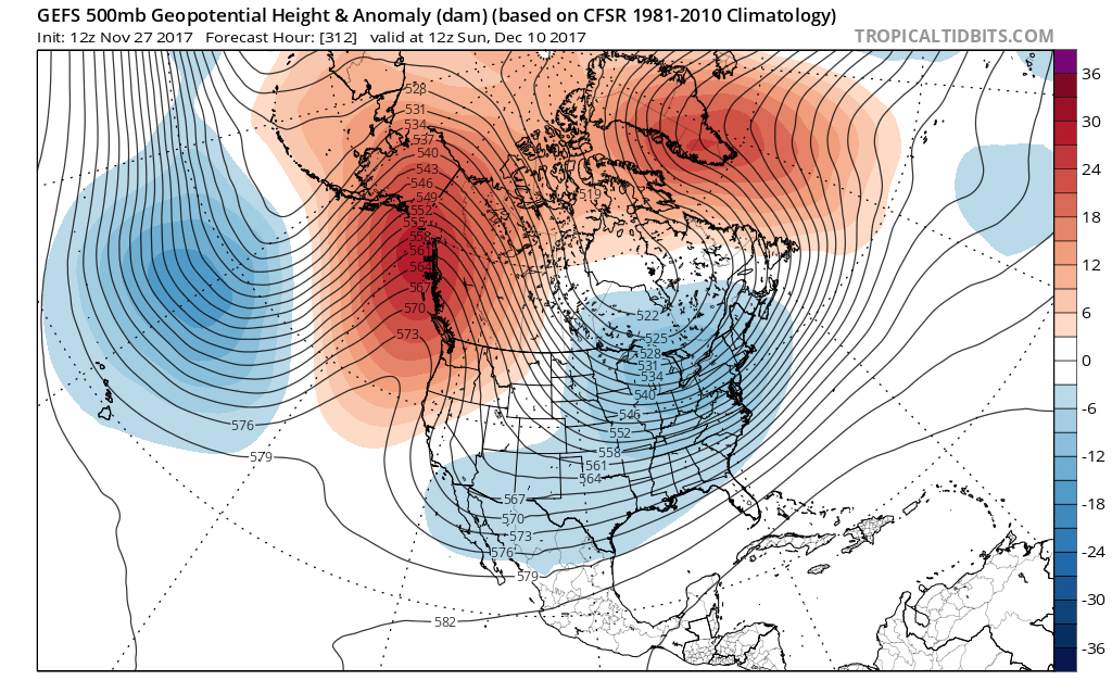
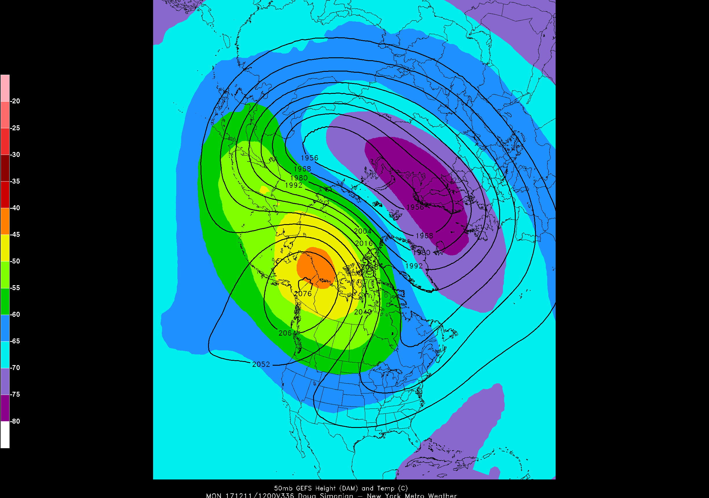
GFS/Ensembles: Minimal change since yesterday. High latitude blocking develops by 12/10 with significantly colder temperatures moving into the USA during Week 3. Opportunities for wintry weather may evolve over the Great Lakes and Ohio Valley near and after this time frame. Particularly noteworthy is the development of a large -EPO ridge (in the NE Pacific), which often preludes Arctic outbreaks in the US. Given the coupling between the stratosphere and the troposphere, this aligns nicely with the anticipated warming event in the stratosphere in those same regions.
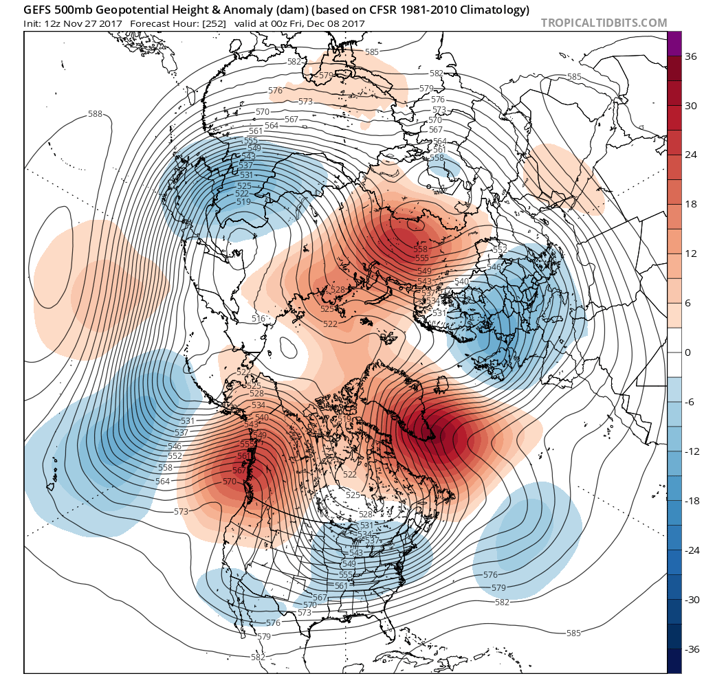
ECMWF/Ensembles: Very similar in nature. Significant changes to the pattern by 12/10 with high latitude blocking both on the Pacific and Atlantic sides of the USA. Colder than normal air surging southward in a similar fashion to the GFS from 12/11 onward. It also has a similar warming event in the stratosphere, with large ridging in Alaska and the Arctic.
ECMWF Weekly products are released later this afternoon and will hopefully continue to add confidence to our ideas regarding this time frame. More to come over the next few days as we hone in on this period of change.