-2")
Warmer Conditions Finally Take Hold, Watching This Weekend
Good Evening!
Today has been quite the interesting day, as we finally saw high temperatures lift above freezing for the first time in almost two weeks for some locations! Many states across the Eastern third of the country saw their coldest first week of January on record, which is a fitting way to bookend this intense Arctic Outbreak that will likely be remembered for years to come. Although some locations to the south and east of the immediate NYC area saw a return to above-freezing, many locations did not and were once again stuck in the middle to upper 20’s. This combinations led to problems, as a weak mid level disturbance moved in from the Ohio Valley this afternoon and brought a mixed bag of precipitation for the majority of the Mid Atlantic and some Northeastern states. Despite having mid level temperatures just slightly above freezing in the lowest 3,000-4000 feet of the atmosphere, low level temperatures were cold enough and were accompanied by enough dry air to have precipitation start off as a mix of freezing rain and sleet for locations mainly to the north of Philadelphia. As this system quickly headed towards the coast during the late afternoon, we were able to see a change to mainly sleet and snow as mid levels once again cooled enough to end the freezing rain threat. Farther south, the freezing rain threat has stuck around longer due to more stubborn mid level warm air and higher temperatures near the surface. No major ice accumulations have been recorded as of this evening, but it would appear that at least some roads have become slick over the past few hours over southern NJ, southeast PA, and portions of MD/DE.
These slippery conditions accompanied by lingering light freezing rain should continue until around 11pm-1am before completely shutting down as dry air begins to take over the mid levels from northwest to southeast. While precipitation may not be all that heavy, freezing rain accumulates the most when rates are light, so please use caution when driving this evening, especially on back-roads and roads that usually are not treated. Otherwise, we should see continued gradual clearing through the overnight hours, with temperatures getting into the lower to upper 20’s over the majority of the Northeast.
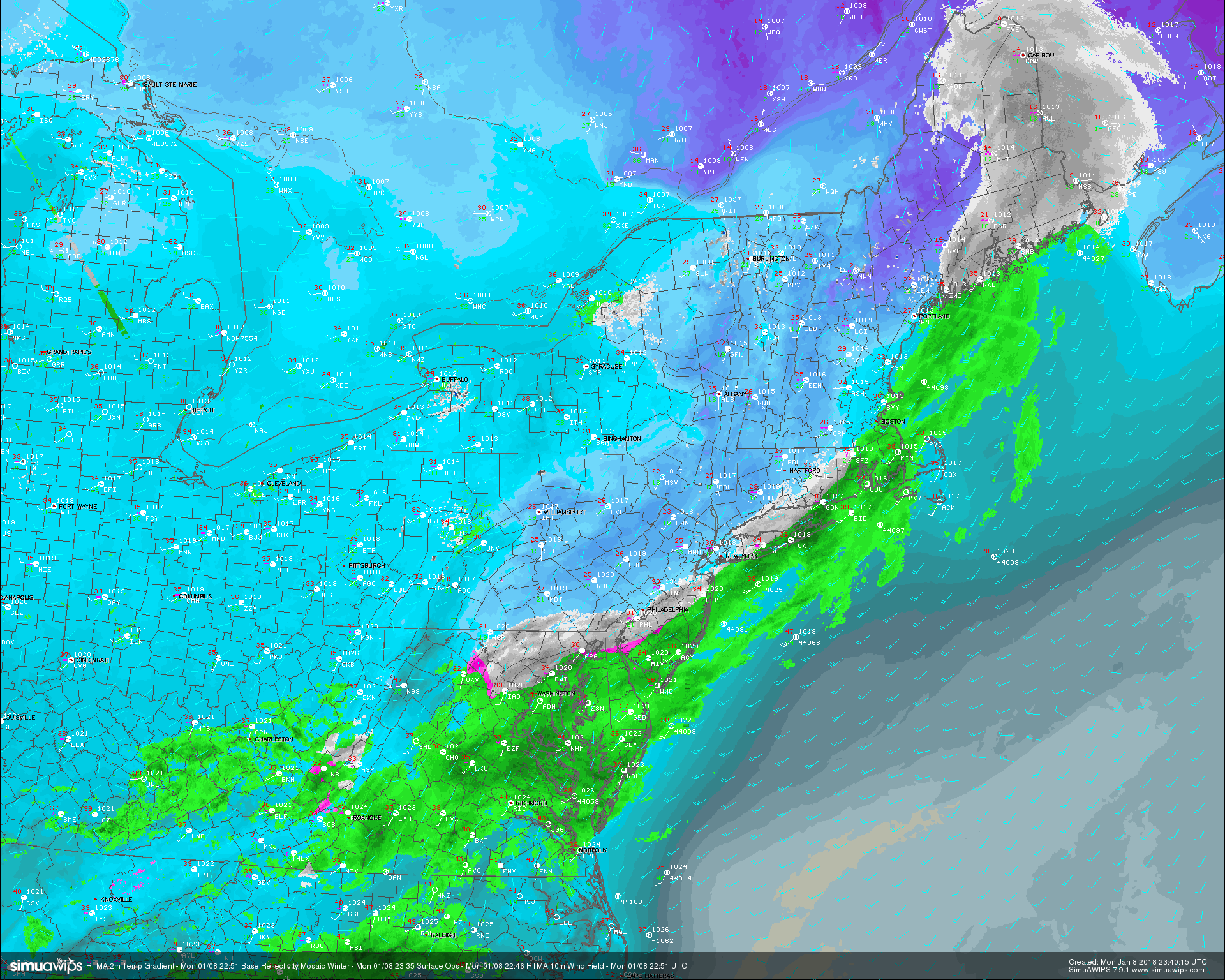
This evenings regional radar mosaic, surface observations, and RTMA 2m temperatures showing some light rain, snow, and freezing rain over the Mid Atlantic states.
Tuesday Into Thursday
Any mid to upper level clouds associated with tonight’s system should be out of the region and well off the coast in time for the morning commute on Tuesday. Tomorrow will likely start off quite cool, but clear for the entire area. Winds should generally be from the west for the vast majority of the day tomorrow, with temperatures likely getting into the middle to upper 30’s across much of the area tomorrow, with only locations north of southern New England staying below freezing. Calm conditions can be expected tomorrow as a surface high pressure system builds in over the Northeast by tomorrow evening. Conditions will be quite calm and just right for some good radiational cooling to take place tomorrow night, which should bring lows down into the lower to middle 20’s right around the NYC metro area, with teens likely to the north and west.
Wednesday should see much of the same, with a high pressure system remaining in control of the weather for the day. Mid level temperatures will begin to rise from the southwest during the afternoon hours, and with relatively clear skies, we should see highs mainly in the middle to upper 30’s, with some locations to the south and east likely getting into the 40’s. Clouds should begin to increase during the late evening hours and into the night as a mid level warm front will begin to lift over the region, bringing warmer temperatures in overnight. Lows will likely range in the middle to upper 30’s, with some locations to the north and west stuck in the low 30’s.
Thursday will likely be one of the more noticeably warmer days as low to mid level flow continues to increase and draw up warmer temperatures in the process. A growing system located in the Plains that will impact our area this weekend should provide some moisture early in the morning hours and possibly into the early afternoon, but these should generally be light in nature as the bulk of the lift associated with the system remains a great distance away. High temperatures on Thursday are going to be tricky, but the increased humidity and mid level temperatures should yield highs in the lower to middle 40’s across much of the Northeast, with some locations likely to hit that 50-degree mark . Any meaningful precipitation looks to wait until the early morning hours of Friday to move in, so expect relatively dry conditions until that time.
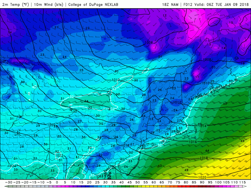
18z NAM models evolution of the surface temperatures over the Northeast, showing a change to a warmer couple of days.
Plain Rain Or A Mix For The Weekend?
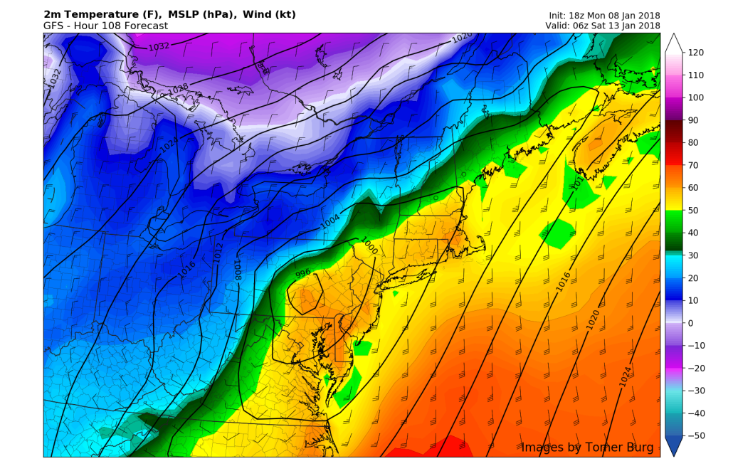
Finally, a large area of energy will be over the southern Plains states by Friday morning, and this will help to pump copious amounts of low level moisture into the East during the day. As of right now, it appears that we may see one heavy burst of rain start to move from the south and over the Mid Atlantic and Northeast early Friday morning and into the afternoon hours. Rain intensity may dwindle a bit in the late afternoon hours and into the evening, but at least some showers are likely during this time. The next batch of steady rain looks to occur right around Saturday morning as the mid level energy begins to strengthen and take on more of a negative tilt over the central US. This kind of setup promotes the development of a primary low pressure system over the Ohio Valley, with moderate precip extending from Illinois from Boston. This will be a large system in nature, so the impacts will already be large, however this afternoons European model has shown a more interesting solution as the surface low pressure system bumps into a strong area of Arctic high pressure located over southern Canada. Such a solution would create the threat for snow/sleet/freezing rain as the more dense cold air runs into the strong warm air advection from the south.
As of this evening, it appears that portions of New England would be at greatest risk from any significant frozen precipitation, but this is still five days out at this moment, and these situations usually continue to change up until the event is occurring. We will be closely monitoring the potential for heavy rain and possibly some frozen precipitation this weekend and will provide numerous updates over the next couple of days!
This afternoons ECMWF model showing a large winter storm centered over the Ohio Valley bringing a wide range of possible impacts.
Have a great evening!
Steve Copertino