-2")
Morning Snow Winds Down This Afternoon
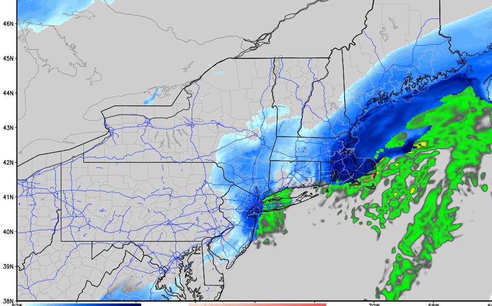
Good morning! An inverted trough extending from low pressure offshore has resulted in bands of snow and rain across parts of the Northeast to start the day. The majority of steady snow so far today has been situated over parts of Northern NJ and the Lower Hudson Valley into Southern New England, where the airmass remains colder and more supportive of precipitation. Closer to the coast, enough warm air from east-southeast winds off the ocean has lead to mainly light rain with some snow mixing in at times.
As low pressure moves further east off the Northeast coast and begins to deepen, it will drag colder air in behind it via northerly winds. Precipitation may end as a period of snow for coastal areas with some light accumulations under 2″. In fact, this is occurring already as of 8am over much of the NYC Metro Area. Any accumulations will likely be relegated to colder surfaces as temperatures remain above freezing.
Further inland, surface temperatures are at or just below freezing. Low-level frontogenetic forcing is also enhancing bands of moderate to heavy snow. Road conditions will continue to deteriorate with snow accumulation and reduced visibilities in these areas, particularly across Northeast New Jersey and Southeast NY.
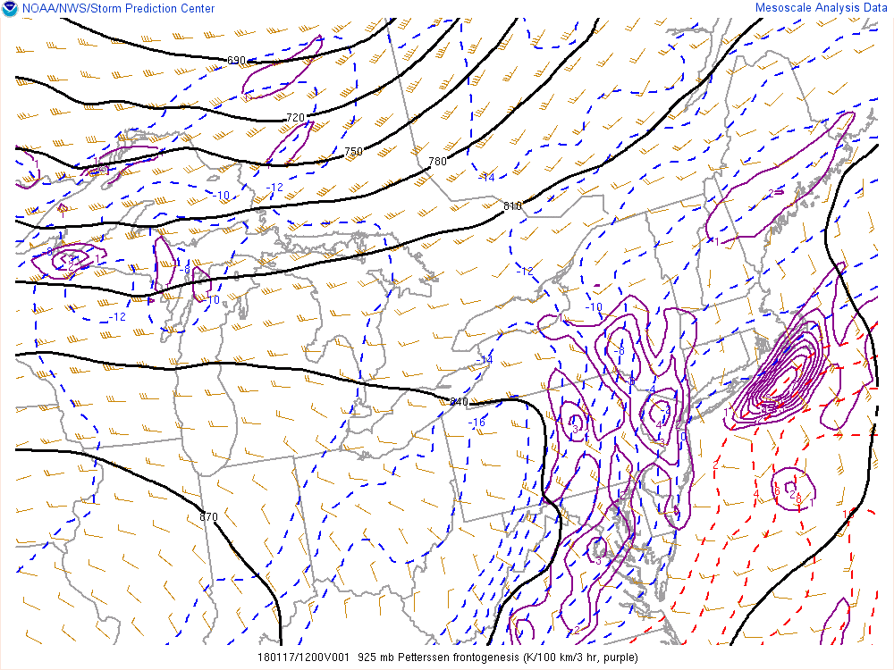
SPC Mesoscale Analysis showing moderate low-level frontogenesis at 925mb over much of New Jersey
The low pressure area has not been quite as deep and close to the coast as forecast models once showed as recently as 48 hours ago. Less precipitation will fall over the interior/colder areas as a result, leading to lower overall snowfall totals in those areas. 4 to 6 inches of snow is still likely across much of interior New Jersey, Southeast New York and Southern New England by the time the system begins to wrap up later this afternoon.
Snow should taper off to snow showers and flurries from west to east during the early part of the afternoon. Skies will begin clearing with sunshine expected across much of the Northeast later today. Temperatures will continue to remain steady or slowly fall into the lower 30s, as colder air continues settle into the region. Tonight will be mostly clear and very cold with low temperatures in the teens and lower 20s.
It will remain cold and dry into Thursday and Friday in the Northeast Then temperatures finally warm up this weekend to above seasonable levels. Stay tuned for more forecast updates this week!