-2")
Warmer and Dry Through the Weekend, Heavy Rain Possible Early Next Week
Good evening!
Today was another cold and dry January day across most of the Northeast as we remain in a rather uneventful pattern for the next couple of days. The jet stream is currently locked in a fast-moving west to east flow across the entire nation. This quick flow does not allow for any disturbances to strengthen and become large storms as the mid level energy that fuels them tends to become sheared out. Despite the quick zonal flow, some cooler air in the mid levels has still been able to bleed down from the southern regions of Canada and into the Northeast. Combined with very dry conditions in the mid levels of the atmosphere, this lead to a seasonably cold and partly sunny day. Highs ranged from the lower to middle 30’s for locations in and around the immediate NYC area, with readings in the lower to upper 40’s across portions of southern New Jersey. This large gradient has been due to more warm air rising up from the south due to increasing mid level heights to our west. Heights will continue to rise through the evening and overnight hours, which will cause surface winds to take on a more southwesterly component. This should in turn usher in more mild air for the Mid Atlantic region and Northeast, with highs likely a good 10-15 degrees warmer than last night. This will equate to lows only getting down into the lower to middle 30’s from the city on south, with locations to the north and west likely seeing temperatures in the middle 20’s.
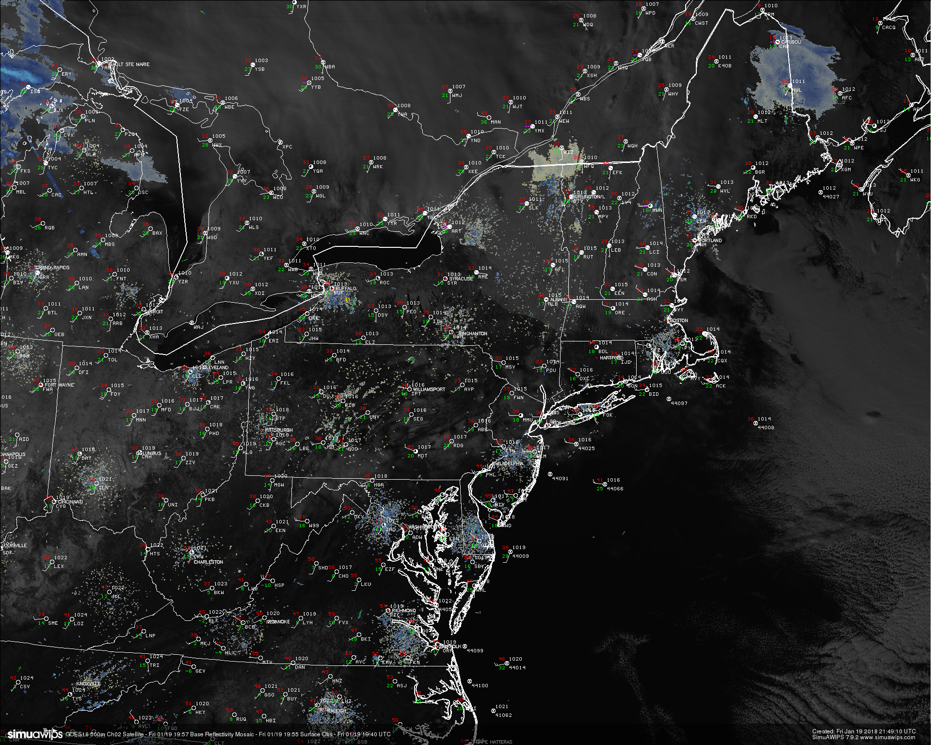
This afternoons high resolution visible satellite imagery, regional surface observations, regional radar mosaic, showing a rather calm and cold day across the Northeast. Note the ice jam located juts to the south of the “MDT” in southeast PA
Tranquil Through the Weekend
Saturday will likely start off rather clear and cool as mid level ridging continues to build over the Ohio Valley. Westerly flow will be quite stout in all levels of the atmosphere, with mid level temperatures warming up quite a bit during the day. The combination of warming mid levels and relatively clear skies should allow for temperatures to rise in the upper 40’s to lower 50’s during the afternoon hours. This will be well-above normal for this time of year and it should be a pretty great day to get some chores done around the house. Clear and clam conditions are expected into the evenings and overnight hours with lows likely staying in the lower to middle 30’s for the majority of the NYC area,
Sunday may start off with a few more mid level clouds than Saturday as a large storm system begins to take shape in the Plains. This developing low pressure will greatly enhance the amount of southerly flow over the region on Sunday, which should also work to bring in some more moisture to work with in the lower to mid levels of the atmosphere. This means that despite the increasing mid level temperatures, cloud cover will likely cap off the temperatures right around where they were on Saturday, with middle 40’s to lower 50’s expected. A very weak cold front may try to approach the Northeast late in the evening on Sunday, but this front will likely lack significant moisture to produce anything outside of some scattered showers.
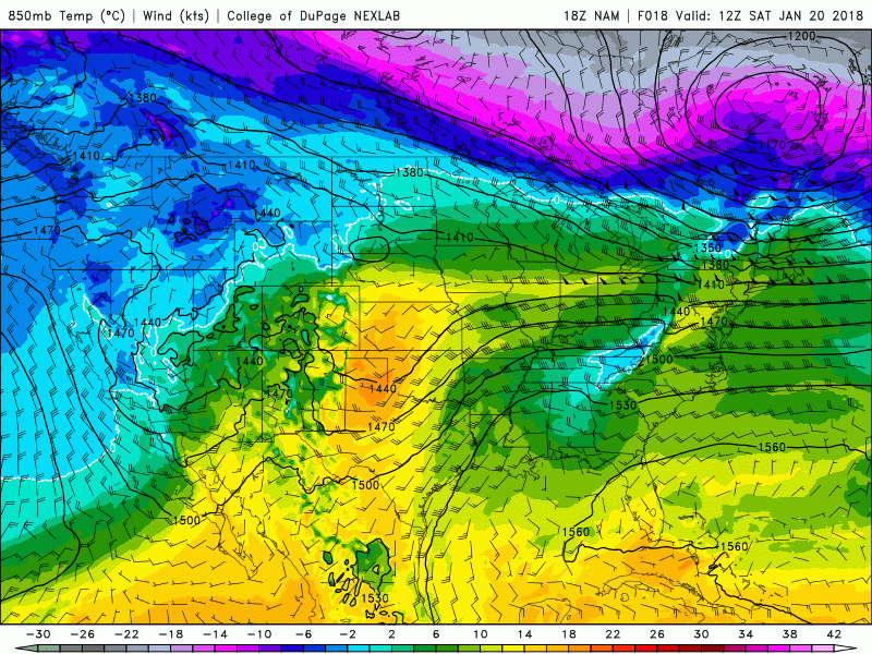
This afternoons NAM model showing increasing mid level temperatures ahead of a large storm system developing in the Plains
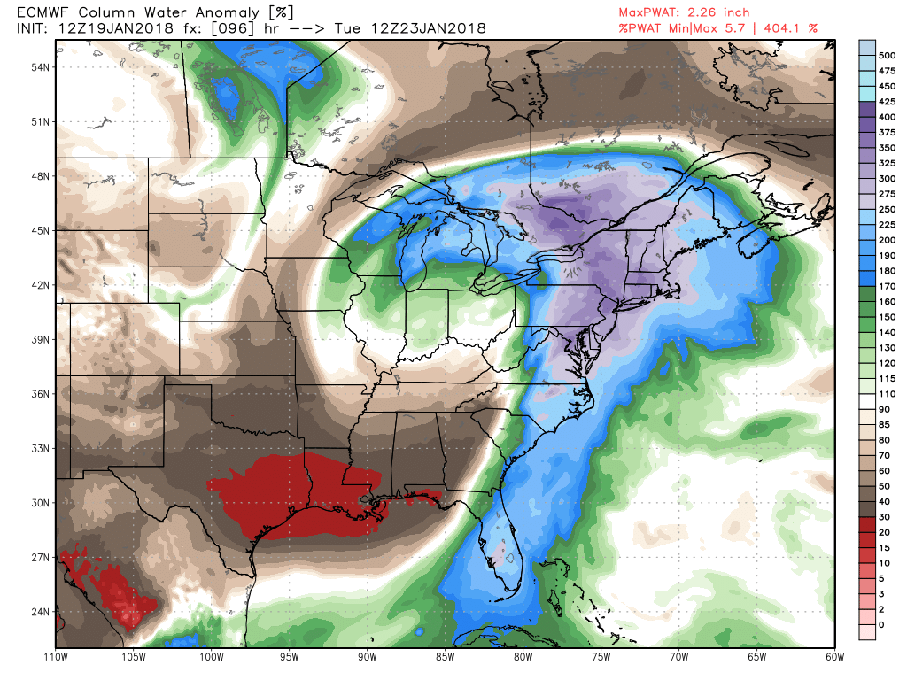
Heavy Rain Possible Early Next Week
The same large Pacific trough that we have been talking about for the better part of the last week will be digging deep into the Rockies and southern Plains by Sunday night, which will trigger a surface low to develop over portions of Kansas and Nebraska. This system will have deep tropical moisture feeding into it from the Gulf of Mexico and as a result, a very expansive area of precipitation will likely fan out with the help of an impressive upper level jet streak. Heavy snow and blizzard conditions will likely fall over the northern Plains, with heavy rain and some thunderstorms likely across the Ozarks and Gulf Coast. This system will likely then begin to weaken as it occludes, but the strong moisture feed will continue to pump northward as the low moves east towards the Great Lakes. By this time the entire East coast should be deep within the warm sector of this system, with temperatures likely reaching into the well-above normal category once again. The models really have not changed much at all over the last 48 hours, with the consensus showing a line of heavy showers and possibly embedded thunderstorms moving through the Northeast on Tuesday morning. Widespread flooding does not seem to be a concern right now due to the speed of the associated cold front. However, this rain will likely be impacting the morning commute in one way or another, so make sure to check back over the next few days as we continue to monitor this large and impactful system!
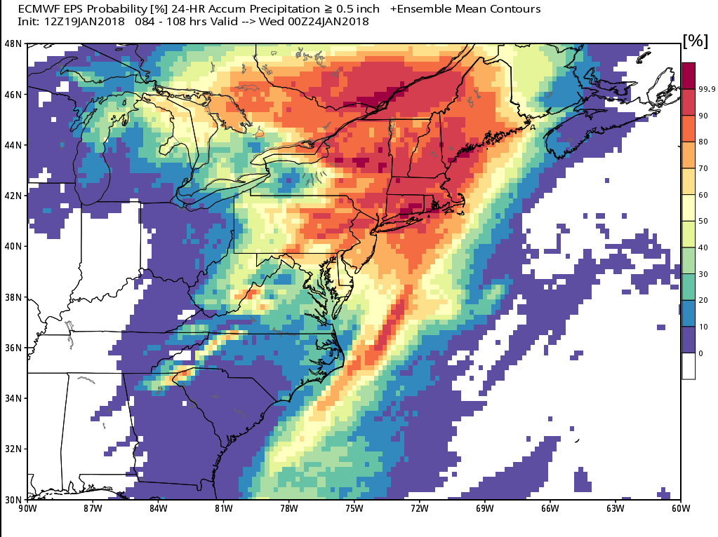
This afternoons European Ensembles showing a rather high probability for heavy rain to occur during the Tuesday morning commute over a large section of the Northeast
Have a great weekend!
Steven Copertino