-2")
Thursday Briefing: Warmer Weekend, Northeast Snow Monday or Tuesday?
Good morning! Very cold and dry weather is expected through today and tonight, as arctic high pressure will remain in control over the Northeast. Mostly sunny skies are expected with high temperatures generally in the upper 20s to lower 30s. The very same clear skies will continue through tonight, as low temperatures fall into the teens over the interior and the lower 20’s even in urban areas.
High pressure will begin moving offshore on Friday, so temperatures will begin to moderate tomorrow afternoon into the upper 30s and lower 40s. Friday night will be warmer for many areas — but some radiational cooling should still allow for the Interior Valleys and Pine Barrens to drop into upper teens or low 20s by daybreak.
Overall a mild weekend is expected, as an upper-level ridge builds over the Northeast and Mid-Atlantic. Saturday will be likely be the better half of the weekend, with mostly sunny skies once again. High temperatures will rise into the upper 40s to middle 50s with southwest winds. Clouds and some rain showers will likely arrive by Sunday, as a cold front and upper-level trough approaches from the west. As a result, high temperatures may be a little cooler on Sunday, in the middle 40s to lower 50s.
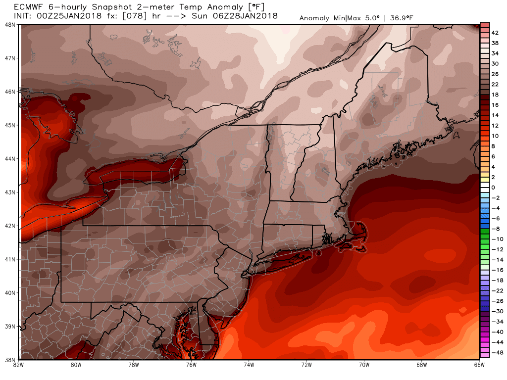
ECMWF model temperatures near 20 degrees above normal on Saturday night
More showers are likely Sunday night as the cold front moves through. Uncertainty then begins to increase as the forecast evolves on Monday and Tuesday. A couple waves of low pressure are forecast to develop along a frontal boundary, and track northeastward from the Gulf of Mexico and Southeast US coast into the Western Atlantic. These waves are associated with southern stream shortwave energy which will be phasing with the northern stream energy near the East Coast. The energy remains somewhat weak, but it were to congeal effectively, it could create a storm of significance.
Currently, most model and ensemble guidance suggest phasing will occur too late. This would keep these waves of low pressure from consolidating into a bigger coastal storm and impacting the Northeast and Mid-Atlantic regions. This solution makes sense given the progressive nature of the pattern, with a lack of high latitude blocking and a fast Pacific jet surging into the West Coast.
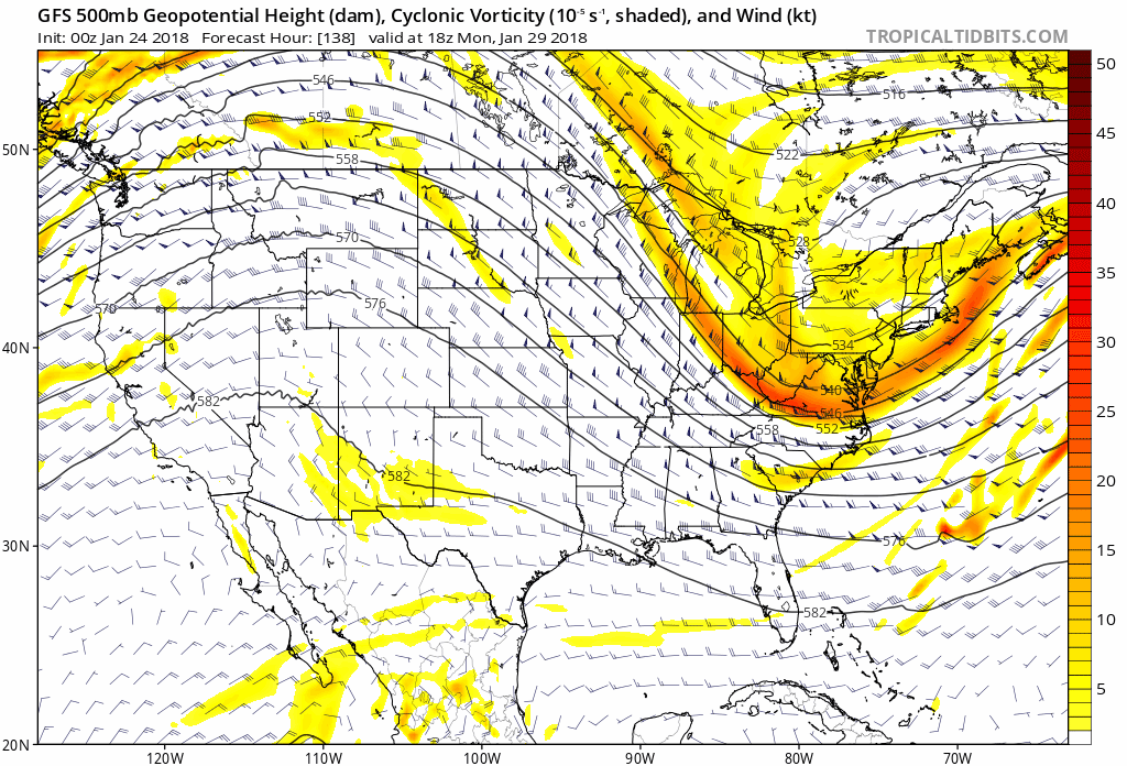
GFS model trend over past 6 runs, in general showing a stronger ridge over Western US and more amplified trough over the Eastern US
However, a strong ridge will build briefly over the Western US, allowing room for the upper-level trough to amplify before reaching the East Coast. There has been a tendency for the model and ensemble guidance to underestimate height rises ahead of troughs this winter season, and that would will lead to further amplification if it were to occur again. So while a bigger coastal storm is unlikely, we will monitor guidance for any trends further northwest and stronger through the weekend as the upper level heights continue to adjust.
Some models, such this mornings GFS, suggest bands of precipitation will form with an inverted trough and positive vorticity advection over parts of the Northeast and Mid-Atlantic regions later Monday and Tuesday. This occurs when the storm itself is well offshore, but lower pressures bend back towards the coast, supporting lift and precipitation. Depending on how much cold air quickly arrives, some of the precipitation may begin as rain or a wintry mix before changing over to snow. We’ll keep our eye on the potential for an evolution similar to this one as well (this mornings ECMWF is pictured below).
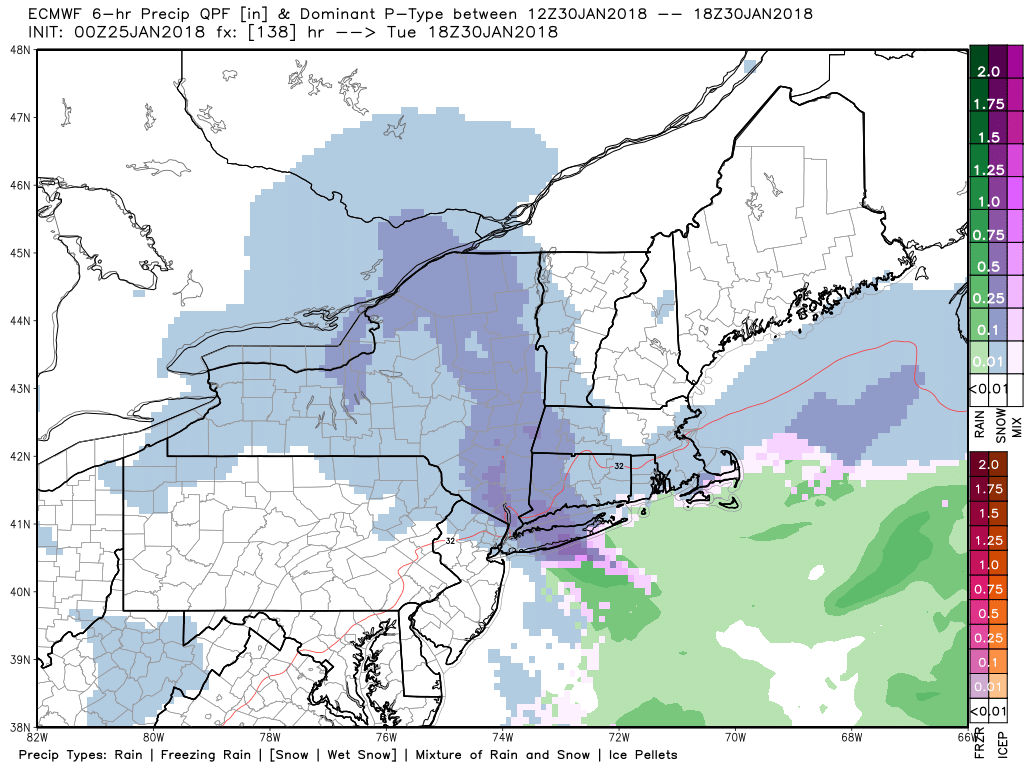
ECMWF model showing an inverted trough with a light to moderate band of snow over parts over the Northeast on Tuesday
Thereafter, another arctic cold airmass will move in behind the storm system by Tuesday and Wednesday. Temperatures will be several degrees below normal again on both days. After a period of brief moderation next week, we anticipate a colder pattern with winter storm threats to evolve for much of the Central and Eastern US as February approaches. More information how that pattern will evolve is right here in this article we wrote yesterday.
Stay tuned for more updates on the mild weather this weekend and possible snow for Monday or Tuesday.