-2")
Saturday AM Briefing: Showers Tonight, Northeast Snow Threats Next Week
Good morning! High pressure will provide mostly sunny skies today. Temperatures started out below freezing this morning outside of the major cities, mostly due radiational cooling overnight. This also resulted in some black ice forming on roadways. However, a strong upper-level ridge and southwest flow will lead to some unseasonably warm temperatures by this afternoon, in the upper 40s to middle 50s.
Clouds will increase this evening as a cold front associated with an upper-level trough approaches from the west. Not a great deal of moisture is expected with this front, but some lift from a strong mid-upper level jet should aid in the development of some rain showers tonight. Temperatures will likely remain mostly in the 40s through tonight with the clouds and rainfall late.
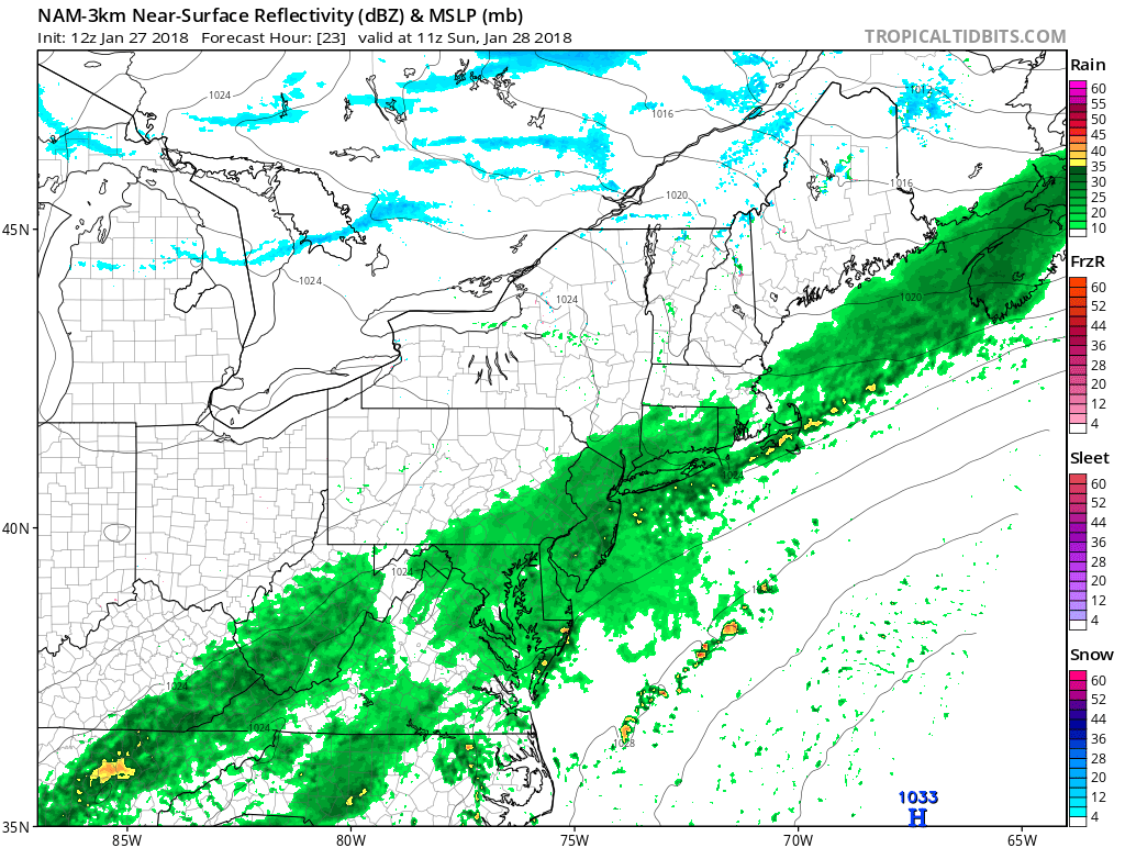
3km NAM model showing showers over region around daybreak Sunday
The cold front will gradually move south into the Mid-Atlantic region on Sunday. Showers gradually taper off from NYC northward during the mid to late morning hours. However, a weak wave of low pressure developing along this front will keep cloudy skies around for most for most of the day. Some showers will likely continue into the afternoon and evening hours over Central and Southern New Jersey and areas further south. High temperatures in the middle 40s to lower 50s will likely occur during the early morning hours. Then temperatures will remain steady or slowly fall for the rest of the day.
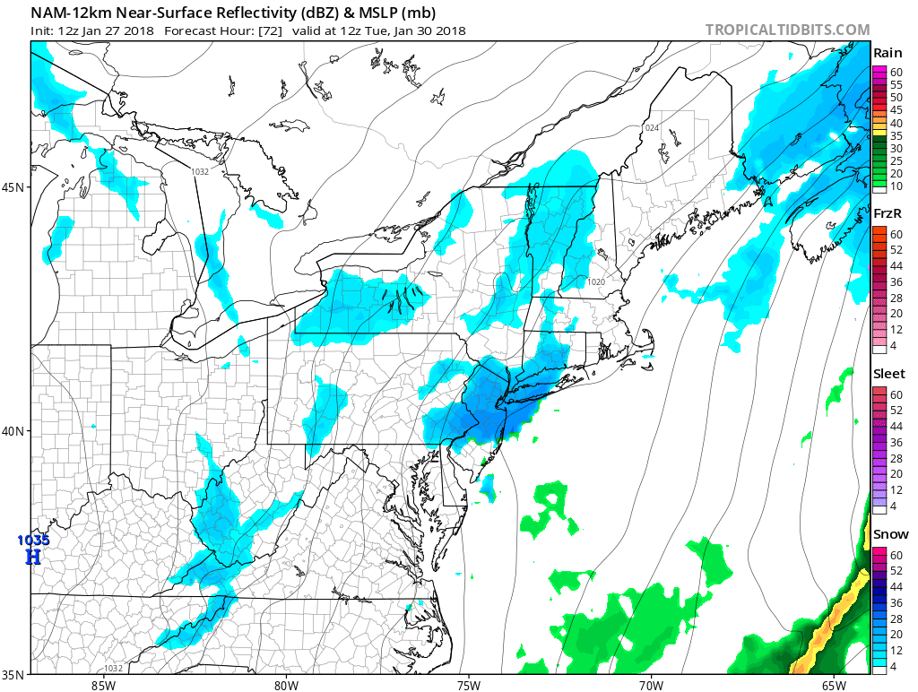
It will gradually turn colder with more unsettled weather on Monday and Tuesday in the Mortheast states. Latest models have trended further offshore and less amplified with a larger coastal storm as the pattern continues to remain too progressive. Accordingly, significant snowfall still appears very unlikely for the Northeast and Mid-Atlantic. Some light snow is still possible with an inverted trough and mid-level shortwave/ jet streak energy moving through by Monday night into Tuesday. Temperatures will be closer to normal on Monday in the upper 30s to middle 40s, droppinginto the lower to middle 30s by Monday night and Tuesday.
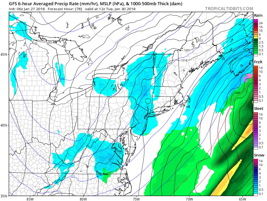
GFS model showing light snow fall over with an inverted trough (seen with lower surface pressures over New Jersey and New York) Tuesday morning
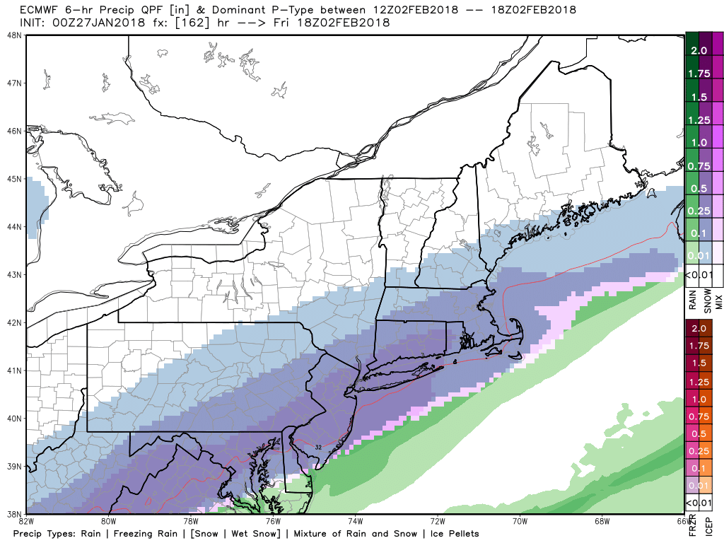
Wednesday will see fair and cold weather take over in the Northeast again. Afterwards, temperatures will briefly moderate again, before another strong cold front associated with an upper-level trough arrives by the end of the week. A wave of low pressure and divergent upper-level jet streaks will enhance precipitation along and behind the front. Arctic cold air will be surging behind this front, so it’s possible this system could bring some rain that changes to snow, as the latest ECMWF model indicates.
Overall, though, the pattern will remain progressive. The exact timing of this wave moving along the mentioned frontal boundary will be crucial for a potential snowfall in Northeast or Mid-Atlantic later next week. If it comes before the front arrives, precipitation will be mostly in the form of rainfall. High-latitude blocking will be lacking – so there will be nothing acting to force this wave to slow down and allow it further amplify near the east coast. We are skeptical of snowier solutions at this time. Stay tuned for more updates on these snow threats for next week!