-2")
Wednesday Briefing: Wintry threats begin in the Northeast this weekend
Good morning! Tranquil weather has taken over in the Northeast states today, as high pressure takes control. With it has come the cold – temperatures will only reach the lower to middle 30s this afternoon in many spots. Some passing clouds will be the only story today as a weak disturbance passes through.
Unsettled weather is expected to return later tonight and Thursday as a broad upper-level trough moves into the Northeast. A warm front associated with this trough will be lifting northward late tonight and tomorrow morning, bringing increased cloudiness and some showers. A stronger cold front will be approaching from the west on Thursday – with mostly cloudy skies and light precipitation possible.
Along coastal sections, temperatures will moderate into the 40s with southerly winds. So any precipitation will be in the form of light rain showers. Over the Interior, some light snow, sleet or freezing rain is late possible in the morning before temperatures rise enough to support rain showers in afternoon. Some slick spots are possible on roadways.
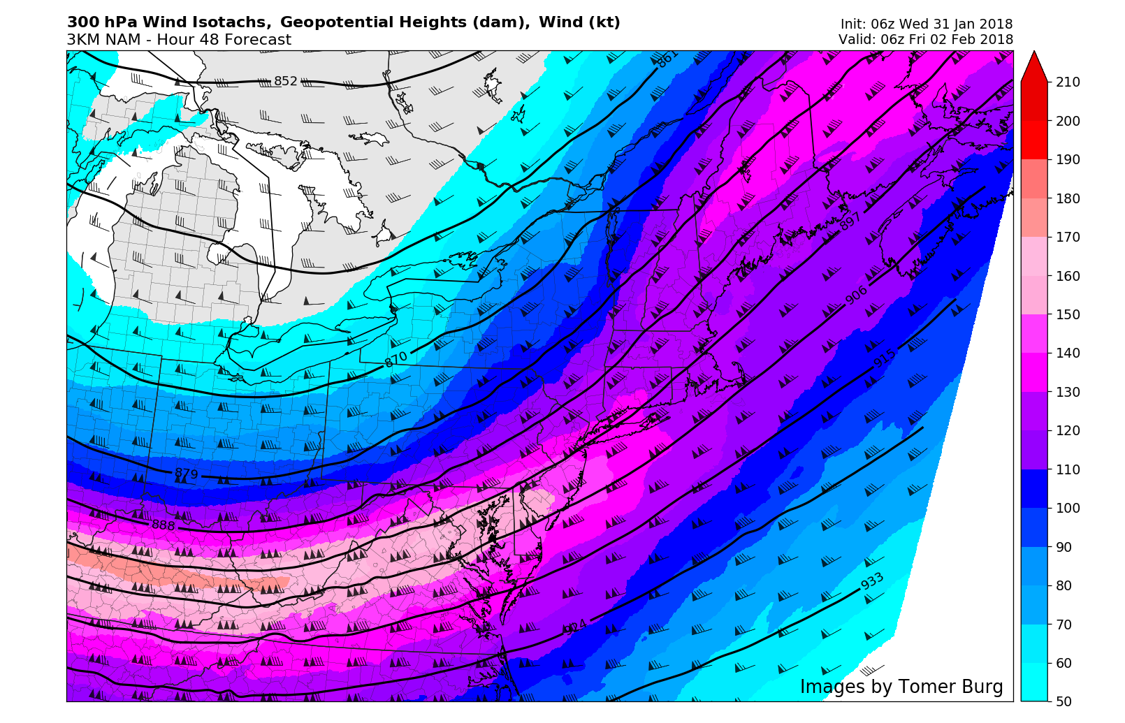
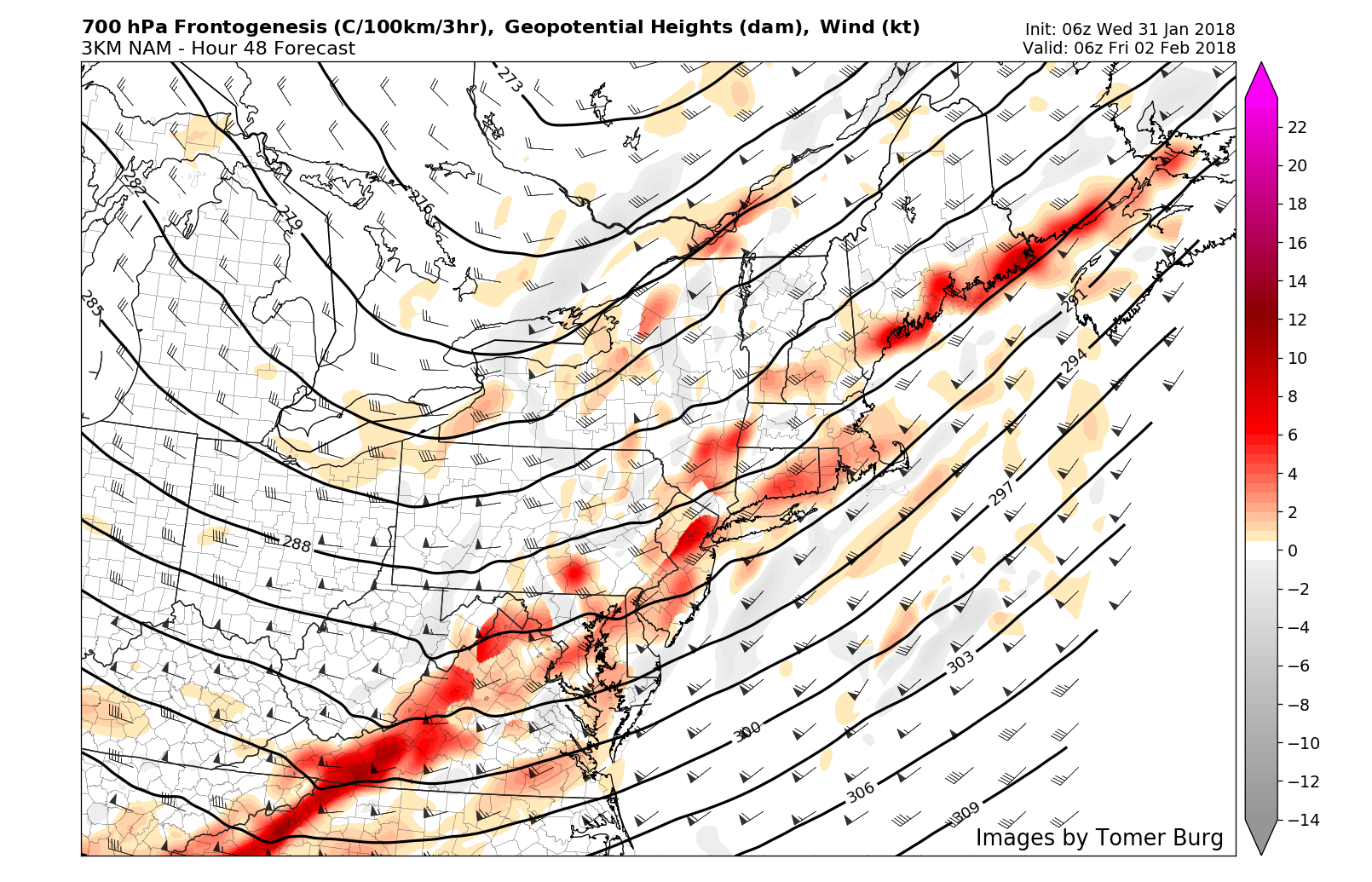
NAM model showing left-exit region of a 300mb jet streak passing over Mid-Atlantic and New England regions Thursday night
Rain showers are expected to become more likely by Thursday evening, as the cold front moves through. The left-exit region of an upper-level jet streak, mid-level vorticity advection and 700mb frontogenesis may enhance light to moderate precipitation as colder air begins to move in behind the cold front. Rain showers could change over to snow showers later Thursday night, especially over the Interior locations. If this occurs, light snowfall accumulations are possible, as this system moves quickly and exits by daybreak Friday.
Tranquil and cold weather returns again for Friday and Saturday. Plenty of sunshine is expected with high temperatures in the lower to middle 30s d each day. Friday night is expected to be quite pleasant, but cold (for those of you heading out and about) with clear and crisp conditions. Another shortwave trough will be amplifying over the Eastern US with clouds increasing by Saturday night and Sunday. Eventually this may consolidate into another coastal storm for the Northeast and Mid-Atlantic from Sunday into Monday.
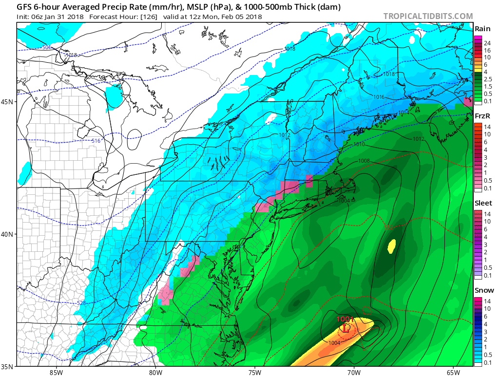
GFS model for Sunday night into Monday with Northeast Storm
As is most often the case, there is uncertainty in regards to how this system will come together, as the atmospheric flow is still progressive. Moisture form the Gulf of Mexico and Atlantic will likely be feeding into this system, so precipitation of significance is possible. The antecedent airmass is expected to be colder than the past few systems – so the potential will exist for wintry precipitation, especially on the front end of the storm.
However, without any high latitude blocking to keep high pressure centered to our north, eventual warming is possible as the system evolves and tracks closer to the Northeast states, leading to a changeover to rain for coastal locations and the big cities along I-95. We have our eyes on this one, and will continue to iron out the details of the system as we get closer to the event. Stay tuned!