-2")
High latitude blocking a key in the late February forecast
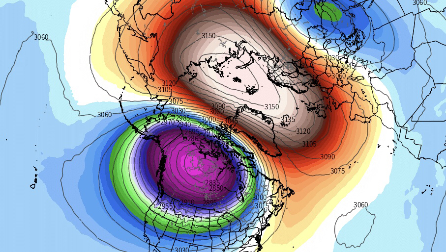
Over the past several days you have probably heard about a Sudden Stratospheric Warming event (SSW) — over, and over, and over again. With good reason, too – the event is important. We spoke about it several days back and will touch on it here again. Forecast models continue to suggest the development of a very impressive stratospheric warming event over the next few days, beginning in just 24-48 hours and continuing through next week. The stratospheric vortex itself will split in two, with the dominant sister vortex centering over Canada.
Warmer than normal temperatures and higher than normal heights will surge into the stratosphere near the North Pole and Arctic regions. Most notably, the stratosphere and troposphere are well coupled heading into the event, which means the warming in the stratosphere will have “maximum impacts” on the atmosphere as a whole – with the troposphere reacting to the warming event happening above rather quickly.
Stratospheric warming events can be significant for several reasons, and one of the main reasons is the potential development of high latitude blocking. In a very simple sense, we can think of it this way: A strong, stout stratospheric vortex will act to fight off any high latitude ridges. Instead, you get a large behemoth of a stratospheric vortex spinning in the Arctic. But a weaker, more perturbed (or in our case, split) vortex can allow for ridges of high pressure to build into the Arctic and higher latitudes (a.k.a high latitude blocking) and those can be big trouble when it comes to the weather pattern across Europe and the United States.
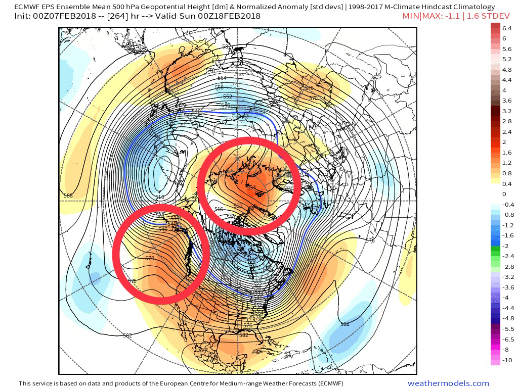
ECMWF EPS showing ridges building poleward into the Arctic regions and Alaska, from over the Kara Sea and over the Eastern Pacific during the next 10-15 days.
High latitude blocking, or ridges of high pressure in the higher latitudes of the Arctic regions, act to dislodge cold air that typically resides in those regions elsewhere, and also works to disrupt circulations and atmospheric flows throughout the Northern Hemisphere – with varying degrees of impact and intensity depending on where they develop. Their development is encouraged by a stratospheric warming event, but can be modulated by a multitude of things: The MJO and atmospheric angular momentum, amongst others. In this coming case, it appears more likely than not that high latitude blocking will have hemispheric support for development. The ECMWF EPS are beginning to suggest a rapidly dropping Arctic Oscillation – which is significant for its signal of high latitude ridging development.
One of the main concerns and uncertainties moving forward into the latter part of February will be the high latitude blocking itself; how strong will it become, where will it develop, and how long will it stay in place? While we know its development is favored, it will take a few more days before the aforementioned details come in to focus. All eyes in North America will be on the Pacific and Atlantic high latitude regions – particularly the Atlantic, which can have a huge effect on the weather pattern if the development of a -NAO does occur.
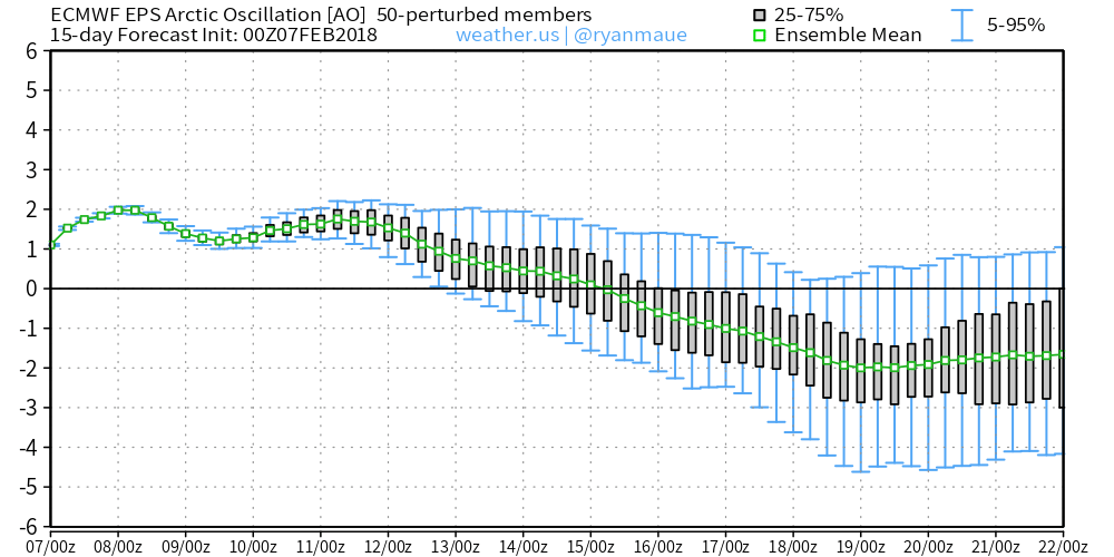
ECMWF EPS showing the AO currently in the positive phase, falling into negative phase after February 15th.
Forecast models and ensembles remain quite muted with the overall signal, but continue to suggest dropping Arctic Oscillation values during the end of February. Early signals are for blocking to develop in the Arctic and then gradually shift towards the Pacific high latitudes with development of ridging towards Greenland on the Atlantic side as well. The exact amplitude and breadth of high latitude ridging, as mentioned, will be a critical aspect of the forecast moving forward.
Overall, from a sensible weather impact, the risk for colder weather should return across the Northern 1/3 of the United States as the development of high latitude blocking is encouraged towards the latter half of February. The potential for winter storms also is likely to increase. The details, however, will still take several days to iron out. More to come…
Trackbacks & Pingbacks
1breastwork
Comments are closed.