-2")
NYC Area Forecast: Close call with another storm on Monday
Another wintry day is on tap today as snow showers and squalls impact the Northeast states. An upper level low is lingering over the Northeast states and providing just enough lift in the atmosphere to create the opportunity for these areas of light snow. Any accumulations should be very limited and brief, but keep an eye out for slick spots on the area roadways with this snow and any ice from overnight.
The focus then turns to the potential for another coastal storm late this weekend and early next week. Yesterday we detailed the threat and the reasoning behind our ideas that the system would miss the NYC Area to the south. Forecast models yesterday evening and overnight didn’t do much to help make the forecast any more clear.
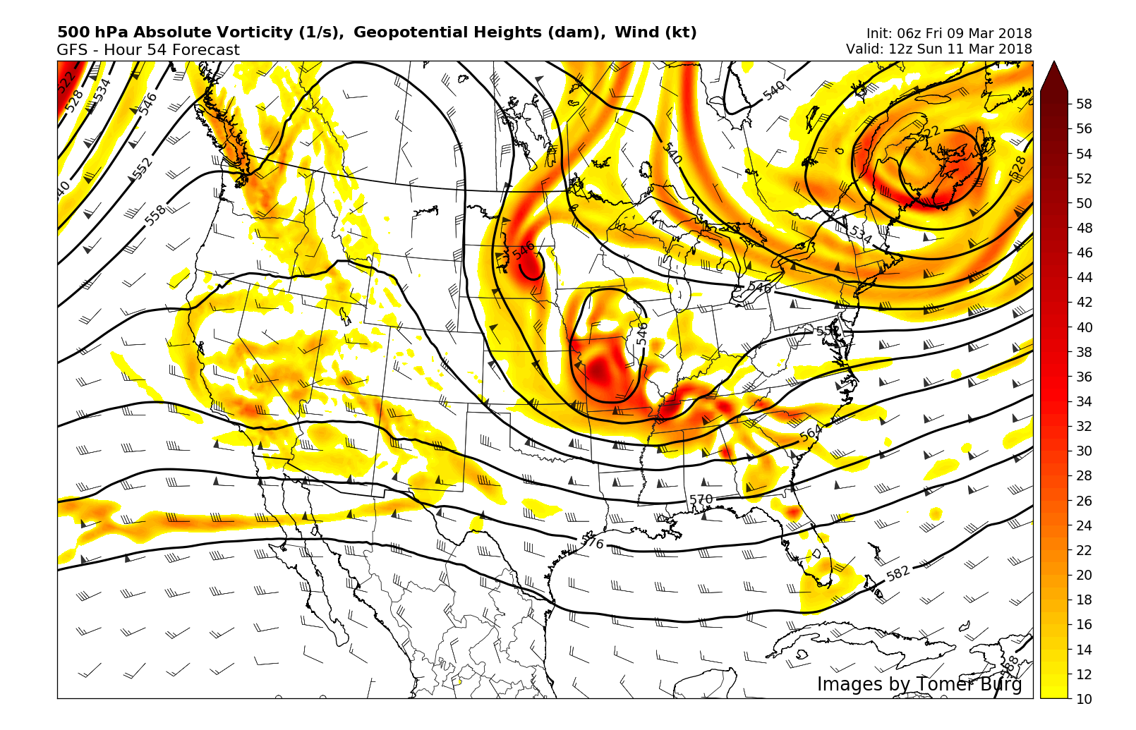
There are still three major moving parts to the forecast. A disturbance drives south into the Plains this weekend and then towards the Tennessee Valley (disturbance #1) while an upper level low spins over the Northwest Atlantic (disturbance #2). Finally, a polar short wave drives south into the Great Lakes late in the weekend (disturbance #3).
Exactly how these three disturbances interact will serve to determine how the storm system evolves. Forecast models are in good agreement now that a low pressure system will move into the Tennessee Valley and then re-develop off the East Coast. But where it goes from there remains uncertain. If the polar disturbance (#3) pushes southward too fast, it will act to suppress the low pressure system. But if it either interacts/phases with it, or leaves it alone entirely, the storm could easily expand up the coast.
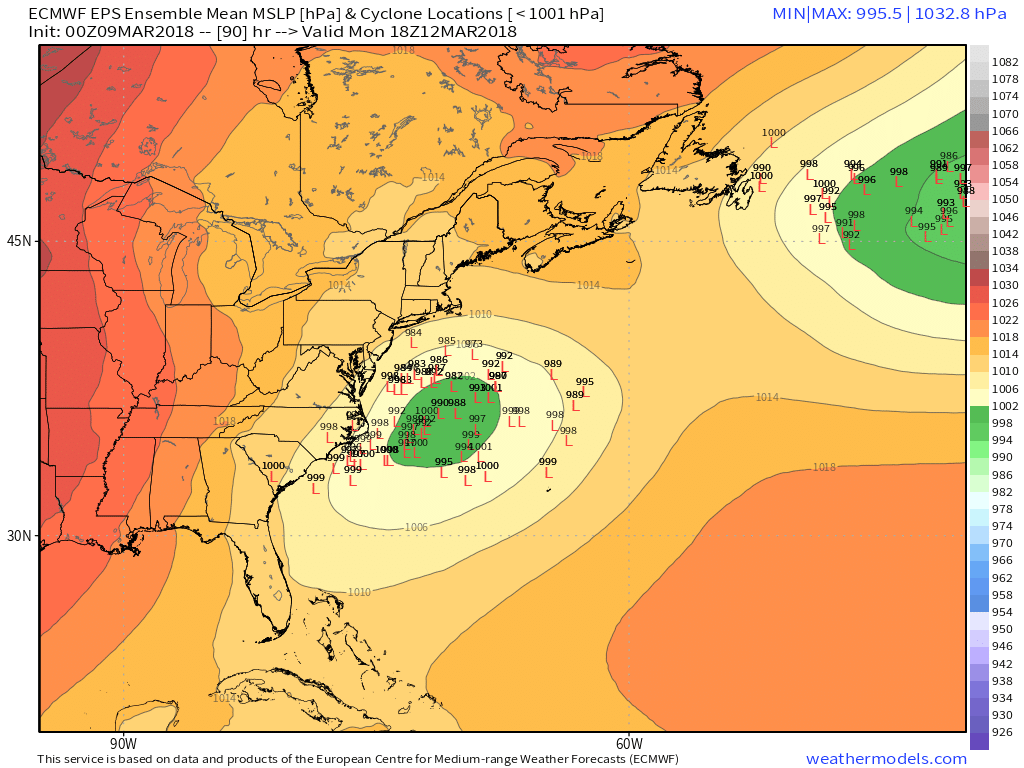
As was the case yesterday, we are hedging our bets against the storm moving far enough north to bring significant impacts to NYC. The European model and its own ensemble members heavily favor an out to sea solution, while the GFS has trended that way as well this morning. There are still a few pieces of guidance suggesting a further north track, so its worth continuing to monitor.
Interests further south, in areas like Washington, D.C. and Philadelphia as well as Southern New Jersey should keep a very close eye on the system. Only a tick northward in expected track could bring impacts of significance there – and the same is true for areas of Eastern New England.
Stay tuned today for further updates on the latest model data and updates to our thoughts on the systems progression.