-2")
NYC Area Weekend Forecast: Pleasant, but remaining very cold
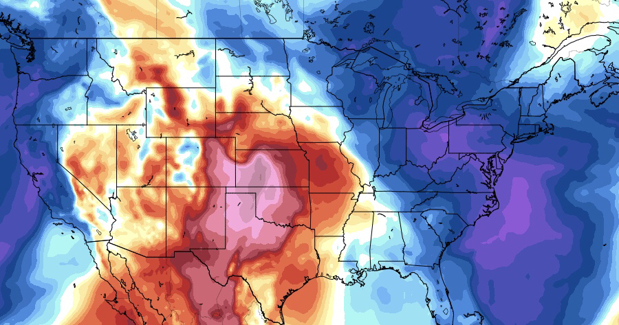
It has been quite some time since we’ve been able to take a break from forecasting significant winter storms, or at least look ahead at a time period where the potential for one didn’t exist. We’ve finally made it to that point! The weather this weekend will be much more quiet compared to the past several days – with sunny conditions generally expected across the Northeast states. Temperatures, however, will be several degrees below normal, with highs only in the 40’s and low temperatures remaining very cold overnight.
The good news, as we mentioned, will be the sunshine. A storm system will pass well to the south over the next 48 hours, scraping the Southern Mid Atlantic and then heading well out to sea. A few snow showers are possible in the Northeast states – courtesy of a separate disturbance to our north – and may drop some light accumulations in the far interior and higher elevations of New England through Sunday. Otherwise, the weather will remain quiet and benign.
The theme is likely to continue into next week. Forecast models continue to suggest that the pattern will finally begin to calm down a bit, as the synoptic support for large Nor’Easters that has largely dominated things over the past several weeks begins to change. High latitude blocking, the cause of most of this, is shifting to the Pacific side instead of the Atlantic over the next week. This will serve to tone down the chaotic weather pattern in our part of the world.
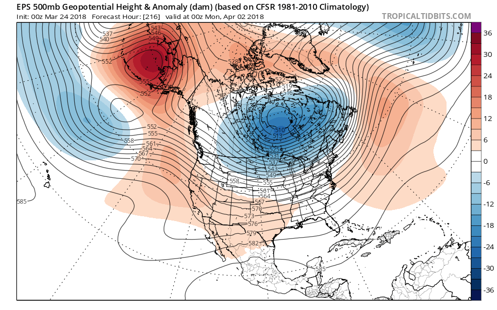
The ECMWF ensembles, showing more high-latitude blocking with stronger ridging over the North Pacific region to start April
Still, the large Pacific ridge that develops near Alaska will dislodge plenty of cold air into Canada. this means that the weather in the Northeast states will largely remain colder than normal with unseasonable cold air lingering to our north. While we aren’t currently anticipating any widespread winter weather risks, it just simply won’t feel like Spring until this high latitude blocking pattern changes. Instead, a continuation of cool/cold weather is likely until the middle part of the month of April – at least.
As we look ahead, the main signs we will be looking for are the degradation of the high latitude blocking we’ve been discussing. It’s not until that occurs that we will be able to look ahead at the potential for larger-scale warmups in the Eastern United States. We’ll have our eyes peeled – for now, enjoy a sunny weekend!
Trackbacks & Pingbacks
2palliate
Comments are closed.