-2")
NYC Area Forecast: Temporary warming trend this week
Good morning, friends! Monday started off wonderfully, albeit cold, throughout the majority of the Northeast states. Plenty of sunshine is expected to persist throughout the remainder of the day today as well, as high pressure remains in control. The cold air has remained stout, and will continue to do so for a few more days, with temperatures running below seasonal averages throughout the Northeast states.
This week, however, will largely be defined by a temporary moderating trend in temperature, something we haven’t been able to chat about for quite some time. This can be attributed to a transitioning pattern in the high latitudes, as the large blocking high pressure that dominated our weather over the past several weeks in the northern Atlantic finally breaks down and begins to shift toward the Pacific (more on that later). As this occurs, a ridge will amplify in the Eastern United States.
Accordingly, temperatures will moderate quite a bit as the week goes on, approaching and then exceeding seasonal averages by the middle and the end of the week. In fact, high temperatures by Thursday and Friday could reach well into the 50’s, possibly near the 60’s, in much of the Mid-Atlantic and parts of the Northeast states. The unfortunate truth is that this weather will come with unsettled conditions, as a warm frontal boundary and storm system approach the region by the end of the week.
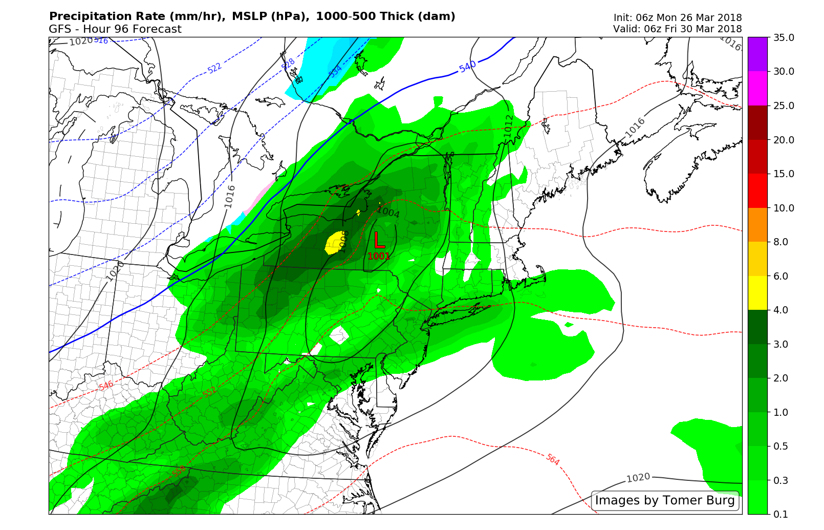
GFS model showing a frontal system with some rain showers by late week
Still, through the showery conditions will come the warmth, which most will enjoy quite a bit after weeks of cold and snow. Temperatures in the 50’s and possibly 60’s will continue through Friday, when a cold front will surge through the Northeast states. As our warmth is occurring mid week, forecast models suggest a large ridge will build in Alaska and the higher latitude Pacific Ocean. This is bad news for those who are hoping for Spring – it’s another blocking high pressure, this time on the Pacific side, that is going to dislodge unusually cold air southward into Canada.
Forecast model and ensemble guidance suggests that cold air will return with a vengeance during the first week of April, surging into the Northern Plains first, followed by the Great Lakes, Ohio Valley and Northeast states. The European model and ensemble, for example, suggests that temperatures will run below average – by several degrees – across the aforementioned regions through the first week of April.
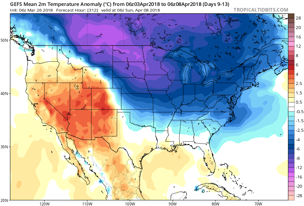
GFS ensembles showing colder the normal temperatures from over much of the Central and Eastern US in early April
There are some early signs of temperature moderation after the middle of the month of April, but for now, the warmth of the next few days must be enjoyed as it appears we are heading back into a colder regime again shortly thereafter. We’ve got more details on Thursday and Friday’s warmth and unsettled conditions coming later today!
Trackbacks & Pingbacks
3considering
Comments are closed.