-2")
NYC Weekend Forecast: Improving weather behind frontal system
After weeks of fighting through unusually cold weather, warmth has finally arrived this morning. It didn’t do so with a grandiose entrance, however, as dreary and wet conditions accompanied a warm fronts movement northward. This morning, southerly winds are drawing in warmer air which is leading to a spike in temperatures out ahead of a front. This frontal system will move gradually eastward today, into New Jersey and eventually New York City later this afternoon.
With it will come a wind shift – and while temperatures will rebound back into the mid to upper 50’s as a result of diurnal heating (fancy words for the sun will warm things up), the westerly flow will be the first sign of impending colder weather that is lurking back to our west. The news isn’t all bad though – the weekend looks likely to be salvaged, for the most part, with seasonable temperatures and comfortable weather conditions.
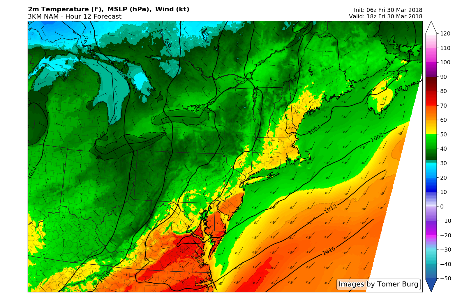
Temperatures warm up quite a bit this afternoon.
This will be the first weekend in over a month, really, where our outlook doesn’t feature the mention of some snow in the short term forecast. We’ll take that as a positive and run with it. Temperatures are likely to rebound quite a bit on Saturday, reaching the middle to upper 50’s throughout a large majority of the upper Mid Atlantic and the warmth will even move into parts of New England as well. It will feel beautiful as well with almost completely sunny skies.
Pleasant conditions are again expected, generally, on Sunday, although temperatures will be several degrees cooler as they fall into the lower 50’s area-wide and clouds increase. Lurking back to the northwest is another surge of unseasonably cold air that we have discussed for quite some time (yes, it’s still coming). It will make its entrance first toward the beginning of next week, and really begin to grab a hold of the pattern by the end of the week ahead.
Forecast models are in good agreement that by the end of next week and into next weekend, temperatures will run several degrees below seasonal averages again. In addition to the cold, well, the potential for winter weather will exist with any disturbances in the mid and upper level atmospheric flow that make their way past the region. We haven’t been able to focus in on one specific potential event yet, but the potential for winter precipitation certainly does exist in the upcoming pattern.
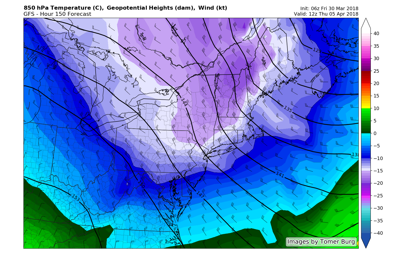
Much colder air returns by the middle to end of next week.
For now, our suggestion is to enjoy the weekend ahead – the first really nice one in quite some time. Temperatures will, again, be quite warm – near or above seasonal averages for the next few days. The next chance for steady rainfall doesn’t come until the early part of next week. After week upon week of significant weather, this weekend will be a nice respite for us all.
For those of you that are celebrating a holiday this weekend – our team sends our best regards to you and yours. Have a great Friday!