-2")
Snow likely Monday morning with quick hitting system
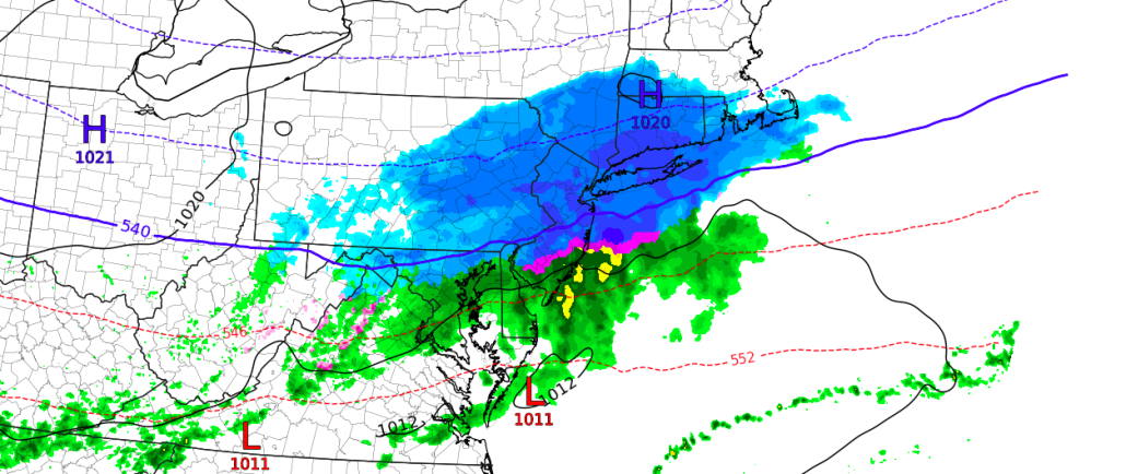
Good afternoon and Happy Easter to those who celebrate! For those of you who enjoyed the beautiful Spring weather this weekend, we have some bad news for you. A weak storm system sliding to the south for the region is expected to strengthen a bit from later Sunday into early Monday morning, with the low pressure center passing off the Mid Atlantic coast during the early morning hours of Monday. Impressive lift along a frontal boundary will allow precipitation to expand and become more steady in nature from late Sunday into Monday.
The system comes right on the edge of an unusually cold airmass that is sliding southward into the Northeast States today. It’s timing is impeccable, really – any faster and the airmass would be too warm for any wintry precipitation, and any slower and the colder air would likely press further south and keep the system more suppressed. Instead, the disturbance comes right along the frontal boundary and will provide wintry precipitation the Northern Mid Atlantic again.
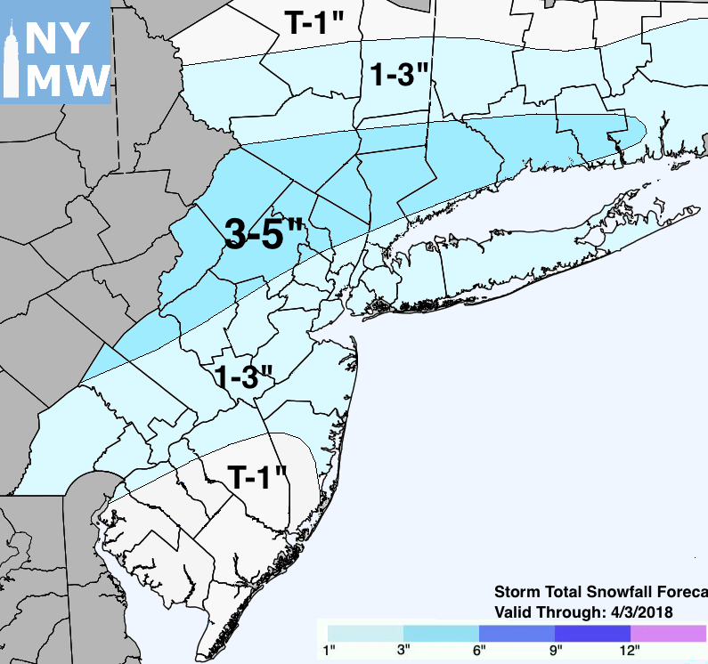
Storm Total Snowfall Forecast through 4/3.
The good news, when it comes to this storm system in particular, is its quick-hitting nature. It is not overly strong, and will shift eastward and towards the Western Atlantic ocean at a good speed on Monday morning. In fact, precipitation will only last 5-6 hours at most across a large part of the region before the storm system heads seaward. This will keep impacts from the storm itself rather minimal, especially when compared to the string of Nor’Easters that we just observed in March.
Snowfall accumulations should be light across the board, with a specific emphasis on colder surfaces such as car tops, grass, etc. Pavement temperatures have warmed quite a bit, especially over the past few days, so snowfall will have some difficulty sticking to pavement, especially initially. Over time, it should stick to roads as the boundary layer cools over New Jersey and other suburbs – but pavement is expected to remain mostly wet in New York City proper.
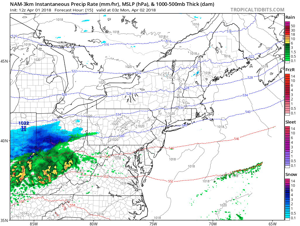
Simulated radar loop of the storm system through Monday afternoon.
Monday morning’s commute does appear to be impacted by the snow – although we aren’t expecting any widespread closures or cancellations, there will almost certainly be delays. A period of heavy snow will occur right near or slightly before the commute. Forecast models show impressive lift in the atmosphere along with frontogenesis, a phenomenon where temperature differences at different layers of the atmosphere act to enhance precipitation rate.
Most models agree that snow will end around 10am, with improving conditions for the remainder of the day. The weather during the scheduled 1:00pm Yankees home opener should be just fine – although the field and stadium itself will likely be wet and cold from the morning’s snowfall. Temperatures warm into the 40’s by the afternoon which should allow for sufficient melting of snow in most areas.
Stay tuned today for further updates as the system evolves!