-2")
Calmer Weather Returns, Some Rain Possible Thursday
Good morning! After a large storm system brought some very heavy rainfall to much of the region on Monday, the weather pattern overall looks more benign over the region — and even the entire Northeast — over the next 7+ days. There will be a few chances for some precipitation, particularly by Thursday, as another weaker storm system passes. But no major storms or significant weather-related hazards are expected.
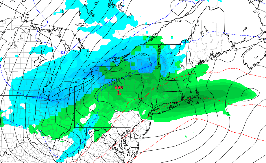
For today, a large, cold upper-level low remains over the Northeast. A couple weaker disturbances rotating around this, will cause more cloud cover to mix with sunshine at times today. Then a stronger shortwave rotating around this upper-level low may enhance enough lift and instability for some scattered showers to develop over parts of the region later this afternoon, before tapering off later during the evening. Best chance of these showers occurring will be over the Interior, where even some wet snow flakes could fall, with much temperatures colder aloft. But moisture is very limited, so we only expect light precipitation, if any. High temperatures will be in the mid-upper 40s over Interior and around 50 near the coast, this afternoon.
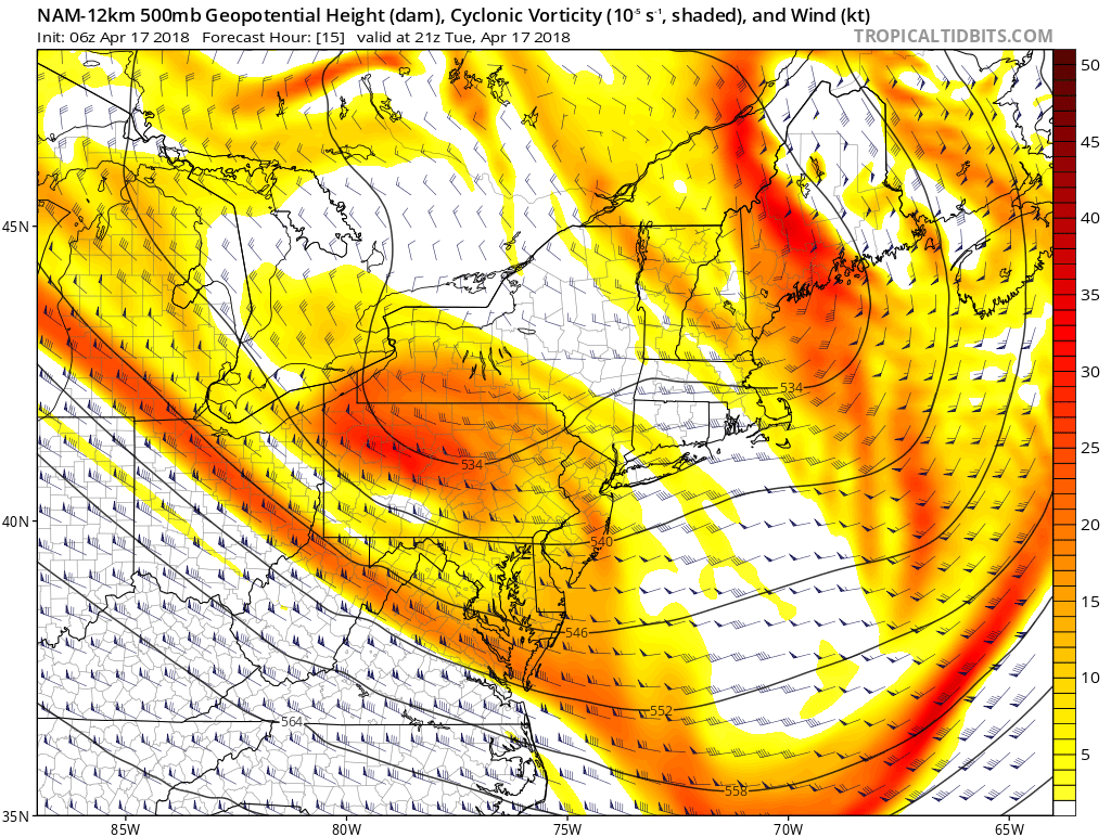
Mid-level shortwave rotating around the large upper-level over the Northeast late today
Clear to partly cloudy skies are expected for the rest of tonight. Temperatures will drop into the 30s for low temperatures over most of the region. Some of Interior valleys could drop into upper 20s with more radiational cooling, as winds will also be light late tonight. On Wednesday, the upper-level low will be moving further north into Southeast Canada. This will allow more subsidence with weak high pressure to build into the region. Thus we expect more sunshine than clouds during the day. Westerly downsloping winds will support high temperatures in the upper 50s to lower 60s. So Wednesday looking a decent at this time.
Then clouds will likely increase on Wednesday night, next storm system approaches. Polar and pacific jetstream disturbances will be phasing back west over Great Lakes and Ohio Valley regions. This will result in the low pressure tracking into the Northeast, with a warm front and cold front moving through the region. Some periods of rain or showers late Wednesday night into Thursday. But phasing unlike Monday’s storm, phasing will be sloppy and moisture from the Atlantic and Gulf of Mexico will be more limited with this system. Thus this system is likely to less organized and we don’t expect more widespread, heavy rainfall in the region. High temperatures on Thursday will depend on how far north the warm front moves through. But temperatures could reach the upper 50s to lower 60s again, in parts of the region.
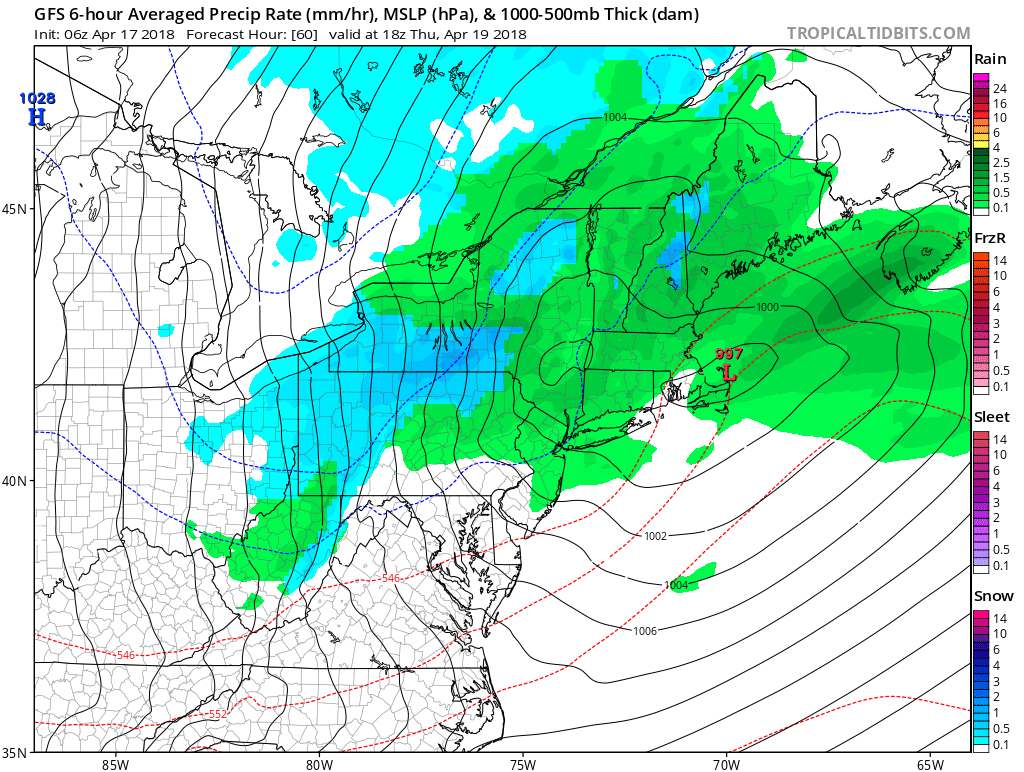
GFS model showing the storm system with some rainfall over the local area on Thursday.
Then some decent, but still cool weather for this of year, is in store on Friday and for the upcoming weekend, as some lower mid-level heights from the upper-level low over Southeast Canada remain over Northeast. But strong high pressure moving out Canada, will support plenty of sunshine each day and mostly clear skies at night. High temperatures will likely be in the mid-upper 50s, and overnight low temperatures in 30s to lower 40s over the region. These temperatures are still a several degrees below normal seasonal levels.
More fair weather is expected continue into the early next week. Temperatures may moderate closer to seasonal levels–in the lower to middle 60s, as high pressure moves offshore with a return southerly flow. But overall, which high-latitude blocking will be relaxing, it appears a split flow pattern in the upper-levels of atmosphere will keep, any huge ridges from building into the Northeast US with more prolonged warmth over next week or two. Stay tuned for more updates later this week, on the longer term pattern as we head into end of April and and early May