-2")
Dreary Today, Pleasant Weekend Weather, Another Storm Possible Next Week
Good morning! Overall today will be dreary, with mostly cloudy skies and some rain and drizzle at times throughout the day. A batch of steadier rain this morning is associated with some with frontogenetic forcing that is now shifting further northeast into New England. Some wet snow and sleet has also mixed in at times over far northern interior locations, such as Northeast PA, the Lower Hudson Valley and Connecticut this morning. Some light accumulations have occurred on some colder surfaces, but most roads are remaining just wet with temperatures above freezing.
There will be a lull, with just perhaps some spotty light showers and drizzle over the region for the rest of the morning, with perhaps clouds breaking for a little sunshine. Then a shortwave trough associated with this system will swing through the region and will enhance lift for more rain showers around the region during the afternoon hours. But overall this system will remain disorganized and not a lot of moisture is available. So only light rainfall totals under 0.50” are expected. Clouds and northeast winds much of the day will keep temperatures in the mid-upper 40s in most areas.
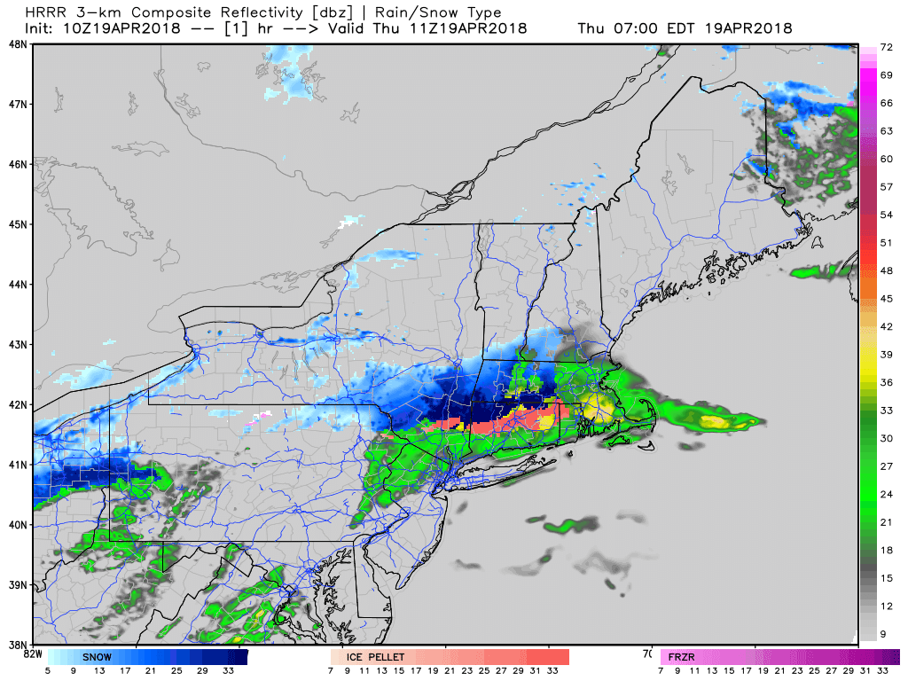
HRRR model showing periods of rain much over the region today. Some snow or wintry mix over far northern interior locations (Weatherbell)
Then some cloud cover and rain showers (or wet snow showers over the Interior) could also still linger behind this system into the evening hours. But then drier conditions are expected later tonight with more clearing, as winds become more northwesterly. As low pressure begins to intensify offshore somewhat, northwest winds will increase to between 15 to 25mph and gust up to around 30mph at times. Temperatures overnight will drop into the lower to middle 30s, as some colder air also arrives overnight.
On Friday, partly sunny skies and cool conditions are expected, as high pressure from Canada begins building into the region. High temperatures will be in the lower to middle 50s, which is cooler than normal for this time year. Then strong high pressure will be over the Northeast and provide more sunshine and clear skies during the weekend and into early next week. High temperatures will likely be in the mid-upper 50s on Saturday. Then temperatures will begin moderating, with highs in the upper 50s to lower 60s on Sunday and lower to middle 60s on Monday, as high pressure moves offshore with a return light southwesterly flow.
The next chance for more significant rainfall will occur as low pressure over the Southeast US slowly tracks northward along the East Coast, and begins to interact with another area of low pressure, associated a with shortwave trough coming out of the Great Lakes. More moisture will likely be involved with this system, with a direct connection from the Atlantic and Gulf of Mexico. But there are model to run to run differences on how these features interact with each other and come together for a larger storm. These modeling differences lead to high uncertainty in the track or evolution of this system, and thus impacts for our region are still uncertain. That being said, there is already some support from ensemble guidance on this storm system.
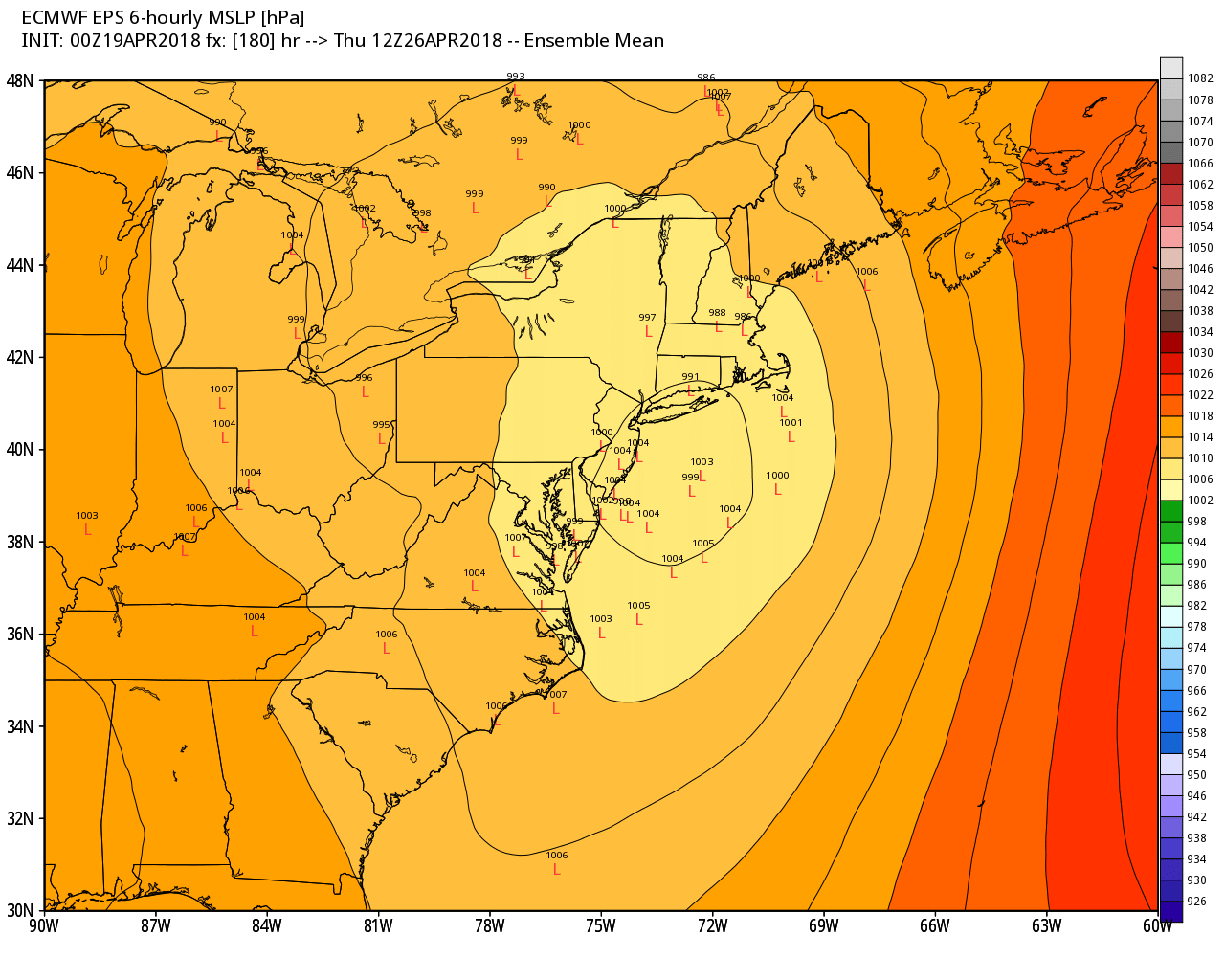
ECMWF ensembles members with a low pressure along the Mid-Atlantic and New England Coast by Wednesday night and Thursday (Weatherbell)
To sum it up: After today, some pleasant weather is on the way as we end the week and head into the weekend. Any outdoor plans should go on without any weather-related issues. Then we will continue monitoring the potential for another storm with some heavier rainfall later next week. Stay tuned for forecast updates on our public blog over the next few days.