Good afternoon! After a some beautiful weather early this week, a more active pattern with some unsettled weather is coming for over the next several days or so. In fact, a much wetter pattern may be developing for the weekend and early next week. We will discuss more details, on this may happen below.
For today, a pre-frontal trough, will move through, with more clouds and perhaps some showers and few isolated thunderstorms, during the early afternoon hours. Some heavy downpours and lightining are possible. But instability will be too low to support any severe weather. Otherwise, party sunny skies are expected for the rest of the day. High temperatures will be in the mid-upper 70s, except cooler near the shore
Then a shortwave trough and cold front will approach the region from the Great Lakes/Ohio Valley, later this afternoon and evening. These features will be weakening with less shear and forcing, as they move closer to the east. But some synoptic lift from mid-level vorticity and theta-e advection, along with some instability, will still help trigger some additional scattered showers and thunderstorms, in parts of Northern Mid-Atlantic region later this afternoon and evening.
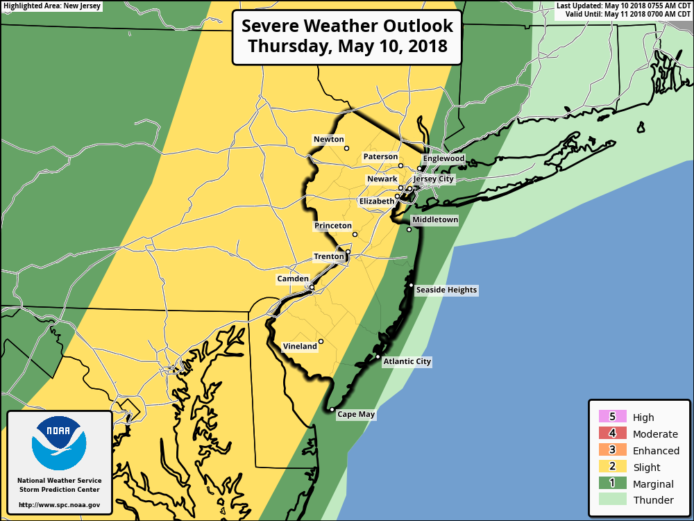
Some of these storms could be strong severe, especially over parts of Eastern PA and Western NJ, where greater instability will most likely be able to recover later today, and higher dewpoints in the lower to middle 60s, are advected by a southerly flow. Mesoscale models indicate MLCAPE values rising to around 1000 to 1005 J/kg. Parts of Eastern NJ and the Lower Hudson Valley, will have chance to build some instability with some clearing later this afternoon. Which support some stronger storms by early this evening. But some anvil cloud tops blowing off, due to a modest mid-level flow, may mitigate also instability over these areas.
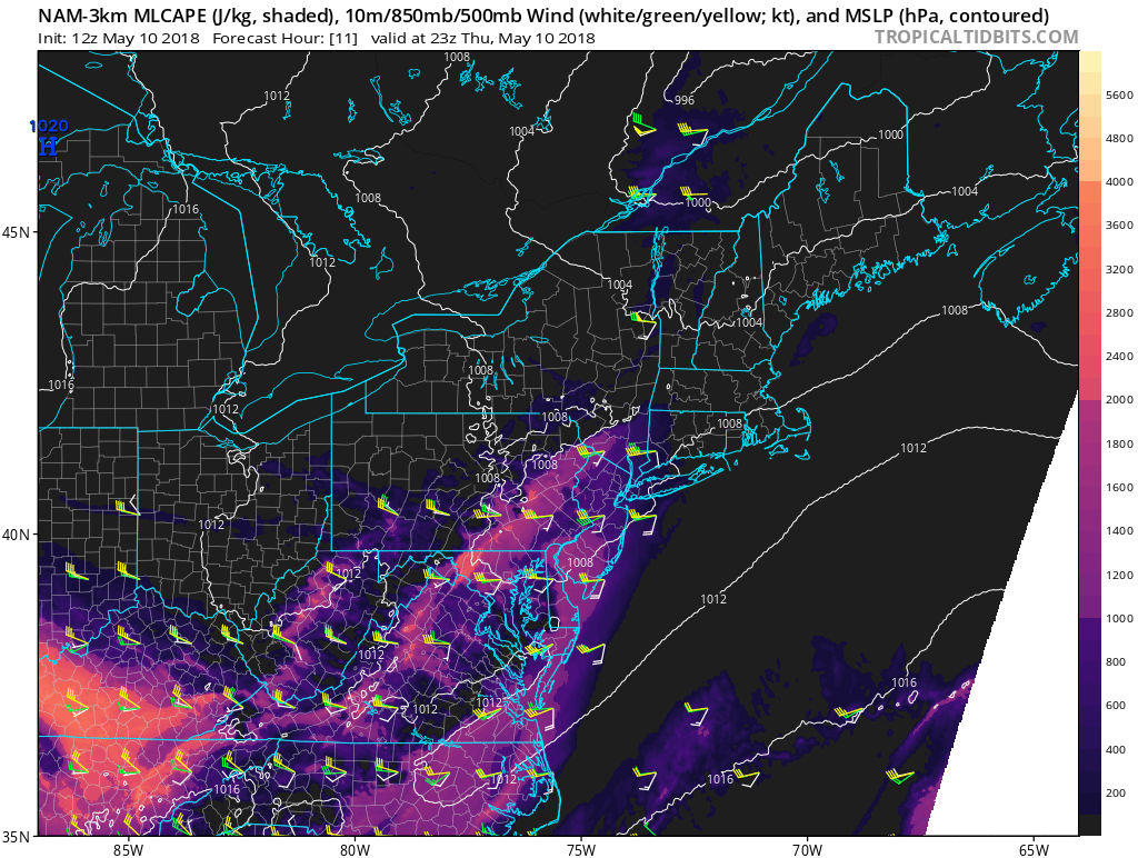
3km NAM model showing MLCAPE values near 1000 J/kg with directional shear over parts of Eastern PA and Western NJ early this evening.
Further east over New York City, Western Long Island, and Western CT, more stable marine layer, near the surface, are most likely to cause thunderstorms to weaken. Thus a lesser risk or more marginal risk for strong to severe storms. But some moderate elevated instability, associated with warm-air advection aloft, may still support some thunderstorms with heavy rainfall, gusty winds between 30-40mph and cloud to ground to lightning. Skies will begin clearing late tonight, as the cold moves east.
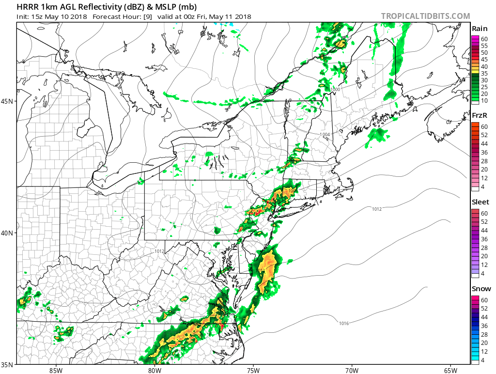
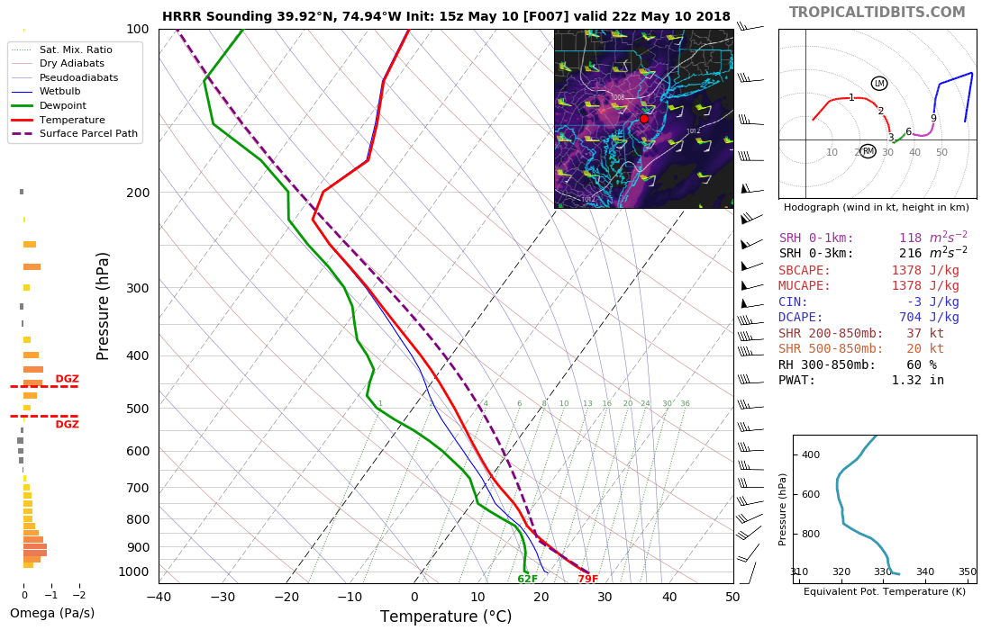
HRRR model showing a cluster of showers and thunderstorms over parts of New Jersey, early this evening
High pressure from Central Canada will build in with more pleasant, sunny weather on Friday. High temperatures will be in the upper 60s to lower 70s, which is more seasonable for this time of year.. Then as high pressure departs, and mid-level ridging builds i, a warm front will begin lifting northward through the Northern Mid-Atlantic region Friday night and Saturday. This could potentially bring some warmer than normal temperatures back by Saturday afternoon.
However, there is some uncertainty how far north the warm front will reach, in the local region. A couple of shortwaves running along this front with some elevated instability, could trigger a few convective complexes of showers and thunderstorms later Friday night and Saturday. Depending on the timing and intensity, this activity could cause the warm front to stall near or just south of NYC metro with more clouds and marine airmass keeping temperatures in the 50s or 60s to the north. While areas to the south of the front have more sunshine and southwest winds causing temperatures to rise into the 70s or 80s. But this airmass will also become more unstable with higher humidity. So another risk for some strong to severe thunderstorms later Saturday afternoon and evening, is expected for parts of the region, especially south of NYC.
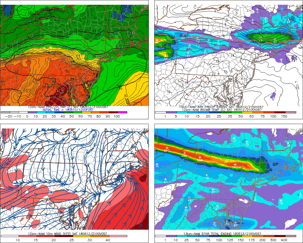
NAM model showing the warm front over South-Central New Jersey after convective complex moves into New England later Saturday afternoon
By late Saturday night and Sunday, stronger confluence to the north will likely force the warm front back south, as a backdoor cold front. More shortwaves along this front may cause more showers and thunderstorms to move through the parts of the region. This will support a more cooler stable airmass, which will diminish the severe weather threat. But the low to mid-level flow will be more parallel to the frontal boundary with abundant moisture. So there is potential for more training convection with very heavy rainfall and flash flooding in some areas.
Some more unsettled weather may continue into the early and middle parts next week, as the frontal boundary remains over the Central Plains to Northern Mid-Atlantic region and some subtropical moisture begins streaming northward from the Gulf of Mexico or Southeast US. Depending the timing of each wave along the frontal boundary, showers and thunderstorms with heavy rainfall are possible over parts of Northeast or Mid-Atlantic region each day. But no complete washouts are expected at this time. More updates to come over next few days!
-2")