-2")
Weekly Briefing: Severe weather possible Tuesday, warm weather ahead
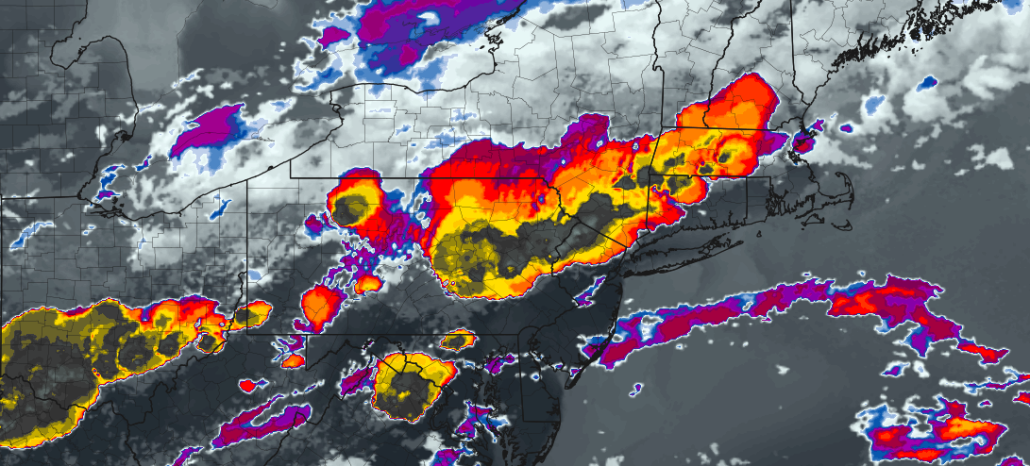
Good morning and Happy Monday! Welcome to our Weekly Briefing, where we break down the Northeast US weather pattern in a detailed and easy to understand forecast. If you were outside at all this weekend, you probably noticed the rain and cool temperatures. You can thank a “wedge” of colder temperatures for that. Cool air was funneled into the Northeast US for the majority of the weekend by northeast winds (it was damp as well).
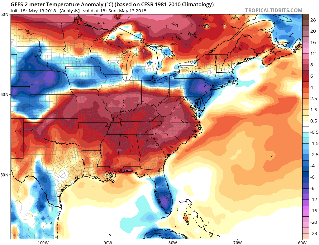
After a few disturbances passed by on Sunday evening and into the overnight hours, things have begun clearing out this morning, and are expected to continue to do so throughout the majority of the day today. All in all, Monday is expected to be a fairly pleasant day. Temperatures will be nearly 20 degrees warmer than they were on Sunday, rising well into the 70’s across a large majority of the Mid-Atlantic and Northeast states. Temperatures will remain quite warm this evening, and the airmass that builds into the area through tonight will mark the approach of a warmer and unstable airmass which will set the stage for an active weather day on Tuesday.
Forecast models are in good agreement that Tuesday will feature very active weather – and the potential for a severe weather throughout a fairly wide portion of the Northeast States, particularly the Northern Mid-Atlantic States. It’s important to remember the key ingredients that are necessary for organized thunderstorm development: Instability, lift, and effective wind shear. All of these things will be present on Tuesday. Here’s how it will shake down:
In the morning, southwesterly winds will begin advecting in a warm and unstable airmass. This airmass will actually be marked by the presence of an “Elevated Mixed Layer” or “EML” in the mid levels of the atmosphere (way above our head). This change in temperature with height is important as it allows the atmosphere to get more unstable before storms form. But more on that later.
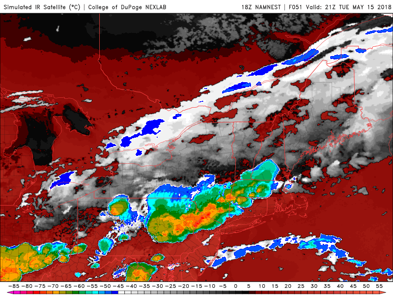
NAM model suggesting the development of impressive thunderstorms on Tuesday (simulated satellite imagery).
As the day goes on, the atmosphere will become moderately to significantly unstable in the Northern Mid Atlantic. A disturbance is expected to approach from the Great Lakes (the timing of which will be very important), and wind shear will be quite impressive throughout the atmosphere (5o knots or more at 500mb). Storms are expected to develop and become organized quite quickly in the Interior parts of the Northeast such as Pennsylvania and Southern New York.
The EML we spoke about earlier becomes important here – if the models are correct in its presence, the very favorable lapse rates will allow storm development to be quite robust. Thunderstorms could become severe quickly, with the potential for strong wind gusts, large hail, dangerous lightning and even a tornado or two.
Thereafter, storms are expected to shift southeastward towards New Jersey, Connecticut, New York, and Long Island (as well as the Mid-Atlantic coast). It remains to be seen exactly how strong they will be and how organized they will remain as they head towards the coast, but the synoptic weather pattern seems more than sufficient for strong to severe thunderstorm progression through the mentioned areas.
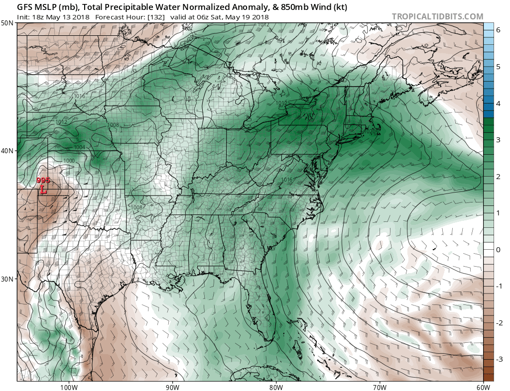
GFS model suggesting tropical moisture connection along the East Coast late week and next weekend.
For now, stay tuned to the forecast – we’ll have more information and details throughout the day on Monday.
The weather pattern is expected to remain unsettled thereafter, and the unfortunate news is that it looks to peak again next weekend. Forecast models are in good agreement (again) that an upper level low will emerge out of the Gulf of Mexico during the late-week period, bringing tropical moisture northward along the East Coast. While the details remain unclear, confidence is rising in a period of unsettled weather with the potential for heavy rain next weekend.
We’ll have more information as the week goes on – for now, enjoy your Monday!