-2")
Weekly Planner: Cooler Start Then A Heat Wave Begins on Friday
Good morning, friends! Another gorgeous day is underway today , as high pressure from Canada (which provided excellent weather in the Northeast US on Monday) remains in place. Temperatures will remain quite comfortable and the weather very benign through midweek. A storm system approaches from the Ohio Valley and brings increasing rainfall chances to the Northeast states from late Wednesday Night into Thursday, followed by increasingly notable heat during the weekend.
Tuesday
Today, mostly sunny skies and lighter winds are expected as high pressure moves closer and remains in control. After a chilly start, with temperatures in the upper 40s and or 50s in many of the suburbs, temperatures will warm nicely through the morning and early afternoon hours. But as high pressure begins sliding offshore this afternoon, light southeast winds will keep high temperatures in the upper 70s instead of allowing them to rise into the 80’s as they otherwise would. Mostly clear skies will give way to some high clouds and increasing humidity overnight.
Wednesday and Thursday
High pressure will continue sliding off the Mid-Atlantic Coast on Wednesday, allowing a warm front to approach from the west in association with the next incoming storm system. Humidity will continue to slowly increase as a southeast flow strengthens. It will remain mostly comfortable and no rainfall is expected for most of the day, but clouds and southeast winds will increase and temperatures will remain cooler than normal. Rainfall chances will slowly increase as the evening approaches.
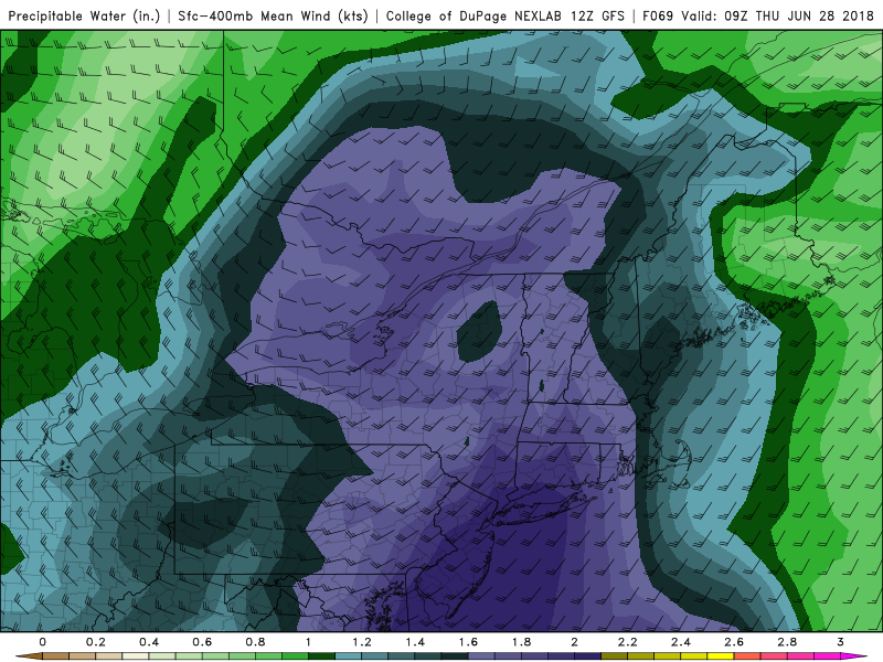
GFS model forecast of precipitable water values over near between 1.50 to 2.00″ over parts of Northeast by early Thursday morning
Showers become more steady during the evening hours in the interior northeast, and as the warm front shifts northeastward Wednesday night and Thursday morning, subtropical moisture will feed into the system. High precipitable water values and some elevated instability could result in locally heavy rainfall across the Northeast states, and also will promote the development of a few thunderstorms. The threat for these thunderstorms will continue into Thursday morning.
The front will eventually wash out near the region during the morning hours on Thursday, and the threat for widespread thunderstorms and showers will slowly decrease.
Friday and beyond
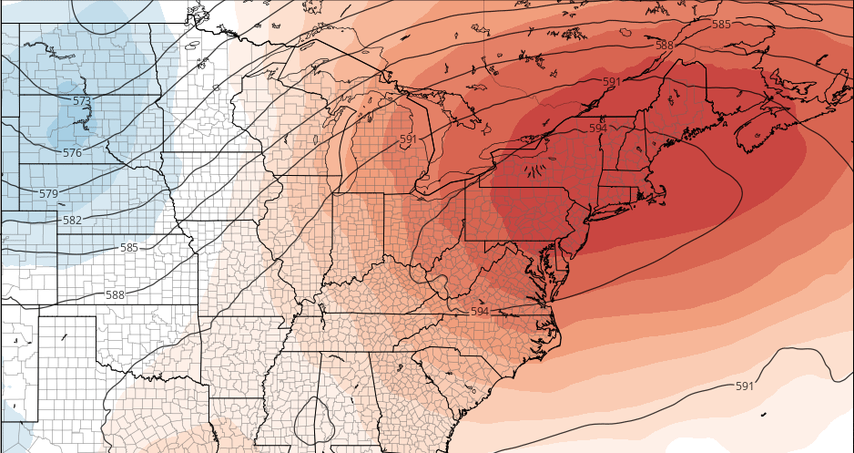
Deeper troughiness over the Northwest US, will cause a strong ridge to build over much of the Eastern US by Friday. As a result, the potential for widespread heat risks will increase. Temperatures will rise into the 80’s by late week and then the lower to middle 90’s by Friday. Humidity will rise gradually, so the heat won’t exactly feel oppressive early on, but by Sunday forecast models suggest a 594dm ridge building over the Northeast states with 850mb temperatures over 20 C. With rising humidity, this supports temperatures in the middle to upper 90’s and heat index values rising near or over 100 F.
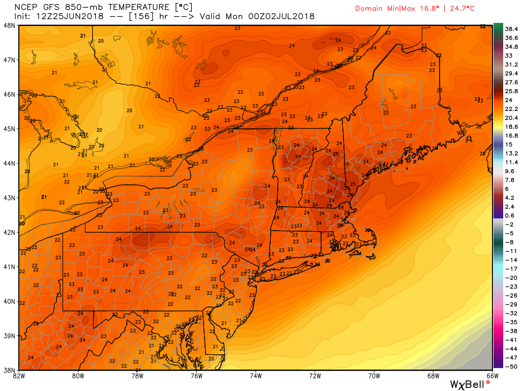
GFS model showing 850mb temperatures (at about 5000 feet) between 22°C to 24°C over parts of Northeast on Sunday. These will support daytime surface high temperatures approaching 100°F
Additional oppressive heat and humidity will arrive by early next week, as southwest flow increases. Chances for afternoon or evening thunderstorms increase during this time frame, although they will initially be isolated underneath the ridging.
The main message here is that the upcoming period will likely feature our first prolonged major heat wave of the season. Even after the weekend and the opportunity for thunderstorms early next week, forecast model guidance suggests the opportunity for heat to continue well into the following week. Relief does not look likely to come until well beyond that, when the ridging retrogrades back to the Central USA and storminess and cool weather can return to the Northeast states near mid-July.