-2")
Isolated storms today, rough surf in the Northeast this week
When it gets cooler and more unsettled, remember this beautiful stretch of weather! It’s another beauty so far today, and temperatures will continue to climb quite a bit in the Northeast states – well into the 90’s with an increasing southwest flow.
Weak seabreezes should keep areas near the shore a bit cooler today, which is typical for this time of year, especially with a southerly wind component. A weak cold front associated with upper level trough will drop slowly the northwest later this afternoon and evening.
Moderate instability and marginally effective wind shear near the front could lead to the development of some thunderstorms later this afternoon across the Interior Northeast. Some of these could become organized enough to produce downpours, gusty winds and lightning.
Overall, though, lacking moisture will limit instability and a weak frontal boundary will also limit lift. This will keep storms isolated and only marginally strong and severe. They are expected to weaken as they approach the coast later this evening. Speaking of marginal, the Storm Prediction Center has placed parts of the Northeast in a “Marginal” risk for severe weather.
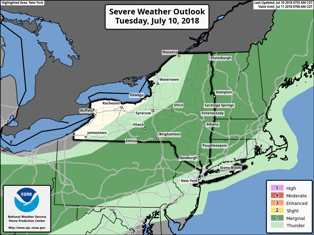
The Storm Prediction Center with a marginal risk for some isolated strong or severe thunderstorms over Interior parts of the Northeast
Partly cloudy skies are then expected to return later in the evening with temperatures falling into the upper 60’s or lower 70’s, which is quite comfortable. High pressure is expected to build back in to the Northeast States from the midweek period through the end of the week, beginning Wednesday. This will lead to warm temperatures and very low humidity – in other words, another stretch of ridiculously comfortable weather is on the way. Temperatures will get a bit warmer and a bit more humid each day as we approach the weekend.
Meanwhile Tropical Storm Chris, which has been meandering off the Carolina coast for the last few days, will be forced to track to the northeast and out to sea by the aforementioned upper level trough. It will likely intensify into a hurricane as it moves over the warmer waters of the Gulf Stream and underneath the right-entrance region of an upper-level jet, which will provide more outflow. We anticipate a higher risk for rip currents and rough surf along the Mid-Atlantic and New England coasts starting Wednesday and Thursday. With the new moon this week, there is also the risk for some minor coastal flooding during high tides.
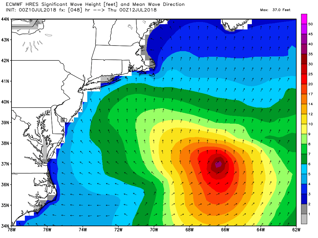
ECMWF model showing swells from Chris impacts the Mid-Atlantic coast which will likely be hurricane by Wednesday
By the end of the week, the upper level trough will be lifting out and high pressure set up off the Mid-Atlantic coast. This will lead to a warming trend with an increasingly strong southerly flow. A frontal boundary will then sink southward into the Northeast states on Saturday, and forecast models suggest there will be a bit more instability and moisture present. This suggests the potential for showers and thunderstorms with the potential for heavy rain in some areas.
By and large, the weather will remain quiet and benign over the next few days. Take extra caution if you’re swimming as rip currents could be widespread with the offshore tropical storm system.